
Where Flight Simulation Enthusiasts Gather from Around the World!
AVSIM Library - Search Results

| Category: Flight Simulator 2004 - Scenery | |
| SBSG - Natal, Brazil UPDATED |

|
File Description:
I made a few mistaken last time uploaded library recently. Please replacement filename for more detail more environment scenery area. Hope that helps.
| Filename: | SBSG__Natal_Brazil_UPDATED.zip |
| License: | Freeware |
| Added: | 22nd August 2016, 00:23:59 |
| Downloads: | 1,548 |
| Author: | Stuart J Gilbert II |
| Size: | 740.12 KB |
| Category: Flight Simulator 2004 - Scenery | |
| Alaska South Slope 1: Noatak PAWN in AK, US |
|
Images related to this file:
File Description:
The town of Kotzebue is in the far northwest of Alaska, and these are villages to the north and then the east of Kotzebue on the South Slope of the Brooks Range of mountains. There will be further additions. Noatak is a small village (population now around 520 and rising) on the west bank of the Noatak River, around 50 miles north of Kotzebue. It is on the edge of the Noatak National Preserve and as the only village on the river is the centre for fishing, rafting, canoe, and other types of outdoor expeditions. The airfield has almost 5,000 feet of lit gravel just south of the town, aligned 18-36. There are scheduled flights by Era (now renamed Ravn) and by Bering Air, both of them originating in Kotzebue and routing north to Noatak, Kivalina, Point Hope, and then back again. The AI includes these flights plus a daily Everts Air cargo flight and GA. There are new bgl's for Kotzebue; the development of the northern and eastern AI meant that more dedicated parking spaces were needed at Kotzebue. The two new Bering Air planes are as listed in the AI folder, and there is also a new Era Cessna 208 to be installed. The next South Slope scenery will be Noorvik ORV, to the east of Kotzebue.
| Filename: | Alaska_South_Slope_1_Noatak_PAWN_in_AK_US.zip |
| License: | Freeware, limited distribution |
| Added: | 2nd September 2016, 20:54:32 |
| Downloads: | 254 |
| Author: | Roger Wensley |
| Size: | 4.22 MB |
| Category: Flight Simulator 2004 - Scenery | |
| Elstree EGTR V2 |
|
File Description:
Updated version of my Elstree scenery for FS9. Fixed the problem with the sunken ai traffic.
| Filename: | Elstree_EGTR_V2.zip |
| License: | Freeware |
| Added: | 3rd September 2016, 19:32:51 |
| Downloads: | 273 |
| Author: | Anders Samuelsson |
| Size: | 9.43 MB |
| Category: Flight Simulator 2004 - Scenery | |
| Alaska South Slope 2 - Noorvik ORV in AK US |
|
Images related to this file:
File Description:
The town of Kotzebue is in the far northwest of Alaska, and these are villages to the north and the east of Kotzebue on the South Slope of the Brooks Range of mountains. There will be further additions. Noorvik is a small village (population now around 670) on the bank of the Kobuk River, around 50 miles east of Kotzebue. The new airfield is 1 mile south of the village; there is a short runway immediately south of the town that is now closed but is not marked as such and appears to be usable; this will still be listed in FS9 when you are presented with a choice of runways but is not connected in any way to the new airfield so ignore it. The new ORV runway has 4,000 feet of lit gravel aligned 06-24. There are scheduled flights by Era (now renamed Ravn) and by Bering Air, both of them originating in Kotzebue and routing east to Noorvik, Kiana, Ambler, Shungnak, Kobuk, and then back again. The AI includes these flights (eventually) plus perhaps an Everts Air cargo flight and GA.
| Filename: | Alaska_South_Slope_2__Noorvik_ORV_in_AK_US.zip |
| License: | Freeware, limited distribution |
| Added: | 4th September 2016, 18:20:02 |
| Downloads: | 222 |
| Author: | Roger Wensley |
| Size: | 3.95 MB |
| Category: Flight Simulator 2004 - Scenery | |
| KEGE - Eagle Regional Airport - Colorado, USA |
|
Images related to this file:
File Description:
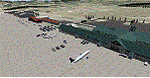
Eagle Regional Airport (KEGE) has an approach through mountainous terrain and challenging departure procedures. It is Home for the Vail Valley Jet Center, the Colorado National Guard High Altitude Training Center and the Army. Because of it's high altitude, it is a very dangerous airport for take-off and landings. This scenery is updated with the new 109,75 ILS, the new Army and National Guard area on the opposite side of the airfield and many trees in the surrounding area.
| Filename: | KEGE__Eagle_Regional_Airport__Colorado_USA.zip |
| License: | Freeware |
| Added: | 7th September 2016, 21:58:26 |
| Downloads: | 775 |
| Author: | David Kolas |
| Size: | 8.55 MB |
| Category: Flight Simulator 2004 - Scenery | |
| Alaska South Slope 3; Kiana PAIK |
|
Images related to this file:
File Description:
The town of Kotzebue is in the far northwest of Alaska, and served by Alaska Airlines. These are villages to the (mostly) east of Kotzebue on the South Slope of the Brooks Range of mountains, served by local flights from Kotzebue. There will be further additions. Kiana is a small village (population now around 360) on the bank of the Kobuk River, around 60 miles east of Kotzebue. The airfield, called Baker Memorial, is just north of the village, with 4,000 feet of lit gravel aligned 06-24 (as are several other runways in the area) with PAPI on 24. There are scheduled flights by Era (now renamed Ravn) and by Bering Air, both of them originating in Kotzebue and routing east to Noorvik, Kiana, Ambler, Shungnak, Kobuk, and then back again. The AI includes these flights along with Everts Air and Northern Air Cargo flights and GA. In real life the runway is around 200 yards closer to the village; this complicated the removal of roads and revised ground textures so I left it as is to make my life easier. The post includes missing night textures that were omitted from the post of Noatak PAWN. Noatak also has incorrectly installed original FS9 taxiway lights that were, as a result, impossible to remove. I had hoped to somehow manage it, but there is no way.
| Filename: | Alaska_South_Slope_3_Kiana_PAIK.zip |
| License: | Freeware, limited distribution |
| Added: | 7th September 2016, 22:00:17 |
| Downloads: | 214 |
| Author: | Roger Wensley |
| Size: | 4.5 MB |
| Category: Flight Simulator 2004 - Scenery | |
| Muscat International - Muscat, Oman - OOMS |
|
File Description:
Muscat Int'l OOMS has additional new terminal and runway should be open in late 2016. Old runway is now taxiway for temporary for now.
| Filename: | Muscat_International__Muscat_Oman__OOMS.zip |
| License: | Freeware |
| Added: | 1st October 2016, 05:31:54 |
| Downloads: | 706 |
| Author: | Stuart John Gilbert II |
| Size: | 3.03 MB |
| Category: Flight Simulator 2004 - Scenery | |
| Merrill Field PAMR 2016 V3 in Anchorage, Alaska, including the Fedex 727 |
|
Images related to this file:
File Description:
This V3 version of Merrill Field 2016 finally adds the Fedex 727 to Merrill Field, the error being totally mine but left as unreported by all but two of the downloaders. Testing on the computer of one of the reporting downloaders solved the problem, and revealed the requirement to have the aircraft "installed" on every user's computer. This was unknown by me, and not "testable" on my computer for obvious reasons. Which is why I need user input!?! Only 2 out of a total of around 500 downloaders? This is not a stand-alone scenery. Put the Fedex727.bgl into the scenery folder of your downloaded Merrill Field V2 and the 727 will be visible. You already have the textures in the scenery texture folder.
| Filename: | Merrill_Field_PAMR_2016_V3_in_Anchorage_Alaska_inc.zip |
| License: | Freeware, limited distribution |
| Added: | 3rd October 2016, 21:38:27 |
| Downloads: | 481 |
| Author: | Roger Wensley |
| Size: | 406.97 KB |
| Category: Flight Simulator 2004 - Scenery | |
| KLFT - Lafayette Regional Airport - Louisana, USA |
|
Images related to this file:
File Description:
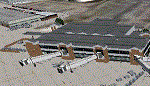
Here comes a brand new photoreal creation of Lafayette Regional Airport. The airport is daily serviced by American Airlibes to Dallas Fort Worth, Delta Airlines to Altlanta and United Airlines to Houston. There is although a AFCAD file for FSX-users included.
| Filename: | KLFT__Lafayette_Regional_Airport__Louisana_USA.zip |
| License: | Freeware |
| Added: | 3rd October 2016, 21:38:30 |
| Downloads: | 962 |
| Author: | David Kolas |
| Size: | 19 MB |
| Category: Flight Simulator 2004 - Scenery | |
| Alaska South Slope 4; Selawik PASK |
|
Images related to this file:
File Description:
There are four main northwestern Alaska towns which are serviced by Alaska Airlines, and from which local flights spread out. The northernmost is Barrow. Southwest of Barrow is Kotzebue, then Nome, and the furthest south is Bethel. This series is for the flights from and around Kotzebue, mostly on the South Slope of the Brooks Range of mountains. There will be further additions. Selawik is a village (population now around 760) around 75 miles east of Kotzebue on three of the delta islands of the Selawik River where it flows into Selawik Lake. The delta forms part of the Selawik National Wildlife Refuge for migratory birds. The airfield is just next to the village, with two runways, 3,450 feet of lit gravel aligned 03-21 and 3,100 feet of gravel aligned 09-27. There are scheduled flights by Era (now renamed Ravn) and by Bering Air, both of them originating in Kotzebue and routing east to Noorvik, Kiana, Selawik, etc, and then back again. The AI includes these flights along with Everts Air and GA.
| Filename: | Alaska_South_Slope_4_Selawik_PASK.zip |
| License: | Freeware, limited distribution |
| Added: | 9th October 2016, 04:17:52 |
| Downloads: | 214 |
| Author: | Roger Wensley |
| Size: | 4.34 MB |


© 2001-2026 AVSIM Online
All Rights Reserved
Privacy Policy |