
Where Flight Simulation Enthusiasts Gather from Around the World!
AVSIM Library - Search Results

| Category: Flight Simulator 2004 - Scenery | |
| Alaska North Slope 10; Kivalina KVL in Alaska |

|
Images related to this file:
File Description:
The town of Barrow is in the far north of Alaska, and these are coastal villages or radar installations to the west, south, and east of Barrow on the North Slope. There will be further additions. Kivalina is a small village (population around 350) midway in the 150 mile gap between Point Hope to the north and Kotzebue to the south. The village is on a spit of land that is growing smaller and smaller with every year of erosion and the rise of sea level. The runway is 3,500 feet of gravel aligned 12-30 to the north of the village on the same spit. It was expected that 2025 would see the end of both village and runway, and possibly also the natural harbour that is the reason for the village's location. The modified width of the spit shown here is halved from the original FS9, and erosion has continued, enough that a sea defence wall has now been built. The AI has a daily flight by an ERA Alaska Cessna 208B, and some GA; read the note about the 208 to be downloaded and/or properly installed.
| Filename: | Alaska_North_Slope_10_Kivalina_KVL_in_Alaska.zip |
| License: | Freeware, limited distribution |
| Added: | 27th July 2016, 21:12:15 |
| Downloads: | 244 |
| Author: | Roger Wensley |
| Size: | 2.87 MB |
| Category: Flight Simulator 2004 - Scenery | |
| Kotzebue PAOT on the northwestern coast of Alaska |
|
Images related to this file:
File Description:
There are four main northwestern Alaska towns which have good airports and are serviced by Alaska Airlines. From these airports local flights connect to nearby villages, "nearby" in Alaska meaning up to 150 miles away. The northernmost is Barrow. Southwest of Barrow is Kotzebue, then Nome, and the furthest south is Bethel. The town of Kotzbue is north of the Bering Strait on the northwestern coast, 320 miles southwest of Barrow. The population is just over 3,000 people. The location was for a long time a base for trading in furs, with three rivers emptying into the sea and providing routes into the interior land and villages; a meeting place between hunters and traders from Russia and elsewhere. The Kotzebue airport is called the Ralph Wien Memorial and has two runways. The modern one is aligned 08-26 and is 5,880 feet of 150 feet wide asphalt built across a shallow lagoon, with an ILS on 08 and PAPI on both ends. The second and older runway is originally military and gravel, aligned 17-35 and 3,786 feet long and used (wind allowing) by the GA planes that park alongside the runway. The prevalent wind is from the west; when the wind is from the east it is generally relatively feeble and with a much lower cloud base, possibly to the ground, hence the need for an ILS. All AI aircraft in FS9 much prefer to use a runway that has an ILS and so will continue to use 08-26 even if the wind is from the south until it reaches 30+ knots, even if they are a Cessna 150 flying VFR. So for AI realism in FS9 a northern or southern wind needs to be a strong one so that the runway is actually used. However, as Alaska Airlines, Northern Air Cargo, and Everts Air also fly to Kotzebue and can only use the east-west runway (as less than 4,000 feet of asphalt would be seriously inconvenient for a Boing 737 or DC6) it is necessary to have the northern or southern wind UNDER 30 knots at the times when they are landing or taking off. Your choice. I suppose a permanent strong wind from the west would be the most realistic on a daily basis, deterring all planes from ever using 17-35. The AI will develop along with further scenery additions in the neighbourhood.
| Filename: | Kotzebue_PAOT_on_the_northwestern_coast_of_Alaska.zip |
| License: | Freeware, limited distribution |
| Added: | 2nd August 2016, 16:47:52 |
| Downloads: | 463 |
| Author: | Roger Wensley |
| Size: | 19.32 MB |
| Category: Flight Simulator 2004 - Scenery | |
| Anchorage - Yukon Landclass Adjustment for UT terrain |
|
File Description:
Anchorage-Yukon Landclass
Missing City and Landscape Landclass for Ultimate Terrain
from Anchorage to Fairbanks Beever Creek - Dawson - Whitehorse
Only copy the bgl files in a addon/scenery folder above the UTCanada folder
Including raw files for your own adjustments with LWM Viewer or EZscenery.
| Filename: | Anchorage__Yukon_Landclass_Adjustment_for_UT_terra.zip |
| License: | Freeware |
| Added: | 2nd August 2016, 17:09:10 |
| Downloads: | 241 |
| Author: | Markus Balz |
| Size: | 158.43 KB |
| Category: Flight Simulator 2004 - Scenery | |
| Tyndall Air Force Base |
|
Images related to this file:
File Description:
Tyndall Air Force Base for FS9. One of the homes of the mighty F-22 and primary training center for the lucky F-15 pilots transitioning to the F-22 (F-16 and F-18 pilots are transitioning to the F-35 down the road at Eglin).
| Filename: | Tyndall_Air_Force_Base.zip |
| License: | Freeware, limited distribution |
| Added: | 4th August 2016, 21:11:28 |
| Downloads: | 528 |
| Author: | Jamie Mayo and John Tennent |
| Size: | 6.76 MB |
| Category: Flight Simulator 2004 - Scenery | |
| Windsor International Airport (CYQG) |
|
File Description:
Windsor international Airport (CYQG). Located in the city of Windsor,Ontario, Canada. For FS9/FS2004 by Garvin Barnicoat.
This scenery for Windsor, Ontario's airport was created using actual photos for the textures. As such, access to the Terminal apron was necessary and could only be done with the consent of the Administrator, Morris Thompson to whom I'm indebted and express my appreciation.
This scenery has been optimized to fit around the Canada Road System by JoelGill, but will of course function with default roads; the exception being that its location will seem distant from said roads. However, only those familiar with the area will likely notice!
| Filename: | Windsor_International_Airport_CYQG.zip |
| License: | Freeware |
| Added: | 13th August 2016, 20:40:35 |
| Downloads: | 481 |
| Author: | Gavin Barnicoat |
| Size: | 6.82 MB |
| Category: Flight Simulator 2004 - Scenery | |
| SBSG - Natal, Brazil UPDATED |
|
File Description:
I made a few mistaken last time uploaded library recently. Please replacement filename for more detail more environment scenery area. Hope that helps.
| Filename: | SBSG__Natal_Brazil_UPDATED.zip |
| License: | Freeware |
| Added: | 22nd August 2016, 00:23:59 |
| Downloads: | 1,548 |
| Author: | Stuart J Gilbert II |
| Size: | 740.12 KB |
| Category: Flight Simulator 2004 - Scenery | |
| Alaska South Slope 1: Noatak PAWN in AK, US |
|
Images related to this file:
File Description:
The town of Kotzebue is in the far northwest of Alaska, and these are villages to the north and then the east of Kotzebue on the South Slope of the Brooks Range of mountains. There will be further additions. Noatak is a small village (population now around 520 and rising) on the west bank of the Noatak River, around 50 miles north of Kotzebue. It is on the edge of the Noatak National Preserve and as the only village on the river is the centre for fishing, rafting, canoe, and other types of outdoor expeditions. The airfield has almost 5,000 feet of lit gravel just south of the town, aligned 18-36. There are scheduled flights by Era (now renamed Ravn) and by Bering Air, both of them originating in Kotzebue and routing north to Noatak, Kivalina, Point Hope, and then back again. The AI includes these flights plus a daily Everts Air cargo flight and GA. There are new bgl's for Kotzebue; the development of the northern and eastern AI meant that more dedicated parking spaces were needed at Kotzebue. The two new Bering Air planes are as listed in the AI folder, and there is also a new Era Cessna 208 to be installed. The next South Slope scenery will be Noorvik ORV, to the east of Kotzebue.
| Filename: | Alaska_South_Slope_1_Noatak_PAWN_in_AK_US.zip |
| License: | Freeware, limited distribution |
| Added: | 2nd September 2016, 20:54:32 |
| Downloads: | 254 |
| Author: | Roger Wensley |
| Size: | 4.22 MB |
| Category: Flight Simulator 2004 - Scenery | |
| Elstree EGTR V2 |
|
File Description:
Updated version of my Elstree scenery for FS9. Fixed the problem with the sunken ai traffic.
| Filename: | Elstree_EGTR_V2.zip |
| License: | Freeware |
| Added: | 3rd September 2016, 19:32:51 |
| Downloads: | 273 |
| Author: | Anders Samuelsson |
| Size: | 9.43 MB |
| Category: Flight Simulator 2004 - Scenery | |
| Alaska South Slope 2 - Noorvik ORV in AK US |
|
Images related to this file:
File Description:
The town of Kotzebue is in the far northwest of Alaska, and these are villages to the north and the east of Kotzebue on the South Slope of the Brooks Range of mountains. There will be further additions. Noorvik is a small village (population now around 670) on the bank of the Kobuk River, around 50 miles east of Kotzebue. The new airfield is 1 mile south of the village; there is a short runway immediately south of the town that is now closed but is not marked as such and appears to be usable; this will still be listed in FS9 when you are presented with a choice of runways but is not connected in any way to the new airfield so ignore it. The new ORV runway has 4,000 feet of lit gravel aligned 06-24. There are scheduled flights by Era (now renamed Ravn) and by Bering Air, both of them originating in Kotzebue and routing east to Noorvik, Kiana, Ambler, Shungnak, Kobuk, and then back again. The AI includes these flights (eventually) plus perhaps an Everts Air cargo flight and GA.
| Filename: | Alaska_South_Slope_2__Noorvik_ORV_in_AK_US.zip |
| License: | Freeware, limited distribution |
| Added: | 4th September 2016, 18:20:02 |
| Downloads: | 222 |
| Author: | Roger Wensley |
| Size: | 3.95 MB |
| Category: Flight Simulator 2004 - Scenery | |
| KEGE - Eagle Regional Airport - Colorado, USA |
|
Images related to this file:
File Description:
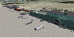
Eagle Regional Airport (KEGE) has an approach through mountainous terrain and challenging departure procedures. It is Home for the Vail Valley Jet Center, the Colorado National Guard High Altitude Training Center and the Army. Because of it's high altitude, it is a very dangerous airport for take-off and landings. This scenery is updated with the new 109,75 ILS, the new Army and National Guard area on the opposite side of the airfield and many trees in the surrounding area.
| Filename: | KEGE__Eagle_Regional_Airport__Colorado_USA.zip |
| License: | Freeware |
| Added: | 7th September 2016, 21:58:26 |
| Downloads: | 775 |
| Author: | David Kolas |
| Size: | 8.55 MB |


© 2001-2026 AVSIM Online
All Rights Reserved
Privacy Policy |