
Where Flight Simulation Enthusiasts Gather from Around the World!
AVSIM Library - Search Results

| Category: Flight Simulator 2004 - Scenery | |
| KSBY Salisbury-Ocean City Wicomico Regional Airport |

|
Images related to this file:
File Description:

Added new terminal with extra hangars and gates for Piedmont Airlines.
Requires RWY12 object library and two other downloads listed inside the READ ME FILE.
| Filename: | KSBY_SalisburyOcean_City_Wicomico_Regional_Airport.zip |
| License: | Freeware, limited distribution |
| Added: | 18th June 2011, 19:20:10 |
| Downloads: | 644 |
| Author: | Rob Touchtone |
| Size: | 8.72 MB |
| Category: Flight Simulator 2004 - Scenery | |
| KDBQ Dubuque Regional Airport |
|
Images related to this file:
File Description:

KDBQ Dubuque IA. Replaced default airport with a new terminal and hangers. Added gate for American Eagle, and general aircraft ramps.
Requires RWY12 object library and some extra downloads available from the read me file.
| Filename: | KDBQ_Dubuque_Regional_Airport.zip |
| License: | Freeware, limited distribution |
| Added: | 19th June 2011, 23:59:40 |
| Downloads: | 787 |
| Author: | Rob Touchtone |
| Size: | 10.73 MB |
| Category: Flight Simulator 2004 - Scenery | |
| KENV Wendover Utah 2011 |
|
Images related to this file:
File Description:
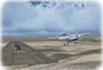
My second scenery to date. This time it features Wendover Utah.
Includes
-Photoreal textures and ground poly.
-3D Taxiway Lights
-Taxiway Signs
-Correct afcad and scasm lighting
| Filename: | KENV_Wendover_Utah_2011.zip |
| License: | Freeware |
| Added: | 20th June 2011, 13:17:46 |
| Downloads: | 1,154 |
| Author: | Ryan Whitford |
| Size: | 6.61 MB |
| Category: Flight Simulator 2004 - Scenery | |
| Cape Dyer CWFD in Nunavut, Canada |
|
Images related to this file:
File Description:
Cape Dyer is on the southeast corner of Baffin Island, around 120 miles east of Pangnirtung at approximately N66 45 W61 30. There is a fine view north up the Davis Strait between Baffin Island and Greenland, and this is the whole reason for the airfield's existance as it was built to support the construction and operation of a DEW line radar station, which has now been updated to a North Warning System site. There are two camps; the upper camp is on the east side of the Cape and is where the radars are located, linked by a gravel road to the lower camp, which is on the west and more sheltered side of the Cape on the clifs above Sunneshine Fjord. The runway is 5,000' of 150' wide gravel, and it is lighted and at 1,320' feet ASL. Cape Dyer is now listed as abandoned in the Canada Flight Supplement. It is, however, still there and presumably is still used for access to the North Warning System equipment, which is automated and generally unmanned. The buildings were modeled for this scenery and include a hanagar large enough to accommodate a C-130. Ultimate Terrain is not required as it does not cover northern Canada.
| Filename: | Cape_Dyer_CWFD_in_Nunavut_Canada.zip |
| License: | Freeware, limited distribution |
| Added: | 21st June 2011, 19:30:07 |
| Downloads: | 491 |
| Author: | Roger Wensley |
| Size: | 1.9 MB |
| Category: Flight Simulator 2004 - Scenery | |
| Peggo Devon CPD7 |
|
Images related to this file:
File Description:
Tucked in the far NE corner of British Columbia, Peggo Devon is a 4200' gravel landing strip serving the Devon Corporation's natural gas mining facility there. The runway has night lighting and there is an NDB on the field, but there are no instrument landing procedures. The layout of the airport is accurately reproduced here, including a portion of the extensive surrounding network of roads and drilling sites.
| Filename: | Peggo_Devon_CPD7.zip |
| License: | Freeware |
| Added: | 25th June 2011, 06:27:50 |
| Downloads: | 281 |
| Author: | Sidney Schwartz & Peter Ham |
| Size: | 1.14 MB |
| Category: Flight Simulator 2004 - Scenery | |
| San Cristoban de las Casas, Chipas, Mexico (MMSC) |
|
Images related to this file:
File Description:
FS2004 Scenery for San Cristoban de las Casas, Chipas, Mexico - MMSC airport. Also compatible with FSX. For other sceneries and repaints visit http://fsbrasil.wordpress.com
| Filename: | San_Cristoban_de_las_Casas_Chipas_Mexico_MMSC.zip |
| License: | Freeware |
| Added: | 27th June 2011, 04:00:15 |
| Downloads: | 1,143 |
| Author: | Rui Mesquita |
| Size: | 20.07 MB |
| Category: Flight Simulator 2004 - Scenery | |
| Mauritius International Airport |
|
Images related to this file:
File Description:
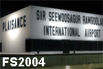
Mauritius International Airport for FS2004. Featuring a totally new modelling of Sir Seewoosagur Ramgoolam (SSR) International airport. Gmax modelled terminals, maintenance, cargo hangars, VIP Aviation terminal, fire station and more as well as photoreal ground textures, building textures, fully customised SSR vehicles and apron objects.
| Filename: | Mauritius_International_Airport.zip |
| License: | Freeware, limited distribution |
| Added: | 27th June 2011, 12:49:25 |
| Downloads: | 10,584 |
| Author: | Max Kraus |
| Size: | 34.28 MB |
| Category: Flight Simulator 2004 - Scenery | |
| Forest fires in Mallorca / Majorca (Spain) |
|
File Description:
4 forest fires in Mallorca / Majorca (Spain), at different locations and times of the day. Mainly situated in the western mountain chain, it will become quite challenging flying at the low altitudes, necessary for an accurate waterdrop. Risks increasing at dawn and dusk.
| Filename: | Forest_fires_in_Mallorca__Majorca_Spain.zip |
| License: | Freeware |
| Added: | 29th June 2011, 11:52:52 |
| Downloads: | 437 |
| Author: | Luc Vermaut |
| Size: | 6.82 MB |
| Category: Flight Simulator 2004 - Scenery | |
| Durban Island CWFB FOX-E DEW line station in Nunavut, Canada |
|
Images related to this file:
File Description:
Durban Island is 40 miles north of Cape Dyer on the southeast corner of Baffin Island, and around 60 miles southeast of Qikiqtarjuaq (known as Broughton until recently). Sitting on the top of the island is FOX-E, an intermediate station that was part of the DEW line. There is no runway (and once you have seen the island you will know why) and the station and its (usually) five man crew were supported by helicopter flights from Cape Dyer. The main feature is a 300' high mast, topped by comms gear to link both to Broughton to the north and Cape Dyer to the south. There was only one really habitable building, 80' x 30' in round figures, and this contained the generators, technical spaces, sleeping areas, kitchen, mess, and showers etc. There were also what were known as Anderson shelters, originally put up to house the construction crew and used in the summer for any maintenance people who visited for short periods. There was also a garage for a snow cat and tanks for fuel. And a view.
This post also includes new bgls for Cape Dyer to provide the 300' tower there too.
| Filename: | Durban_Island_CWFB_FOXE_DEW_line_station_in_Nunavu.zip |
| License: | Freeware, limited distribution |
| Added: | 1st July 2011, 22:11:33 |
| Downloads: | 316 |
| Author: | Roger Wensley |
| Size: | 1.87 MB |
| Category: Flight Simulator 2004 - Scenery | |
| Alternates for Durban Island CWFB FOX-E DEW line station in Nunavut, Canada |
|
File Description:
These are alternative bgls that include a flatten. They will change the shape of the hill that the FOX-E station sits on top of, but they will also make sure that there are no "floating" or "buried" scenery objects. If you are having that problem then just throw these into the scenery folder that you already created when you installed Durban Island, and say Yes! to over-write or whatever the question is. If you have a mesh that is compatible with what I use then you won't be having that problem, so don't do anything.
| Filename: | Alternates_for_Durban_Island_CWFB_FOXE_DEW_line_st.zip |
| License: | Freeware, limited distribution |
| Added: | 1st July 2011, 22:12:35 |
| Downloads: | 268 |
| Author: | Roger Wensley |
| Size: | 353.65 KB |


© 2001-2026 AVSIM Online
All Rights Reserved
Privacy Policy |