
Where Flight Simulation Enthusiasts Gather from Around the World!
AVSIM Library - Search Results

| Category: Flight Simulator X - Scenery | |
| SWSI - Sinop-MT Airport - Mato Grosso, Brazil ** NEW VERSION ** |

|
Images related to this file:
File Description:
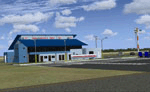
FSX Sinop Airport Scenery 3D. Scenery of Sinop Airport (SWSI) located in the state of Mato Grosso, Brazil. Based on coordinates taken from Google Earth. Includes AFCAD, fences and 3D objects. Version 1.6.
| Filename: | SWSI__SinopMT_Airport__Mato_Grosso_Brazil___NEW_VE.zip |
| License: | Freeware, limited distribution |
| Added: | 1st February 2015, 13:30:22 |
| Downloads: | 2,183 |
| Author: | Eduardo Mello |
| Size: | 3.15 MB |
| Category: Flight Simulator X - Scenery | |
| Boca Raton HD |
|
Images related to this file:
File Description:

Boca Raton is located in Florida and is a small GA airfield that serves larger corporate groups. Soarfly Concepts has made this dulled down version prior to a full X-HD release for a few good reasons but the main one is we liked the airport and hope to get a photo real version out soon.
| Filename: | Boca_Raton_HD.zip |
| License: | Freeware, limited distribution |
| Added: | 1st February 2015, 23:14:04 |
| Downloads: | 1,270 |
| Author: | Mark Piccolo - Soarfly Concepts |
| Size: | 18.94 MB |
| Category: Flight Simulator X - Scenery | |
| Dieuze - Gueblange V2 |
|
Images related to this file:
File Description:
This scenery depicts Dieuze-Gueblange aerodrome located in the north east of France. It is a very accurate rendition of this aerodrome made with photoreal textures for the ground and the objects. The ground is covered with volumetric grass. I have modelled an animated sock that indicates the wind direction and velocity. To see this windsock, Sode (Sim Objects Display Engine) module must be installed (module availabale here : http://sode.12bpilot.ch/?page_id=9). A user manual (pdf) is included.
The windsock library may be used in your own sceneries. If you share a scenery using this library, you must add the BJP_SOCKS folder without any modification in order to avoid duplicate files. Please include my name in any of your included documents. This new release is now compatible with a landclass environment: snowy ground and trees in the hard winter (from the first day of december to the last day of january). Please read the specific enclosed manual.
| Filename: | Dieuze__Gueblange_V2.zip |
| License: | Freeware, limited distribution |
| Added: | 1st February 2015, 23:14:45 |
| Downloads: | 1,453 |
| Author: | Jacques-Paul Bollard |
| Size: | 21.98 MB |
| Category: Flight Simulator X - Scenery | |
| KRNO - Reno/Tahoe Intl - Nevada, USA |
|
Images related to this file:
File Description:
This airport update is made only for those that have Acceleration installed: there is one version with the Crosswind runway operating where all 3 runways will be used for takeoff/landing and one version as the default runway operation: assigned parking as per their website with extra parking including JetBlue Airways which begins on May 28 2015, taxiways and taxi signs updated to the latest charts, extra fuel trucks, support vehicle roads rebuilt and many other scenery improvements, airport views are from inside the control tower (when in tower view) please view the readme before installation.
| Filename: | KRNO__RenoTahoe_Intl__Nevada_USA.zip |
| License: | Freeware, limited distribution |
| Added: | 2nd February 2015, 14:33:51 |
| Downloads: | 19,709 |
| Author: | Craig Scott |
| Size: | 754.51 KB |
| Category: Flight Simulator X - Scenery | |
| IGT - Nightmute Airport - Alaska, USA |
|
Images related to this file:
File Description:
The airport islocated southeast of the central business district of the vellage of Nightmute.Nightmute is located on Nelson Island near Toksook Bay. The two villages connect by snowmachine trail in winter.
Runway 2/20 was changed to 3/21. Changed the length of Runway 3/21 from 50 feet wide and a legth of 1,600 feet to 75 feet wide and 3,200 feet long.Added Runway 11/29 along with custom models.Changes are based on construction plans dated 2005.
Created with Airport Design Editor by ScruffyDuck Software using current FAA documentation and Google Earth's measurements, this package offers a replacement for FSX's stock airport. All these enhancements are as close to the real airport as I can get with stock library objects and custom buildings.
| Filename: | IGT__Nightmute_Airport__Alaska_USA.zip |
| License: | Freeware |
| Added: | 3rd February 2015, 09:12:14 |
| Downloads: | 671 |
| Author: | Wayne Roberts |
| Size: | 197.17 KB |
| Category: Flight Simulator X - Scenery | |
| EHVE - Traffic Port Venlo - Venlo, Netherlands |
|
Images related to this file:
File Description:
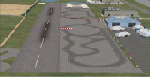
The Dutch airstrip of Traffic Port Venlo is a few miles WNW of Venlo. Opened in 2009, it is unusual in that it shares its site with an Articulated -Lorry Driving School! Hence the road markings on the apron. I did it at the request of a Dutch Flight Simmer who drives past it regularly and wanted to be able to 'fly in' as well.
| Filename: | EHVE__Traffic_Port_Venlo__Venlo_Netherlands.zip |
| License: | Freeware |
| Added: | 6th February 2015, 13:20:59 |
| Downloads: | 572 |
| Author: | Alf Denham |
| Size: | 2.66 MB |
| Category: Flight Simulator X - Scenery | |
| Sicily VFR - Terrain Mesh SRTM 1 Arc/Sec version 3 |
|
Images related to this file:
File Description:
Enhanced Terrain Mesh with SRTM 1 Arc/Sec (30 meters) version 3 at LOD 11 (19mt meters/pixel). SRTM 1 Arc-Second Global elevation data offer worldwide coverage of void filled data at a resolution of 1 arc-second (30 meters/0,000278 degrees) and provide open distribution of this high-resolution global data set. The SRTM 1 Arc-Second Global (30 meters) data set released in phases starting September 24, 2014. Fully compatible also with P3D.
| Filename: | Sicily_VFR__Terrain_Mesh_SRTM_1_ArcSec_version_3.zip |
| License: | Freeware |
| Added: | 7th February 2015, 20:18:17 |
| Downloads: | 4,693 |
| Author: | Giovanni Miduri |
| Size: | 43.32 MB |
| Category: Flight Simulator X - Scenery | |
| Hawaiian Airports Part 3 |
|
Images related to this file:
File Description:
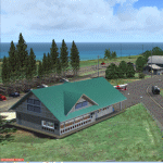
Hawaiian Airports Part 3
This scenery features the airports at Princeville, Port Allen, Waimea and Upolu. HI01-Princeville and PAK-Port Allen are located on the island of Kauai, the film location made famous by Stephen Spielberg's blockbuster, Jurassic Park. PHMU-Waimea and PHUP-Upolu are located in the North West of Hawaii, also known as the Big Island. All runways, aprons, taxiways and buildings have been repositioned to their correct locations, and the scenery has been recreated based on photos of the real airports. The scenery features many animated objects including people, aircraft, animals, waves, cars, trucks and many more. Full night textures with light maps are included.
All the scenery files have been sub-divided so they can be switched on or off according to user preference and hardware configuration. It has been designed for, and tested in DX9 and FSXA only. The airports include sloped flattens so they can also be used with high density mesh. This file also includes updates for Hawaiian Airports Part 2. Please enjoy, and I hope you like my scenery as much as I enjoyed building it.
| Filename: | Hawaiian_Airports_Part_3.zip |
| License: | Freeware, limited distribution |
| Added: | 8th February 2015, 21:23:05 |
| Downloads: | 6,973 |
| Author: | George Keogh |
| Size: | 82.23 MB |
| Category: Flight Simulator X - Scenery | |
| Puerto Rico 2015 - Plus Voice Packs and Boat traffic! |
|
Images related to this file:
File Description:
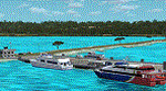
Here is my latest depiction of Puerto Rico for FSX . Added other non airport areas like boat piers and popular beaches and towns. Just copy these files inside your addon scenery folder inside FSX (Always make a Back-Up copy before any changes!!!!)
Bonus: Voice Packs And Boat Traffic for the area.
| Filename: | Puerto_Rico_2015__Plus_Voice_Packs_and_Boat_traffi.zip |
| License: | Freeware |
| Added: | 8th February 2015, 21:25:16 |
| Downloads: | 1,197 |
| Author: | Roberto Rotol Ayala |
| Size: | 12.98 MB |
| Category: Flight Simulator X - Scenery | |
| ZSFZ - Fuzhou Changle International Airport - Fuzhou, Fujian Province, China |
|
Images related to this file:
File Description:
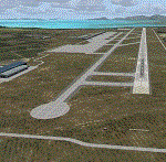
This is an accurate, up to date depiction of ZSFZ in Fujian Province, China. Based on the latest satellite imagery, it features accurate taxiways, taxisigns, apron, gates and jetways. I've also added a variety of buildings and extras to add some life to the surroundings.
| Filename: | ZSFZ__Fuzhou_Changle_International_Airport___Fuzho.zip |
| License: | Freeware |
| Added: | 9th February 2015, 15:40:30 |
| Downloads: | 1,298 |
| Author: | Michael Orchard |
| Size: | 23.21 KB |


© 2001-2026 AVSIM Online
All Rights Reserved
Privacy Policy |