
Where Flight Simulation Enthusiasts Gather from Around the World!
AVSIM Library - Search Results

| Category: Flight Simulator X - Scenery | |
| 17Z - Manakotak Airport - Alaska |

|
Images related to this file:
File Description:
Manokotak Airport (IATA: KMO, ICAO: PAMB, FAA LID: MBA, formerly 17Z) is a state-owned public-use airport located one mile (2 km) north of the central business district of Manokotak, a city in the Dillingham Census Area of the U.S. state of Alaska.
Increased runway 3/21 from 3,300 feet to 4,000 feet. Added aditional aprons and custom buildings. Changes are based on 2006 construction plans.
Created with Airport Design Editor 9x by ScruffyDuck Software using current FAA documentation and Google Earth measurements, this package offers a replacement for FSX's stock airport. All these enhancements are as close to the real airport as I can get with stock library objects and custom buildings.
| Filename: | 17Z__Manakotak_Airport__Alaska.zip |
| License: | Freeware |
| Added: | 16th January 2015, 20:14:02 |
| Downloads: | 790 |
| Author: | Wayne Roberts |
| Size: | 53.55 KB |
| Category: Flight Simulator X - Scenery | |
| Bhutan Airports and Paro Valley |
|
Images related to this file:
File Description:
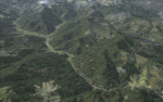
This project adds and updates all of the airports of Bhutan. Bathpalathang (VQBT) and Gelephu (VQGP) are added, Yongphulla (VQ10) is updated and recoded as VQTY, and Paro (VQPR) is fully updated to reflect current satellite imagery. These are all fully functioning AI airports as well. Special attention was given to the entire Paro Valley, and numerous road/river vectors were updated around Gelephu. Accurate coastlines, lakes, road and river data, as well as corrected landclass are provided based on the latest available satellite imagery. They are optimized to fit seamlessly with FTX Vector's roads/water, but they should be fully functional in all FSX configurations.
GA-encoded flight plans for the Buddha Air/Kathmandu charter are provided to enhance service to Paro. NASA SRTM Global 3 arc second terrain mesh is also included for all of Bhutan. Updates were created or rebuilt in a manner which carefully aligned airport data with current satellite imagery, when available. Scenery was created using Airport Design Editor X v1.61.5298, SBuilderX 3.13, and the FSX Object Placement Tool. Scenery objects were added and modified from stock FSX scenery to resemble as closely as possible the actual airports.
| Filename: | Bhutan_Airports_and_Paro_Valley.zip |
| License: | Freeware |
| Added: | 19th January 2015, 06:09:17 |
| Downloads: | 11,440 |
| Author: | Carlyle Sharpe |
| Size: | 21.4 MB |
| Category: Flight Simulator X - Scenery | |
| Bhutan Airports Tower Information |
|
File Description:
These files update the tower information for the "Bhutan Airports and Paro Valley" scenery and require the "bhutan_airports_and_paro_valley.zip" file. Unzip the "bhutan_airports_twr_info.zip" file and copy/replace the files in the "Bhutan_Airports_and_Paro_Valley\scenery" folder with the new files.
| Filename: | Bhutan_Airports_Tower_Information.zip |
| License: | Freeware |
| Added: | 19th January 2015, 18:54:22 |
| Downloads: | 3,035 |
| Author: | Carlyle Sharpe |
| Size: | 3.62 KB |
| Category: Flight Simulator X - Scenery | |
| Dieuze - Gueblange |
|
Images related to this file:
File Description:
This scenery depicts Dieuze-Gueblange aerodrome located in the north east of France.
It is a very accurate rendition of this aerodrome made with photoreal textures for the ground and the objects.
The ground is covered with volumetric grass.
I have modelled an animated sock that indicates the wind direction and velocity.
To see this windsock, Sode (Sim Objects Display Engine) module must be installed (module availabale here : http://sode.12bpilot.ch/?page_id=9). A user manual (pdf) is included.
| Filename: | Dieuze__Gueblange.zip |
| License: | Freeware, limited distribution |
| Added: | 21st January 2015, 21:41:16 |
| Downloads: | 642 |
| Author: | Jacques-Paul Bollard |
| Size: | 10.19 MB |
| Category: Flight Simulator X - Scenery | |
| RJTT - Tokyo Haneda Intl - Tokyo, Japan |
|
Images related to this file:
File Description:
This scenery is a very accurate rendition of Haneda Intl airport and made only for FSX: one file with the Crosswind runways operating, where all 4 runways will be used for takeoff/landing and one file as the default runway operation: the new International terminal expansion added, Terminal 2 and gates also updated, assigned parking with extra parking including several gates for the A380, all taxiways and taxi signs updated to the latest charts, extra fuel trucks, support vehicle roads rebuilt, lighted helipad with a start location, airport views are from inside the control tower (when in tower view) please view the readme before installation
| Filename: | RJTT__Tokyo_Haneda_Intl__Tokyo_Japan.zip |
| License: | Freeware, limited distribution |
| Added: | 23rd January 2015, 17:41:03 |
| Downloads: | 44,640 |
| Author: | Ray Smith |
| Size: | 2.71 MB |
| Category: Flight Simulator X - Scenery | |
| Alfs UK Airfields - Vol 1 and 2 Updates |
|
File Description:
REQUIRES: alf_s_uk__airfields.zip (available HERE) and alfs_uk_airfields_vol2.zip (available HERE)
Alf's UK airfields Vols.1 and 2 Updates *IMPORTANT* Cures Faults on other airfield ILS Glide Pathes. Old faulty AFX files replaced with ADEX ones. Culprits are Cosford/Dunsfold/Elstree/Netherthorpe/Old Warden v.1/Popham v.1
| Filename: | Alfs_UK_Airfields__Vol_1_and_2_Updates.zip |
| License: | Freeware |
| Added: | 23rd January 2015, 18:04:26 |
| Downloads: | 605 |
| Author: | Alf Denham |
| Size: | 27.36 KB |
| Category: Flight Simulator X - Scenery | |
| KMKJ - Mountain Empire Airport - Virginia, USA |
|
Images related to this file:
File Description:
Mountain Empire Airport (ICAO: KMKJ, FAA LID: MKJ) is a public use airport in Smyth County, Virginia, United States.[1] It located nine nautical miles (10 mi, 17 km) northeast of the central business district of Marion (in Smyth County)[1] and 13 nautical miles (15 mi, 24 km) west of Wytheville (in Wythe County).[2] The airport is situated between Interstate 81 and U.S. Route 11 (Lee Highway), near Groseclose. It is owned by Smyth Wythe Airport Commission.
This is a complete re-work of the airport. Added taxiway, additional parking aprons and custom buildings.
Created with Airport Design Editor by ScruffyDuck Software using current FAA documentation and Google Earth measurements, this package offers a replacement for FSX's stock airport. All these enhancements are as close to the real airport as I can get with stock library objects and custom buildings.
| Filename: | KMKJ__Mountain_Empire_Airport__Virginia_USA.zip |
| License: | Freeware |
| Added: | 25th January 2015, 15:55:52 |
| Downloads: | 309 |
| Author: | Wayne Roberts |
| Size: | 339.5 KB |
| Category: Flight Simulator X - Scenery | |
| Hawaiian Airports Part 2 |
|
Images related to this file:
File Description:
Hawaiian Airports Part 2
This scenery features the airports at PHJR John Rodgers Field, PHBK Barking Sands, NPS Ford Island and PHNG Kaneohe Bay. All runways, aprons, taxiways and buildings have been repositioned to their correct locations, and include custom textures based on photographs of the real airports. The scenery features many animated objects including people, aircraft, animals, waves, cars, trucks and many more. Full night textures with light maps are included.
All the scenery files have been sub-divided so they can be switched on or off according to user preference. It has been designed for, and tested in DX9 and FSXA only. The airports include sloped flattens so they can also be used with high density mesh. These airports have long runways and can easily cater for the 'heavies', PHJR now acts as a backup to the main airort at PHNL Honolulu. Runway 04 at PHNG is a real challenge, and requires a 90 degree turn under the mountains.
Please enjoy, and I hope you like my scenery as much as I enjoyed building it.
| Filename: | Hawaiian_Airports_Part_2.zip |
| License: | Freeware, limited distribution |
| Added: | 27th January 2015, 09:03:22 |
| Downloads: | 8,351 |
| Author: | George Keogh |
| Size: | 152.19 MB |
| Category: Flight Simulator X - Scenery | |
| Trenton Luna International (Concept) |
|
Images related to this file:
File Description:

Trenton Luna is the second instalment of the Luna name for us. our first gave us Los Angeles Luna and now we're in Trenton, New Jersey.
The Airport features the new Pan Am World Port and HD ground detailing. all in all a very eye pleasing concept for the remote are we chose.The Airport does not yet feature default ACT or traffic but should you wish for both there will be an update following soon where we will bring the airport to life.
| Filename: | Trenton_Luna_International_Concept.zip |
| License: | Freeware, limited distribution |
| Added: | 27th January 2015, 23:02:32 |
| Downloads: | 273 |
| Author: | Mark Piccolo - Soarfly Concepts |
| Size: | 14.12 MB |
| Category: Flight Simulator X - Scenery | |
| KSAT - San Antonio International - Texas, USA ** UPDATE ** |
|
Images related to this file:
File Description:
This Update does not require the original file. It updates all the correct runways lengths, and number. Correct General Aviation Parking. Made with help of Jeppesen charts from Southwest Airlines. New terminal B added. Version 2.1 will update some faults and bugs in the airport.
| Filename: | KSAT__San_Antonio_International__Texas_USA__UPDATE.zip |
| License: | Freeware, limited distribution |
| Added: | 29th January 2015, 10:58:23 |
| Downloads: | 1,413 |
| Author: | Alex Kulak |
| Size: | 22.65 KB |


© 2001-2026 AVSIM Online
All Rights Reserved
Privacy Policy |