
Where Flight Simulation Enthusiasts Gather from Around the World!
AVSIM Library - Search Results

| Category: Flight Simulator 2004 - Scenery | |
| Edson CYET in Alberta, Canada |

|
Images related to this file:
File Description:
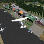
Edson is 120 miles west of Edmonton in Alberta, on Highway 16. It was originally named Heatherwood, but that was changed to honour the vice president of the Grand Trunk Pacific Railway when it was made the local railway centre. It thrived, and when Highway 16 was upgraded it thrived even more. Coal mining and industry connected with timber are the main employers of a population of around 8,500. The airport is at the western edge of the town at 3,041 feet asl, with a single lit runway 6,000 feet long and 100 feet wide aligned 07-25, with displaced thresholds and VASI at each end. The two joined aprons are at the eastern end of the airfield, with fire fighting chemical tanks beside the western one which is reserved in the summer months for the Lockheed Electra Air Spray planes; these are included in the AI. The eastern apron is for visiting charters and GA planes, next to a small terminal building. There is further parking on the grass for resident planes next to a large gravel car parking area and clubhouse. As the Air Spray planes would not be fighting fires in the winter there are in fact two editions of the AI, one for the summer fire fighting season and the other for the winter freeze. Use whichever one is appropriate for your flight time; I never strayed far from Ottawa in the winter so for me it is the summer one only. While making this I came across something new in the shape of some incorrectly installed edge lights in the stock fs9 version that refused to be deleted. There is still an "Edson TOP" folder which would normally be used to delete all unwanted taxiway edge lights, but in this case it deletes only some of them. Apologies, but there is nothing more that I can do and so I suggest you use this in daylight only.
| Filename: | Edson_CYET_in_Alberta_Canada.zip |
| License: | Freeware, limited distribution |
| Added: | 10th February 2019, 23:59:04 |
| Downloads: | 148 |
| Author: | Roger Wensley |
| Size: | 7.14 MB |
| Category: Flight Simulator 2004 - Scenery | |
| Photoreal Scenery for Brussels South Charleroi Airport |
|
Images related to this file:
File Description:
4 seasons Photoreal Scenery of the Brussels South Charleroi Airport (centered on the Airport)
(Designed to be used with Serge Libon's fantastic freeware 2018v2 rendition of the EBCI - Brussels South Charleroi Airport, available from the AVSIM Library)
| Filename: | Photoreal_Scenery_for_Brussels_South_Charleroi_Air.zip |
| License: | Freeware |
| Added: | 19th February 2019, 18:47:32 |
| Downloads: | 453 |
| Author: | Diego Varela Rodriguez |
| Size: | 34.6 MB |
| Category: Flight Simulator 2004 - Scenery | |
| Arusha Airport (ARK/HTAR) |
|
Images related to this file:
File Description:
This is Arusha Airport (ARK/ HTAR) located in Northern Tanzania in the town of Arusha. It serves as the main gateway for GA planes for tourists to the National Parks. Built using Sketchup, ADE v1.76, Sbuilder. Needs RWY12 Objects
| Filename: | Arusha_Airport_ARKHTAR.zip |
| License: | Freeware |
| Added: | 2nd March 2019, 04:15:17 |
| Downloads: | 653 |
| Author: | Emmanuel Mwandosya |
| Size: | 10.07 MB |
| Category: Flight Simulator 2004 - Scenery | |
| Arusha Airport (ARK/HTAR) Update 1 |
|
File Description:
Update fix that removes static planes and adds AI parking spots and also fixes few issues to HTAR-Arusha scenery
Contact: [email protected]
| Filename: | Arusha_Airport_ARKHTAR_Update_1.zip |
| License: | Freeware |
| Added: | 3rd March 2019, 00:22:36 |
| Downloads: | 249 |
| Author: | Emmanuel Mwandosya |
| Size: | 159.54 KB |
| Category: Flight Simulator 2004 - Scenery | |
| Bethel PABE in southwest Alaska |
|
Images related to this file:
File Description:
There are four main northwestern Alaska towns which have good airports and are serviced by Alaska Airlines. From these airports local flights connect to nearby villages, "nearby" in Alaska meaning up to 200 miles away. The northernmost is Barrow. Southwest of Barrow is Kotzebue, then Nome, and the furthest south is this one, Bethel. The town of Bethel has a population of just over 6,000 and is 50 miles from the sea on the Kuskowim River, that splits and forks into many tributaries. Bethel Airport is close to the town and provides the only contact with the rest of Alaska, as there is no connecting highway system. There are scheduled flights by Alaska Airlines, ERA (now called Ravn) and Grant Aviation, plus others such as Ryan Air. There are cargo flights by Everts, Northern, and Lynden, and redistribution onwards to nearby villages by the smaller locally-based planes; all of these are included in the AI. There are two main runways, one just under 6,400 feet and another just under 3,900 feet, both of them aligned 19-1. The third runway is around 1,800 feet and mainly gravel, aligned 11-29. Parking at PABE is on three aprons, the northern for smaller commercial planes of Grant, ERA, Ryan etc, the central for larger planes of Alaska, Northern, Everts, and Lynden, and the southern for a large collection of GA; each apron has further hangars for maintenance companies and smaller operators. There is also another separate apron for the local military and Coastguard. There is not much photographic information available for PABE, and I have never been there; as a result it was impossible to make detailed photographic textures for some of the buildings. However, for most hangars I have made textures of at least the right colour etc based on the information I assembled and if it is green with white trim and side windows then that is how it now appears here. The exceptions are the Alaska Airlines terminal building which has complicated curved elements, and the two military hangars and workshops where I had to settle for an Alaska terminal building from another airport and the same for the military. There are numerous small villages in the vicinity of Bethel, all of them being beside either a river tributary or the coast. There are two Google Earth screenshots to show the villages that are served by the flights from Bethel and that are (mostly) included in the AI. Some of these airfields were not included in FS9 but AI will still operate in and out of Bethel. The smaller area screenshot shows the villages that are close to Bethel, and of these eight I have so far made six and they are included in this post: Napaskiak PKA, Napakiak WNA, Kwethluk KWT, Atmautluak 4A2, Nunapitchuk 16A, and Kasigluk Z09. I will work my way through the rest of the area.
| Filename: | Bethel_PABE_in_southwest_Alaska.zip |
| License: | Freeware, limited distribution |
| Added: | 8th March 2019, 00:37:58 |
| Downloads: | 309 |
| Author: | Roger Wensley |
| Size: | 32.02 MB |
| Category: Flight Simulator 2004 - Scenery | |
| Belagondapalli, India - Hosur Aerodrome |
|
File Description:
VO95 is in Belagondapalli, India is for private military and maintenance services for SpiceJet and others for check up 737's. There are a few details in the scenery.
| Filename: | Belagondapalli_India__Hosur_Aerodrome.zip |
| License: | Freeware |
| Added: | 8th March 2019, 00:41:02 |
| Downloads: | 182 |
| Author: | Stuart John Gilbert II |
| Size: | 1.36 MB |
| Category: Flight Simulator 2004 - Scenery | |
| OMSJ Sharjah Minor Update for FS2004 March 2019 |
|
File Description:
This is a basic 2019 rework of the Sharjah Airport by Matthew Ministry made in 2010. I have only updated the Airport Layout as it shows to this day. The old runway 12/30 is now Taxiway B as per the real charts. PLEASE note, the parking spaces are a bit off but the main focus of this was to updated the Airport layout with the updates taxiways. See readme for details. But it does the job for FS9 pilots to fly and enjoy some Air Arabia hops out of the UAE. Happy flying FS9 users!
This works fully with Flytampa OMDB, only prioritize in your library order to show the scenery properly!
| Filename: | OMSJ_Sharjah_Minor_Update_for_FS2004_March_2019.zip |
| License: | Freeware, limited distribution |
| Added: | 23rd March 2019, 16:26:39 |
| Downloads: | 912 |
| Author: | Nadeem Zabaneh |
| Size: | 4.19 MB |
| Category: Flight Simulator 2004 - Scenery | |
| FS2004 Panama Tocument Int Airport |
|
File Description:
Scenery of the Airport TOCUMEN International detailed that includes
the northern extension of the terminal, Moving jetways and some catering service
for your plane, Moving stairs at the South Ramp, Moving vehicles, Night lights over all scenery
Development and donated as freeware By VIRTUALCOL FS SOFTWARE
Email: [email protected]
| Filename: | FS2004_Panama_Tocument_Int_Airport.zip |
| License: | Freeware, limited distribution |
| Added: | 31st March 2019, 00:30:09 |
| Downloads: | 1,283 |
| Author: | Virtualcol FS Software |
| Size: | 14.11 MB |
| Category: Flight Simulator 2004 - Scenery | |
| FS9 SimCopter |
|
Images related to this file:
File Description:

This is a remake of a popular helicopter game called SimCopter by Maxis. It was one of my favorite games to fly. I have made this version of the game with FS9 using the sound files from SimCopter. This sound files is located in the download. This adventure is made up of different mission in one adventure. Complete all missions to successfully complete the adventure. As a pilot for the city you will be dispatched to several types of calls in the city and the surrounding towns. Calls are: Passenger Transportation, Medical Transports, Rescue or Police calls. Hospitals are located as close to their actually location as the scenery allows. A briefing is included to help you fly these missions.
SimCopter Intallation.pdf is included.
Good luck and have fun.
| Filename: | FS9_SimCopter.zip |
| License: | Freeware |
| Added: | 12th April 2019, 03:17:53 |
| Downloads: | 133 |
| Author: | David J Crandall |
| Size: | 149.53 MB |
| Category: Flight Simulator 2004 - Scenery | |
| Bethel area airfields in southwest Alaska close to the Yukon River |
|
Images related to this file:
File Description:
This presumes you have already installed my post of Bethel PABE. In the Yukon River area of Alaska there are a lot of small villages close together, which is unusual for Alaska. Almost all of them are on the coast or a river bank, and the local economies depend on fishing. Some are larger than others and have a fish processing plant, such as in Emmonak. This is the largest such plant and it exports prepared fish by cargo planes which fly in on a daily basis, using an extended runway. This post includes airfields to the south and west of PABE, 17 of them; some of them already included and now modified. There will be more airfields to the north and northwest of Bethel in a future post. There are revisions to Bethel to include parking spaces for Yute Air (newly included here) and extra spaces for Ryan Air. Both of these flew Cessna 205 planes into the smaller village strips from Bethel (past tense as Yute Air recently went bankrupt). The northwest area is served both from Bethel and also from St Mary's PASM, which is in the northwest and at a more economical range to the local airfields (100 miles closer than Bethel). These smaller airfields have few airfield buildings or any other creature comforts; featuring heavily are a new standard blue garage building (sometimes not yet installed) and a small and old terminal shed (that has sometimes collapsed and been removed). Go to "http://vfrmap.com/" for free vfr maps of the area, There is a pic of the local chart area included here. The screenshots are a random sample. Kipnuk PAKI is the one that appears to have a second and long grass runway; what it actually has is the ground prepared for a new and long gravel runway but which hasn't been started yet as it has taken 10 years just to prepare the ground. I have no idea why.
| Filename: | Bethel_area_airfields_in_southwest_Alaska_close_to.zip |
| License: | Freeware, limited distribution |
| Added: | 16th April 2019, 22:47:47 |
| Downloads: | 156 |
| Author: | Roger Wensley |
| Size: | 5.93 MB |


© 2001-2026 AVSIM Online
All Rights Reserved
Privacy Policy |