
Where Flight Simulation Enthusiasts Gather from Around the World!
AVSIM Library - Search Results

| Category: Flight Simulator 2004 - Scenery | |
| Terrace CYXT Updated |

|
Images related to this file:
File Description:
This revises the previous versions by adding two missing buildings, corrects the apron markings and parking and adds a third gate, creates more GA parking, updates the AI to include, for instance, a Westjet flight, and most importantly of all adds the ILS to runway 33. It is complete in itself and can be installed as-is without first installing previous versions. Terrace is fifteen miles east and inland from Prince Rupert, which is 500 miles north of Vancouver up the BC coast. It is at the point in the mountains where two fjords meet, one coming from Prince Rupert and the other from Kitimat. The population of the town is around 12,500. The airport is called Terrace-Kitimat and is a couple of miles south of the town of Terrace, on the south side of the Skeena River. There are two runways, and the main one is a recently-extended 7,500 feet long and lit 33-15 with approach lighting to both ends and an ILS on 33. The second is 5,373 feet of unlit 03-21. The apron has been enlarged to be able to accommodate a Boeing 737, though there is at the moment no airline using a 737 for flights to Terrace. The pics and the video show the surrounding hilly terrain and the nearby river between the airport and the town.
| Filename: | Terrace_CYXT_Updated.zip |
| License: | Freeware, limited distribution |
| Added: | 13th January 2019, 18:38:12 |
| Downloads: | 178 |
| Author: | Roger Wensley |
| Size: | 15.64 MB |
| Category: Flight Simulator 2004 - Scenery | |
| FS2004 Scenery EFKS_KUUSAMO (FINLAND) |
|
Images related to this file:
File Description:
FS2004 Scenery EFKS_KUUSAMO (FINLAND) -- This scenery was built from the official maps for the runway and taxiways with Google Maps as a background image as support. The different signs were positioned without any documentation or references. Only use with IVAO or VATSIM; no AI possible. By Serge Libon.
| Filename: | FS2004_Scenery_EFKS_KUUSAMO_FINLAND.zip |
| License: | Freeware |
| Added: | 17th January 2019, 19:13:20 |
| Downloads: | 285 |
| Author: | Serge Libon |
| Size: | 9.28 MB |
| Category: Flight Simulator 2004 - Scenery | |
| Stewart CZST and CAC9 in British Columbia Canada, plus Hyder 4Z7 in AK |
|
Images related to this file:
File Description:
Stewart is in northern British Columbia, around 115 miles north of Terrace, 70 miles northeast of the open sea, and 2 miles from the Canada/US border at the head of a fjord named the Portland Canal. Both Stewart and the nearby Hyder in AK thrived along with silver and gold mining in the early 1900's in the AK and BC interiors and in 1914 Stewart's population was over 10,000, but the current population is now less than 500. This scenery includes Stewart airport (CZST) and also Stewart floats (CAC9) plus Hyder floats 4Z7 which is within sight of Stewart but in Alaska. 4Z7 is based upon the three FSAddon freeware and payware Alaska sceneries, and without whichever one covers Hyder (I forget which) the float base will be isolated way offshore. The Stewart airport is adjacent to the town. There is a single runway that is unlit and just under 4,000 feet of asphalt aligned 18-36, with right hand circuits on 18; a brief view of the surrounding terrain makes it quite clear why. This version is for a period around 2010 to 2012 or so, before a second fuel tank was installed. There are no regularly scheduled flights to Stewart, only GA and charters, but the airport survives with the tourist trips. I have not forgotten the signage for CZST; there isn't any. There is also no clearly defined and fenced boundary to the airport, with a gravel apron beyond the asphalt that then fades to dirt and grass and a road. Hyder has no land connection to the rest of Alaska except through Stewart and a long road trip; the only direct link is by float plane to Ketchikan, 75 miles in a straight line. The AI includes this.
| Filename: | Stewart_CZST_and_CAC9_in_British_Columbia_Canada_p.zip |
| License: | Freeware, limited distribution |
| Added: | 18th January 2019, 18:08:29 |
| Downloads: | 175 |
| Author: | Roger Wensley |
| Size: | 8.9 MB |
| Category: Flight Simulator 2004 - Scenery | |
| Fort Smith CYSM in Northwest Territories, Canada Revised |
|
Images related to this file:
File Description:
This is an updated version to remove an incomplete static Beaver reported by Graeme (thanks Cobber) and to include other modifications that I made for my own version since posting the original; different taxiway lights, revised aprons, and in particular the revised AI that I mentioned in the original 2011 post. This is complete and can be installed as-is, or used to modify an existing post by changing the original folder contents. Fort Smith is just north of the border between Alberta and Northwestern Territories, midway between Lake Athabasca to the southeast and Great Slave Lake to the north west. You might stop there when flying between Yellowknife or Hay River to La Ronge or Saskatoon. It looks as if it is ex-military and these are the remains of what were once 10,000 feet of asphalt runways. The main runway is now 11/29 and 6,000 feet long, and the secondary one is 1,800 feet of mostly gravel. There is an airline based at the field, Northwestern Air, and fuel is available at a self service point. The town of Fort Smith is two miles east of the airfield, on the bank of the Slave River and where there are some rapids that require a portage to get around them. Before aviation came along the river was a major route to the north and all those furry animals, which was why the Hudson's Bay Company established an outpost there in 1872. Today it has a population of 2,400 and the main activities are government administration of much of the Northwest Territories, education, and tourism.
| Filename: | Fort_Smith_CYSM_in_Northwest_Territories_Canada_Re.zip |
| License: | Freeware, limited distribution |
| Added: | 23rd January 2019, 19:14:44 |
| Downloads: | 143 |
| Author: | Roger Wensley |
| Size: | 7.16 MB |
| Category: Flight Simulator 2004 - Scenery | |
| FS2004 Scenery OLBA_BEIRUT_V3 BEYROUTH (LEBANON - LIBAN) |
|
Images related to this file:
File Description:
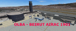
FS2004 Scenery--OLBA Beirut Beyrouth V3 (Lebanon - Liban)- NEW FULL INSTALLATION -- new night textures - gate numbers added - trees- Vehicules This scenery was built from the official maps for the runway and taxiways with Google Maps as a background image as support. The different signs were positioned without any documentation or references. Only use with IVAO or VATSIM; no AI possible. By Serge Libon.
| Filename: | FS2004_Scenery_OLBA_BEIRUT_V3_BEYROUTH_LEBANON__LI.zip |
| License: | Freeware |
| Added: | 24th January 2019, 05:06:27 |
| Downloads: | 1,168 |
| Author: | Libon Serge |
| Size: | 41.93 MB |
| Category: Flight Simulator 2004 - Scenery | |
| Abeid Amani Karume International Airport (HTZA) v1 |
|
Images related to this file:
File Description:
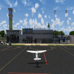
Abeid Amani Karume International Airport is the main International Airport in Zanzibar, Tanzania. The Airport scenery was built from Sketchup, SBUILDER, Fencebuilder Pro and ADE v1.76 utilizing Google Earth for correct positions. Objects placed with Instant Scenery 3. This is version 1, it includes Terminal 1, Terminal 2 (under construction), Old colonial era terminal, Fire Station and GA Hangar and facility areas. and the afcad. More improvements will come once new terminal is open . Needs RWY12 Object library. See README file for install instructions.
| Filename: | Abeid_Amani_Karume_International_Airport_HTZA_v1.zip |
| License: | Freeware |
| Added: | 26th January 2019, 00:30:59 |
| Downloads: | 812 |
| Author: | Emmanuel Mwandosya & ItaySimDesign |
| Size: | 100.36 MB |
| Category: Flight Simulator 2004 - Scenery | |
| Pemba Airport (HTPE) v1 |
|
Images related to this file:
File Description:
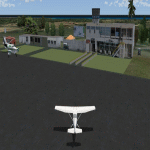
his is Pemba Airport (Also called Karume Airport- not to be confused with Karume International on the island next door.). This is the second Airport on the Zanzibar Islands, and is the main Airport of the Island of Pemba. Build using Sketchup, Sbuilder and ADE. Requires RWY12 object library if you want to see scenery objects appear. You can find rwy12 library in avsim or flightsim
| Filename: | Pemba_Airport_HTPE_v1.zip |
| License: | Freeware |
| Added: | 26th January 2019, 22:34:29 |
| Downloads: | 326 |
| Author: | Emmanuel Mwandosya |
| Size: | 4.38 MB |
| Category: Flight Simulator 2004 - Scenery | |
| Beaver Creek CYXQ in Yukon Territory, Canada |
|
Images related to this file:
File Description:
Beaver Creek is located at mile 1202 of the Alaska Highway, just east of the Alaska/Yukon border. The populaton is around 100 and the main employment is with the Border Agency, the White River First Nation, or with local tourist lodges. The airfield is a mile north of the town and close to the Canadian border post, which is included in the scenery. It was built by Jack Stalberg in the 1960's, and I have no further information beyond the fact that he loved to fly. The airport serves as an "airport of entry", though it is restricted in hours of opening and in the size of aircraft that it can handle; up to a maximum of only 15 seats. The single runway is 3,745 feet long and 100 feet wide, gravel, aligned 13-31 in FS9, lit, and with vasi at both ends. Righthand circuits for runway 13. There is a 340 feet threshold displacement to runway 31, which is of course unmarked on a gravel runway. The terminal building was recently reclad; I don't like it, but they didn't consult me. The ai reflects the sort of traffic the airfield gets; ie brief paperwork stopovers for GA or small charter flights into Canada from Alaska, usually in the mornings.I have adjusted the local scenery terrain levels to remove adjacent hills that I believe do not exist in real life but are part of the Northern Canada terrain mesh that I have installed. If you do not have this mesh you may find that the scenery works fine for you without the API flatten that is included here. The airfield is at 2,129 feet ASL.
| Filename: | Beaver_Creek_CYXQ_in_Yukon_Territory_Canada.zip |
| License: | Freeware, limited distribution |
| Added: | 28th January 2019, 06:19:20 |
| Downloads: | 175 |
| Author: | Roger Wensley |
| Size: | 4.68 MB |
| Category: Flight Simulator 2004 - Scenery | |
| McCarran Int'l Terminal 3 Addon for FSDreamteam's KLAS Version 1.0 |
|
Images related to this file:
File Description:
A brand new, built from scratch, representation of Terminal 3, the newest terminal at the airport. It comes completely integrated into the existing legacy scenery for KLAS which was created before Terminal 3 existed in real life. The new terminal rests on new ground images modified from the originals. PHOTOS INSIDE ZIPDIVE
| Filename: | McCarran_Intl_Terminal_3_Addon_for_FSDreamteams__K.zip |
| License: | Freeware |
| Added: | 4th February 2019, 17:47:39 |
| Downloads: | 1,245 |
| Author: | William Morgan / Studio F Simulations |
| Size: | 28.75 MB |
| Category: Flight Simulator 2004 - Scenery | |
| Some airports in Indonesia |
|
File Description:
There are missing airports data in FS2004. Few changed or errors or added. Please readme in my installment download.
Airports are listed:
WAFD - Bua - Polopo Lagaligo ;
WAMI - Tolitoli - Tolitoli ;
WAFY - Pogogul - Bandar Udara ;
WAPD - Rar Gwumar - Rar Gwumar ;
WATA - Alambua - A A Bere Tallo ;
WAWR - Sugimanuru - Sugimanuru ;
WAMA - Galela - Galela ;
WIPH - Kerinci - Depati Parbo ;
WITK - Takengon - Rembele ;
WITN - Sabang - Maimum Saleh ;
WIPY - Pagar Alam - Atung Bungsu ;
WAOK - Katabaru - Gusti Syamsir Alam ;
WASN - Waisai - Marinda ;
WATB - Bajawa - Turelelo Soa ;
| Filename: | Some_airports_in_Indonesia.zip |
| License: | Freeware |
| Added: | 10th February 2019, 19:20:13 |
| Downloads: | 474 |
| Author: | Stuart John Gilbert II |
| Size: | 6.89 MB |


© 2001-2026 AVSIM Online
All Rights Reserved
Privacy Policy |