
Where Flight Simulation Enthusiasts Gather from Around the World!
AVSIM Library - Search Results

| Category: Flight Simulator 2004 - Scenery | |
| New Night Textures - Newark Liberty Intl (KEWR) |

|
Images related to this file:
File Description:
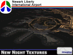
Some time ago, I purchased the Newark Liberty Intl (KEWR) by ImagineSim, but the night textures did not seem realistic. I set out to try to make them more so. This is the result of that work. Many of the scenery's night textures have been updated. The cargo areas for FedEx, UPS and UNITED Cargo now look much more realistic. The Marriott Hotel, the centerpiece of the airport and this scenery, looks considerably more realistic, as well as the terminals and the Continental Hanger and maintenance area. One of the nice unexpected results of this change is the light splash effect around the terminals; it definitely outlines the terminal area well. For those who own this scenery, I hope this enhances your flight experiences in and out of KEWR. For those who do not yet own this, but enjoy or would like to fly in and out of KEWR, it is now considered a legacy product by ImagineSim. As a result, the price was cut considerably and for a few shillings and this update, you'll have a nice addition to the airports in your FS2004 environment. I dedicate this work to all the controllers of VATSIM NYARTCC. I hope this brings more traffic your way. I want to thank ImagineSim for giving me permission to release these textures. See Readme.txt for installation instructions.
| Filename: | New_Night_Textures__Newark_Liberty_Intl_KEWR.zip |
| License: | Freeware, limited distribution |
| Added: | 27th October 2012, 03:48:59 |
| Downloads: | 2,292 |
| Author: | Jeffrey S. Bryner, Imagine Simulation |
| Size: | 1.97 MB |
| Category: Flight Simulator 2004 - Scenery | |
| Doncaster Xtreme |
|
Images related to this file:
File Description:
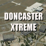
Extremely accurate scenery for Doncaster-sheffield airport (robin hood airport).Includes night lighting, animation vehicles,replacement AFCAD file, XH558 Vulcan aircraft. All textures made to the highest standard based on actual photographs. This is a DEMO version only, for full version please see authors website
| Filename: | Doncaster_Xtreme.zip |
| License: | Commercial demo |
| Added: | 27th October 2012, 20:53:02 |
| Downloads: | 951 |
| Author: | Gary Summons - UK2000 Scenery |
| Size: | 90.75 MB |
| Category: Flight Simulator 2004 - Scenery | |
| Long Beach KLGB Version 4.0 (New Terminal Construction) |
|
Images related to this file:
File Description:

This is a transitional version of Long Beach Daugherty Field. A brand new terminal is currently under construction and due to open in 2013. This version of the scenery shows the terminal as built but not yet operational which reflects current operations as of November 2012. All parking stands have been moved from their original staggered locations to positions surrounding the new terminal complex. Airlines serving the airport have been updated, and other heavy modifications have also taken place. In addition, Signal Hill has been converted from the giant rock scenery object to a correct elevation change file. The hill now has autogen and proper positioning and elevation. A future update with the fully operational terminal will be forthcoming.
| Filename: | Long_Beach_KLGB_Version_40_New_Terminal_Constructi.zip |
| License: | Freeware |
| Added: | 28th October 2012, 12:58:03 |
| Downloads: | 2,632 |
| Author: | FRFStudio.net / William Morgan / Sheryar Ansari |
| Size: | 81.5 MB |
| Category: Flight Simulator 2004 - Scenery | |
| Aviosuperficie S. Anna di Montecassiano |
|
Images related to this file:
File Description:
S. Anna airstrip. Located in Montecassiano, Italy. Middle flight between the Adriatic Sea and the Sibillini National Park. 8 Hangars to recover GA and ULM.
| Filename: | Aviosuperficie_S_Anna_di_Montecassiano.zip |
| License: | Freeware |
| Added: | 3rd November 2012, 00:40:39 |
| Downloads: | 321 |
| Author: | Andrea Reani |
| Size: | 5.73 MB |
| Category: Flight Simulator 2004 - Scenery | |
| Santorini LGSR Big Scenery 2012 (airport and full island scenery) |
|
Images related to this file:
File Description:

This FS2004 project is about the greek Santorini island (located in the Aegean Sea 200 km southeast from Greece's mainland) and contain two main scenery parts:
1) the "Santorini (Thira) International Airport" (Iata: JTR, Icao: LGSR) where you'll find all buldings (airport and close sourroundings buildings), hundred of custom made detailed objects, static and animated vehicles, animated scenery parts and various effects.
2)the Santorini island scenery where you'll find real hand-made landmarks (churches, factories, windmills,harbors and more), boats/ferries, completely redesigned landclasses with custom (seasonal+night) ground textures, coastlines, roads, main towns with custom greek textures, extreme autogen density and a lot of objects.
Every scenery part (frame-rate friendly thanks to the low poly design) has photoreal textures and everything is placed in the right position (wich was found at spring 2012) and in according to the satellite image.English extendet handbook is included. Watch the screenshot and the demo video on the Albysim youtube chanel and enjoy all scenery features (in this free/demo edition some features are limited).
| Filename: | Santorini_LGSR_Big_Scenery_2012_airport_and_full_i.zip |
| License: | Check within download |
| Added: | 4th November 2012, 13:13:55 |
| Downloads: | 4,724 |
| Author: | Albysim Scenery Design (Alberto Di Bolzano) |
| Size: | 35.43 MB |
| Category: Flight Simulator 2004 - Scenery | |
| LGSA Chania Airport I. Daskalogiannis FS2004 |
|
File Description:
LGSA Chania Airport I. Daskalogiannis FS2004. This is a complete update for the HSP(Hellas Scenery Team) - LGSA v1 FS2004 scenery. You can use this scenery as standalone scenery or if you have the Hellas Scenery Project (HSP) - All in One scenery (more details bellow/check details at readme). Thanks for downloading. Enjoy your flights at Greece.
| Filename: | LGSA_Chania_Airport_I_Daskalogiannis_FS2004.zip |
| License: | Freeware, limited distribution |
| Added: | 8th November 2012, 03:30:51 |
| Downloads: | 4,014 |
| Author: | Christopher Barbas |
| Size: | 13.19 MB |
| Category: Flight Simulator 2004 - Scenery | |
| Kugluktuk CYCO in Nunavut, Canada |
|
Images related to this file:
File Description:
Kugluktuk is on the coast of northern mainland Canada on the mouth of the Coppermine River. It is around 250 miles west of Cambridge Bay and 200 miles south of Ulukhaktok. Tuktoyaktuk is 450 miles west. Kugluktuk used to be called Coppermine as copper was mined along the banks of the river and used for spear and arrow heads, and this attracted a semi-permanent population. The population now numbers around 1,450. The airfield is inland from the village and the 5,500 feet of 100 feet wide gravel runway is aligned 121T/3301T where T stands for "true" as opposed to magnetic in the Northern Domestic Airspace. Both JETA-1 and 100LL are available, dispensed by a truck as the storage tanks are just off the northern edge of the field. There are flights by First Air and Canadian North and the AI includes a daily flight of each, plus a cargo visit by Buffalo; the closest large city is Yellowknife, 375 miles south. I should have mentioned a long time ago that to see the apron lights working requires you to have the "lights_ss_v2" by Sidney Schwartz installed.
| Filename: | Kugluktuk_CYCO_in_Nunavut_Canada.zip |
| License: | Freeware |
| Added: | 10th November 2012, 04:03:35 |
| Downloads: | 430 |
| Author: | Roger Wensley |
| Size: | 3.04 MB |
| Category: Flight Simulator 2004 - Scenery | |
| Lady Franklin Point CWLF in Nunavut, Canada |
|
Images related to this file:
File Description:
Lady Franklin Point was a DEW line station on the southwest corner of Victoria Island, and then a North Warning System station until January 2000 when there was a fire. As a result there are now no NWS buildings, and no central long DEW line station building, only the outlying and already unused buildings from the DEW line site. However, the runway is still there and over 5,000 feet of gravel in length, aligned and signed 90T/270T, though on the atc it will be called 55/235 as FS9 knows nothing about the Canadian Northern Domestic Airspace. There is no runway lighting. Kugluktuk is around 80 miles to the southwest, on the mainland.
I should have mentioned a long time ago that to see the apron lights working (on my fields that HAVE apron lights) requires you to have the "lights_ss_v2" by Sidney Schwartz installed.
| Filename: | Lady_Franklin_Point_CWLF_in_Nunavut_Canada.zip |
| License: | Freeware, limited distribution |
| Added: | 10th November 2012, 04:04:06 |
| Downloads: | 261 |
| Author: | Roger Wensley |
| Size: | 1.81 MB |
| Category: Flight Simulator 2004 - Scenery | |
| CWCY - Cape Young - Nunavut, Canada |
|
Images related to this file:
File Description:
Cape Young was a DEW line station on the nothern mainland coast 50 miles northwest of Kugluktuk, and 50 miles west of Lady Franklin Point. It closed in August 1993. Most of the buildings are still there, in various shades of decay. The runway is also still there and close to 5,000 feet of gravel in length, aligned and signed 110T/290T, though on the atc it will be called 07/25 as FS9 knows nothing about the Canadian Northern Domestic Airspace. There is no runway lighting, and don't be surprised if there are bushes growing amid the gravel.
| Filename: | CWCY__Cape_Young__Nunavut_Canada.zip |
| License: | Freeware, limited distribution |
| Added: | 11th November 2012, 01:23:51 |
| Downloads: | 224 |
| Author: | Roger Wensley |
| Size: | 1.53 MB |
| Category: Flight Simulator 2004 - Scenery | |
| CWBH - Bernard Harbour - Nunavut, Canada |
|
Images related to this file:
File Description:
Bernard Harbour was a DEW line "iStation" (a small station with a staff of 5 or 7 people) on the nothern mainland coast 75 miles north of Kugluktuk, and 45 miles west of Lady Franklin Point. It closed in 1963. The slowly deteriorating buildings are still there, along with a fallen radio communications mast. The runway is also still there and has 3,040 feet of gravel, aligned 122T/302T. There is now no runway lighting, no signage, no windsock, and the bushes growing amid the gravel are winning, though slowly. In 1991 a North Warning System (NWS) automated station was established 3 miles to the southwest and there is a second smaller runway there (1,450 feet) along with a helicopter pad. A road joins the two sites for when diesel resupply is undertaken from a ship in the summer, and the zigzag route is (in reality) dictated by the numerous ponds that are too small to be picked up by Ultimate Terrain.
| Filename: | CWBH__Bernard_Harbour__Nunavut_Canada.zip |
| License: | Freeware, limited distribution |
| Added: | 11th November 2012, 01:24:20 |
| Downloads: | 258 |
| Author: | Roger Wensley |
| Size: | 1.49 MB |


© 2001-2026 AVSIM Online
All Rights Reserved
Privacy Policy |