
Where Flight Simulation Enthusiasts Gather from Around the World!
AVSIM Library - Search Results

| Category: Flight Simulator 2004 - Scenery | |
| "Sky King Flying Crown" Version 2 |

|
Images related to this file:
File Description:
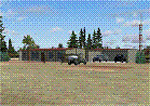
Updated version of Bill Lyon's Sky King FS2002 scenery.
| Filename: | Sky_King_Flying_Crown_Version_2.zip |
| License: | Freeware |
| Added: | 1st May 2010, 05:37:45 |
| Downloads: | 397 |
| Author: | Ed Moore and Paul Young |
| Size: | 3.57 MB |
| Category: Flight Simulator 2004 - Scenery | |
| NZ Rural Airstrips Vs4 |
|
Images related to this file:
File Description:
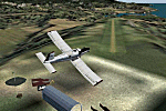
This replaces my previous rural strips sceneries. A series of rural airstrips, (some with sloping runways), based on actual locations around New Zealand. This batch adds strips to the northern area of New Zealand's South Island. You must have Christian Stock's NZ mesh in the form of "Mountains of New Zealand" and topo in the form of "Lakes and Rivers of New Zealand".
| Filename: | NZ_Rural_Airstrips_Vs4.zip |
| License: | Freeware |
| Added: | 1st May 2010, 07:33:37 |
| Downloads: | 384 |
| Author: | Godfrey Tier |
| Size: | 2.67 MB |
| Category: Flight Simulator 2004 - Scenery | |
| CYDF Deer Lake Regional Airport for Newfoundland & Labrador FS9 |
|
Images related to this file:
File Description:
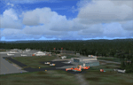
This scenery is a very accurate freeware version of Deer Lake Regional airport and sorounding area, on the west coast of the island of Newfoundland.
Designed to suit a variaty of computers, there is a setup for everyone.
There is something here for Heli, Bush, Low and slow right up to the IFR hight in the sky fliers.
Two solid years went into this scenery to try to capture as much detail as possible.
I really hope you enjoy it as much as Flight Ontario enjoyed working on it.
| Filename: | CYDF_Deer_Lake_Regional_Airport_for_Newfoundland__.zip |
| License: | Freeware |
| Added: | 2nd May 2010, 02:07:39 |
| Downloads: | 1,941 |
| Author: | Al Sibley Flight Ontario |
| Size: | 89.8 MB |
| Category: Flight Simulator 2004 - Scenery | |
| Alpha Ventus Windpark |
|
File Description:
Alpha Ventus, Germanys first Ofshore-Windpark aprox. 45 Km north of the island of Borkum in the Northsea, consisting of 12 windturbines of 5 MW each. Went into operation on April 27. 2010 and was built at a cost of 250 million Euro, exceeding the initial estimate by 60 millions.
| Filename: | Alpha_Ventus_Windpark.zip |
| License: | Freeware |
| Added: | 2nd May 2010, 05:31:23 |
| Downloads: | 897 |
| Author: | Juergen Kuhnert |
| Size: | 19.38 KB |
| Category: Flight Simulator 2004 - Scenery | |
| Domenican Rebublic Constanza (MDCZ) V1.0 |
|
Images related to this file:
File Description:
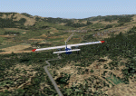
Constanza airport and surroundings. Requires overwriting of original files to fix one of FS2004 "hole in the scenery" problems.
| Filename: | Domenican_Rebublic_Constanza_MDCZ_V10.zip |
| License: | Freeware |
| Added: | 2nd May 2010, 05:54:22 |
| Downloads: | 598 |
| Author: | Alf B. Meier |
| Size: | 1.9 MB |
| Category: Flight Simulator 2004 - Scenery | |
| Paugan & Mercier Dams on the Gatineau River in Quebec Canada |
|
Images related to this file:
File Description:
This will not work without Ultimate Terrain, as the rivers and lakes just won't be there. The Paugan and Mercier Dams are on the Gatineau River in Quebec, north of Ottawa. Both of them are for power generation, rather than water conservation; the Paugan power generation building sits at the bottom of the sluiceway below the dam and appears far larger than the dam itself; there is a separate overflow sluice system nearby. The Paugan Dam is around 30 miles north up the river from Ottawa and the Mercier a further 70 miles. The Mercier holds back a huge and irregularly shaped volume of water known as the Reservoir Baskatong, with numerous branching arms and islands, and you will recognise where the dam must be long before you see it.
| Filename: | Paugan__Mercier_Dams_on_the_Gatineau_River_in_Queb.zip |
| License: | Freeware, limited distribution |
| Added: | 3rd May 2010, 00:11:21 |
| Downloads: | 273 |
| Author: | Roger Wensley |
| Size: | 421.81 KB |
| Category: Flight Simulator 2004 - Scenery | |
| Ryan Airfield KRYN |
|
File Description:
FS2004 Scenery - Ryan Airfield (ICAO: KRYN, FAA LID: RYN), is a general aviation reliever airport located 12 miles west of Tucson International Airport at the intersection of Ajo Way and Valencia Road. The field was created in the 1940s as a training camp for the Army Air Corps. After the war, the state of Arizona approached the Tucson Airport Authority, who also manages Tucson International, about operating the airfield. The Authority and the state entered into a long-term lease agreement and over the years Ryan Airfield has become a busy and popular airfield. Scenery is compatible with both default FS and Ultimate Terrain. AFCAD file by Ray Lunning. Created with Instant Scenery by John B. Loney, Jr.
| Filename: | Ryan_Airfield_KRYN.zip |
| License: | Freeware, limited distribution |
| Added: | 3rd May 2010, 00:59:53 |
| Downloads: | 1,811 |
| Author: | John B. Loney, Jr. |
| Size: | 5.36 MB |
| Category: Flight Simulator 2004 - Scenery | |
| Belize, Lamanai Airfield |
|
Images related to this file:
File Description:
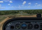
Lamanai is Belize's newest and most controversial airfield. It was built to facilitate access to the Lamanai archaeological sites (the limited area you see in your GPS while flying over).
| Filename: | Belize_Lamanai_Airfield.zip |
| License: | Freeware, limited distribution |
| Added: | 4th May 2010, 09:12:40 |
| Downloads: | 188 |
| Author: | Alf B. Meier |
| Size: | 204.45 KB |
| Category: Flight Simulator 2004 - Scenery | |
| Wadi Seidna, Sudanese Air base |
|
Images related to this file:
File Description:
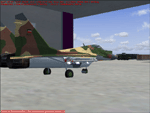
It's a fictionally scenery based on Google earth picture, about a military base in Sudan, called Wadi Seidna, home (maybe) of Sudanese Air force MIG29 FULCRUM squadron.
You required some libraries (from MAIW and EZ-Scenery) for complete functionality.
| Filename: | Wadi_Seidna_Sudanese_Air_base.zip |
| License: | Freeware |
| Added: | 4th May 2010, 09:14:52 |
| Downloads: | 537 |
| Author: | Luciano Franchini |
| Size: | 166.38 KB |
| Category: Flight Simulator 2004 - Scenery | |
| LFBT Tarbes/Lourdes-Pyrenees, France |
|
Images related to this file:
File Description:
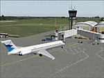
Googly scenery for LFBT Tarbes - a normally quiet airport that just sees a few
domestic flights a day but bursts into life for those of the the Catholic faith to
participate in the pilgrimage to Lourdes. At these times it is served by a
regular stream of charter flights and the airport can handle aircraft as large
as the Boeing 747. The only scheduled flights are between here and Paris, normally operated by Canadair CRJ700 craft worked by Brittany Air International on behalf of Air France, but a huge range of charter operators - mostly from Italy, Ireland, Belgium, the
United Kingdom and Germany - may be seen here at times and although seasonal this
traffic represents 80% of the airport's entire annual activity.
The scenery does not purport to be ultra-accurate. Based on less-than-perfect
satellite imagery from Google Earth, the layout is proportionally correct but the
added airport features, such as buildings, are built from default Microsoft objects
and add-on libraries so will not look exactly like the real thing. You are not obliged to download and install any additional scenery libraries, but to enjoy this scenery in its entirety, you may wish to. It will work fine, with or without.
[File re-uploaded at the request of AVSIM]
| Filename: | LFBT_TarbesLourdesPyrenees_France.zip |
| License: | Freeware |
| Added: | 4th May 2010, 15:02:30 |
| Downloads: | 7,818 |
| Author: | John Hinson |
| Size: | 73 KB |


© 2001-2026 AVSIM Online
All Rights Reserved
Privacy Policy |