
Where Flight Simulation Enthusiasts Gather from Around the World!
AVSIM Library - Search Results

| Category: Flight Simulator 2004 - Scenery | |
| Belize Melinda airfileld |

|
Images related to this file:
File Description:
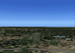
Melinda airfield used to serve as Dangriga's main airport until location and security concerns prompted the construction of a new one near Pelican Beach (see Belize Dangriga). It is still used by the Belize Forestry Office and seems to be in good repair.
| Filename: | Belize_Melinda_airfileld.zip |
| License: | Freeware, limited distribution |
| Added: | 28th April 2010, 08:47:34 |
| Downloads: | 358 |
| Author: | Alf B. Meier |
| Size: | 237.82 KB |
| Category: Flight Simulator 2004 - Scenery | |
| Italy, Toscana 6, Firenze, Photo Real |
|
Images related to this file:
File Description:
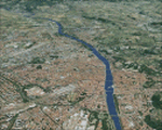
Toscana, Italy, Photoreal Scenery Part 6 (Firenze).
The photoreal scenery covers a great area of Toscana (Tuscany) around the city of Firenze (Florence). The airport of Firenze Peretola (LIRQ) are found inside the scenery (see map). For the best results, use it in association with other parts of Toscana photoreal: Toscana 1 Grosseto, Toscana 2 Piombino, Toscana 3 Siena, Toscana 4 Poggibonsi, Toscana 5 Livorno_Lucca_Pisa_Pistoia, Toscana 7 Massa_Carrara, italy_islands_vfr_part2_nw.zip
| Filename: | Italy_Toscana_6_Firenze_Photo_Real.zip |
| License: | Freeware |
| Added: | 28th April 2010, 13:46:09 |
| Downloads: | 7,057 |
| Author: | Fulvio Mazzokan |
| Size: | 89.82 MB |
| Category: Flight Simulator 2004 - Scenery | |
| Kheria Airport, Agra (India) AGR / VIAG |
|
Images related to this file:
File Description:

AFCAD2 file for Kheria Airport, Agra (India). It is a military airbase and public airport serving the city of Agra. This air force station is one of the largest air bases of Indian Air Force (IAF). Agra is also known for the famous landmark, Taj Mahal.
| Filename: | Kheria_Airport_Agra_India__AGR__VIAG.zip |
| License: | Freeware |
| Added: | 28th April 2010, 13:49:16 |
| Downloads: | 1,121 |
| Author: | Deepak Blassi |
| Size: | 91.81 KB |
| Category: Flight Simulator 2004 - Scenery | |
| LFRD2004 Dinard/St-Malo VFR Scenery |
|
Images related to this file:
File Description:
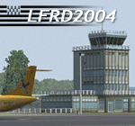
LFRD is a regional airport in Brittany, France. This scenery was created entirely with GMax and the latest Microsoft compilers. Everything was made to ensure maximum framerate while giving maximum visual impact, even on humbler machines. This scenery will run just as fast as the default one (which is very bare) with your current settings, even though there are literally thousands of houses, buildings, trees and a detailed airport.
This is a complete package:
-SRTM local mesh with custom coast trimming
-Custom phototexture (200sq km), with seamless blending into FS9 standard landclass
-Full autogen with custom local texture
-Custom landclass and waterclass
-AFCAD2 file with parking codes
-Custom Hi-res photographic textures at airport.
-Gmax buildings and xml librairy objects.
It was made by a real life pilot and is totally aimed at recreating the feeling of being there, not so much on the ground (after all, this is a FLIGHT simulator), but at circuit altitudes. This is not about recreating an airport in all its glorious details at the cost of framerate, but instead an exercise in balancing visual cues and details as viewed from up there to make it 'as real as it gets' within the limits of FS9. Scenery made by Vauchez (http://mapage.noos.fr/euro_vauchez/)
| Filename: | LFRD2004_DinardStMalo_VFR_Scenery.zip |
| License: | Freeware, limited distribution |
| Added: | 28th April 2010, 18:06:05 |
| Downloads: | 46,564 |
| Author: | Etienne Vauchez |
| Size: | 10.55 MB |
| Category: Flight Simulator 2004 - Scenery | |
| Belize Orange Walk |
|
Images related to this file:
File Description:
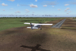
It is not that I have run out of enthusiasm, it is just the what you see in the picture is all there is to the Orange Walk airstrip. An asphalted runway running parallel to the road from Orange Walk to San Lazaro and Yo Creek. Nevertheless it is served several times a week by Tropic Air.
| Filename: | Belize_Orange_Walk.zip |
| License: | Freeware |
| Added: | 29th April 2010, 10:00:40 |
| Downloads: | 360 |
| Author: | Alf B. Meier |
| Size: | 168.21 KB |
| Category: Flight Simulator 2004 - Scenery | |
| Chandigarh Airport, India IXC / VICG v2.0 |
|
Images related to this file:
File Description:

AFCAD2 file for CHANDIGARH AIRPORT. It is being upgraded to an international airport. On the other side of runway Mohali International Airport will come up. The airport will have a modular terminal building and will cater to around 700 passengers at a time with four aerobridges and eight remote parking bays for wide-bodied jet aircraft. The new airport will also have a cargo complex, parallel taxi track, three-link taxiway and hangars for a flying club. New features in this release are runway length signs, taxi signs and airport fence.
| Filename: | Chandigarh_Airport_India_IXC__VICG__v20.zip |
| License: | Freeware |
| Added: | 29th April 2010, 16:58:56 |
| Downloads: | 832 |
| Author: | Deepak Blassi |
| Size: | 178.25 KB |
| Category: Flight Simulator 2004 - Scenery | |
| Belize Northen Cayes |
|
Images related to this file:
File Description:
The Cayes (Islands) north of Belize City, except Ambergis, including the airfields on Caye Caulker and Caye Chapel.
| Filename: | Belize_Northen_Cayes.zip |
| License: | Freeware, limited distribution |
| Added: | 29th April 2010, 19:10:22 |
| Downloads: | 520 |
| Author: | Alf B. Meier |
| Size: | 209.92 KB |
| Category: Flight Simulator 2004 - Scenery | |
| Pontiac Airpark CPC7 in Quebec Canada |
|
Images related to this file:
File Description:
Pontiac Airpark is in Quebec on the north bank of the Ottawa River, some 20 miles northwest of Ottawa in Canada. It is a new airfield and in fact is still under construction, though the east-west runway has been in use since late last year. This east-west runway is 3,400 feet long and gravel, though it will later be lighted, and then asphalted. The second runway will be just under 2,000 feet and unlighted gravel, and at its southern end there are docks for float planes. The float base is already in use; CPC7 is the ICAO code for the float base. There are lots for sale, and the idea is to build your house right on the airfield so there is no driving necessary between house and plane, thus leaving more time for what is important. There will be updates as things progress.
| Filename: | Pontiac_Airpark_CPC7_in_Quebec_Canada.zip |
| License: | Freeware, limited distribution |
| Added: | 1st May 2010, 00:33:40 |
| Downloads: | 342 |
| Author: | Roger Wensley |
| Size: | 7.06 MB |
| Category: Flight Simulator 2004 - Scenery | |
| Wakefield riverfront in Quebec Canada |
|
Images related to this file:
File Description:
The village of Wakefield is 18 miles northwest of Ottawa on the west shore of the Gatineau River, and I seem to have been flying north up that river from Rock cliffe for years, past the village in a bend of the river just a few miles north of Cascades float base. It is where the tourist steam train goes through, and by "through" I mean that literally as the tracks are at the side of the main street, and one of the things it goes past is the Black Sheep Inn which hosts Canadian musical groups and individuals at the weekends. Though the radio in Ottawa uses the name in English it is actually and visibly called "Mouton Noir" on the sign. There is no airfield, and no float base. There aren't even all the buildings that are on the riverfront as it stretches further south and north. There is a public dock where you can tie up. Apart from the fact that the idea caught my fancy one afternoon outside the Mouton Noir I really can't think why I made this.
| Filename: | Wakefield_riverfront_in_Quebec_Canada.zip |
| License: | Freeware, limited distribution |
| Added: | 1st May 2010, 00:39:24 |
| Downloads: | 411 |
| Author: | Roger Wensley |
| Size: | 11.23 MB |
| Category: Flight Simulator 2004 - Scenery | |
| Mesa Verde National Park, Cortez (KCEZ), Colorado, Photo-Scenery (FS9 & FSX) |
|
Images related to this file:
File Description:
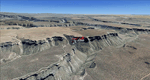
Mesa Verde National Park is famed for its numerous ruins of cliff dwellings built in the 12th century by ancient Pueblo people called Anasazi. Cliff dwellings are highly defensible stone villages situated under alcoves (rock overhangs) along the canyon walls. The largest cliff dwelling in the park is Cliff Palace, which is the largest cliff dwelling in North America. Cliff Palace contained 150 rooms and housed approximately 100 people. Unfortunately you won't see the cliff dwellings from the air, because they are under the cliffs but you will see everything else like all roads, trails and facilities. Very little is known about the Anasazis and the reason for their sudden departure at the end of the 13th century remains a mystery. Theories range from crop failures due to droughts to an intrusion of foreign tribes from the North. The name "Mesa Verde" stems from Spanish explorers seeking for a route from Sante Fe to California. They named the region Mesa Verde (spanish for green table) because of its high, tree-covered plateaus. High resolution versions of this scenery for FS9 and FSX (much sharper, but larger and multiple downloads)
are available at www.blueskyscenery.com/GNB_West2.html . The screenies are taken from the high-res versions, so expect this version to be slightly more blurry. Thanks to Joop Mak for providing custom AFCADs that correct airport layouts so that they align with the photo-textures! They are available at www.blueskyscenery.com/AFCADs.html . YourDonation@Work: Dedicated to David.
| Filename: | Mesa_Verde_National_Park_Cortez_KCEZ_Colorado_Phot.zip |
| License: | Freeware, limited distribution |
| Added: | 1st May 2010, 03:55:31 |
| Downloads: | 1,469 |
| Author: | Gottfried Razek - blueskyscenery.com |
| Size: | 92.87 MB |


© 2001-2026 AVSIM Online
All Rights Reserved
Privacy Policy |