
Where Flight Simulation Enthusiasts Gather from Around the World!
AVSIM Library - Search Results

| Category: Flight Simulator X - Scenery | |
| St Remy de Maurienne LFKR Senery |

|
File Description:
Scenery of small airport of St Remy de Maurienne LFKR in French Alpes missed in the default scenery in FSX.
| Filename: | St_Remy_de_Maurienne_LFKR_Senery.zip |
| License: | Freeware, limited distribution |
| Added: | 26th April 2016, 20:31:58 |
| Downloads: | 514 |
| Author: | Jean-Pierre Kozerawski |
| Size: | 5.96 MB |
| Category: Flight Simulator X - Scenery | |
| LI40 - Montagnana Airfield - Montagnana, Italy ** v2.0 ** |
|
Images related to this file:
File Description:
New version for the airfield of Montagnana in northern Italy with the corrected photorealistic base and more objects, included the city of Montagnana.
Thanks to Pasquale Marrulli for the collaboration!
| Filename: | LI40___Montagnana_Airfield__Montagnana_Italy__v20_.zip |
| License: | Freeware |
| Added: | 26th April 2016, 20:32:15 |
| Downloads: | 698 |
| Author: | Carlo Boninsegna |
| Size: | 37.57 MB |
| Category: Flight Simulator X - Scenery | |
| EKVG - Vagar Airport - Faroe Islands |
|
Images related to this file:
File Description:
Simple and nice version of Vagar Airport on the Faroe Islands.
| Filename: | EKVG__Vagar_Airport__Faroe_Islands.zip |
| License: | Freeware |
| Added: | 27th April 2016, 15:35:39 |
| Downloads: | 2,046 |
| Author: | Rene Scharlach |
| Size: | 328.33 KB |
| Category: Flight Simulator X - Scenery | |
| Nordhorn Air To Ground Weapon Range EDR-37A |
|
Images related to this file:
File Description:
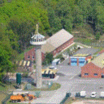
Nordhorn Air To Ground Weapon Range EDR-37A for FSX SP2/Acceleration/P3D V2.X & V3.X.
Features in this version:
- Accurate Targets and its locations;
- Accurate Building incl. Range Tower;
- Accurate Landclass based on photoreal ground (no photoreal background included)
| Filename: | Nordhorn_Air_To_Ground_Weapon_Range_EDR37A.zip |
| License: | Freeware, limited distribution |
| Added: | 27th April 2016, 15:37:22 |
| Downloads: | 627 |
| Author: | Felix Gradtke |
| Size: | 1.51 MB |
| Category: Flight Simulator X - Scenery | |
| X3SY - RAF Saltby - Leicestershire, England |
|
File Description:
RAF Saltby (ICAO X3SY)was a World War II airfield in Leicestershire, England. The airfield is located approximately 8 miles (13 km) northeast of Melton Mowbray; about 90 miles (140 km) north-northwestof London.
It was opened in 1942, and was used by both the Royal Air Force and United States Army Air Forces. During the war it was used primarily as a transport airfield. Like many airfields of the time it closed after the war in 1945 but kept in reserve until 1955.
Today the remains of the airfield are located on private property and, now known as Saltby Airfield, is used primarily for gliding.
Source: Wikipedia
| Filename: | X3SY__RAF_Saltby__Leicestershire_England.zip |
| License: | Freeware |
| Added: | 27th April 2016, 15:39:01 |
| Downloads: | 130 |
| Author: | Terry Boissel |
| Size: | 1.36 MB |
| Category: Flight Simulator X - Scenery | |
| LIKE - Caorle Airfield - Venice, Italy |
|
Images related to this file:
File Description:
Caorle airfield near Venice in Italy. The scenery includes the airfield with objects and a photorealistic base, and the city of Caorle.
Thanks to Pasquale Marrulli for the collaboration!
| Filename: | LIKE__Caorle_Airfield__Venice_Italy.zip |
| License: | Freeware |
| Added: | 28th April 2016, 09:54:36 |
| Downloads: | 1,325 |
| Author: | Carlo Boninsegna |
| Size: | 30.37 MB |
| Category: Flight Simulator X - Scenery | |
| ETNL - Rostock Laage Airport - Rostock, Germany |
|
Images related to this file:
File Description:
Frame rate friendly version of Rostock Laage (ETNL). The airport is shared by GA, commercial traffic, and military aircraft. It is an interesting airport to fly VFR too. Gates are accurate and have working jetways. ILS frequencies are current. Approach lights work in bad weather. For more information see https://sites.google.com/site/fsxvideosairports/.
| Filename: | ETNL__Rostock_Laage_Airport__Rostock_Germany.zip |
| License: | Freeware |
| Added: | 28th April 2016, 09:57:24 |
| Downloads: | 1,332 |
| Author: | Rene Scharlach |
| Size: | 248.22 KB |
| Category: Flight Simulator X - Scenery | |
| St. Helena, Ascension, and Tristan da Cunha Islands |
|
Images related to this file:
File Description:
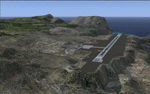
This project was begun to add the new airport (FHSH) to St. Helena Island and eventually was expanded to include a complete remake of Ascension Island (FHAW) and Tristan da Cunha (with an optional airport FHTC) and Gough Island with the actual weather station heliport (FHGH). Tested in both the default FSX/Acceleration and with FTX Global/Vector, accurate coastlines, lakes, road data, and SRTMGL1 (30m) mesh, as well as corrected landclass are provided based on the latest available satellite imagery. Flight plans are provided for the proposed commercial service to St. Helena, and some additional GA and military flights to the island are added as well.
The FSX St. Helena (FHSH) airport was created by aligning master plans for the airport with current satellite data and by studying many of the pictures that have been posted as the airport has taken shape. The official opening of the real airport on May 21, 2016, has been pushed back for more field tests due to challenging crosswinds. The Ascension Island (FHAW) airport was updated after I realized that Ascension could receive commercial service as a result of the new St. Helena airport. The entire airfield is redesigned to allow the volcanic terrain to display properly. The airbase, towns, BBC Atlantic relay station, and numerous satellite dishes, radomes, and wind turbines now appear in their real-world locations. Since I was already in the region, I added the Tristan da Cunha Islands (including Inaccessible, Nightingale and Gough Islands) and the Gough Island weather station maintained by the South African National Antarctic Programme. I also added an optional airport (and flight plans) to Tristan da Cunha (FHTC), which can be easily enabled/disabled. The FHTC airport is placed on the only part of the island that appears to be free of people or farmland, and the area is just long enough to accommodate a pared-down version of the St. Helena airport.
Updates were created or rebuilt in a manner which carefully aligns airport data with current satellite imagery. Scenery was created using Airport Design Editor X v1.67.5684, SBuilderX 3.13, and the FSX Object Placement Tool. Scenery objects were added and modified from stock FSX scenery to resemble as closely as possible the actual airports. The animated flag model is by Dietmar Loleit, the FSX apron lights included are from the set created by Jim Dhaenens, and the animated wind turbines and radomes are from the freeware package by Ray Porter.
| Filename: | St_Helena_Ascension_and_Tristan_da_Cunha_Islands.zip |
| License: | Freeware |
| Added: | 1st May 2016, 11:23:05 |
| Downloads: | 6,088 |
| Author: | Carlyle Sharpe |
| Size: | 10.52 MB |
| Category: Flight Simulator X - Scenery | |
| Marine Mishaps and Shipping Situations |
|
File Description:
This program is a depiction of a few water wrecks and marine mishaps from around the world.
It will only work in FSX Acceleration.
Although they can be seen from a plane, this scenery is best viewed, up close and personal from a helicopter.
There are powerboats racing, cruise ships sinking, tankers on fire. Old wrecks, not so old wrecks and even a sunken truck. There is a text doc giving their locations included in the download.
Created by Carl Vokes.
| Filename: | Marine_Mishaps_and_Shipping_Situations.zip |
| License: | Freeware |
| Added: | 1st May 2016, 20:54:01 |
| Downloads: | 269 |
| Author: | Carl Vokes |
| Size: | 6.07 MB |
| Category: Flight Simulator X - Scenery | |
| RAF Staplehurst - Kent, England |
|
File Description:
RAF Staplehurst is a former World War II airfield in Kent, England. The airfield is located approximately 1 mile (1.6 km) northeast of Staplehurst; about 38 miles (61 km) southeast of London.
Opened in 1943, Staplehurst was a prototype for temporary Advanced Landing Grounds built in France after D-Day, and as the Allied forces moved east across France and Germany. It was used by the Royal Air Force, Canadian and the United States Army Air Forces. It was closed in September 1944.
Today the airfield is a mixture of agricultural fields with no recognizable remains, except a memorial now near the site.
| Filename: | RAF_Staplehurst__Kent_England.zip |
| License: | Freeware |
| Added: | 1st May 2016, 20:56:55 |
| Downloads: | 158 |
| Author: | Terry Boissel |
| Size: | 1.25 MB |


© 2001-2026 AVSIM Online
All Rights Reserved
Privacy Policy |