
Where Flight Simulation Enthusiasts Gather from Around the World!
AVSIM Library - Search Results

| Category: Flight Simulator X - Scenery | |
| X2MB - RAF Membury - Berkshire, England |

|
File Description:
RAF Membury (ICAO X2MB) is a former Royal Air Force station built in the civil parish of Lambourn in Berkshire, England. The airfield is located approximately 4.6 miles (7.4 km) mi north-northwest of Hungerford, at the Membury services stop of the M4 motorway; about 60 miles (97 km) miles west-southwest of London. The airfield also lies immediately next to the Iron Age hill fort of Membury Camp.
Opened in 1942, it was used by both the Royal Air Force (RAF) and United States Army Air Forces (USAAF). During the war it was used by several combat units with varying missions. It was also a major supply and maintenance depot. After the war, it was a private airport until the construction of the M4 motorway in the 1960s when it was closed.
Today the remains of the airfield are located on private property with the former technical site now being an industrial estate (Membury Business Park).
Source: Wikipedia
| Filename: | X2MB__RAF_Membury__Berkshire_England.zip |
| License: | Freeware |
| Added: | 7th April 2016, 17:26:37 |
| Downloads: | 126 |
| Author: | Terry Boissel |
| Size: | 1.63 MB |
| Category: Flight Simulator X - Scenery | |
| KIAD - Washington's Dulles International Airport - Virginia, USA **UPDATE** |
|
Images related to this file:
File Description:
This airport update is for KIAD with two optional files made only for FSX: one version with the Crosswind runway operating, where all 4 runways will be used for takeoff/landing and one version as the default airport runway operation, all terminals and concourses completely rebuilt/replaced, assigned parking as per their website including the correct gates for the A380, all runway approaches updated to the latest charts, taxiways and taxi signs updated, extra fuel trucks, support vehicle roads rebuilt and many other scenery improvements added, airport views are from inside the control tower (when in tower view) please view the readme before installation
| Filename: | KIAD__Washingtons_Dulles_International_Airport__Vi.zip |
| License: | Freeware, limited distribution |
| Added: | 7th April 2016, 17:35:32 |
| Downloads: | 44,445 |
| Author: | Ray Smith |
| Size: | 2.79 MB |
| Category: Flight Simulator X - Scenery | |
| YPPH - Perth International Airport - Western Australia |
|
Images related to this file:
File Description:
This is a very accurate rendition for YPPH international airport with two optional files made only for FSX: one version with the Crosswind runway activated and in full operation where both runways will be used for takeoff/landing and one version as the default airport runway operation: assigned parking updated as per their website including gates for the A380, the new Virgin terminal at the international terminal 1 and Domestic 2 also included, Terminals 3 and 4 completely rebuilt/replaced, new control tower, taxiways and taxi signs updated to the latest charts, lighted helipad, support vehicle roads rebuilt and many other scenery improvements included, airport views are from the roof of the control tower (when in tower view) please view the readme before installation.
| Filename: | YPPH__Perth_International_Airport__Western_Austral.zip |
| License: | Freeware, limited distribution |
| Added: | 10th April 2016, 19:49:34 |
| Downloads: | 26,519 |
| Author: | Ray Smith |
| Size: | 2.64 MB |
| Category: Flight Simulator X - Scenery | |
| KMSN - Madison Wisconsin Dane County Airport - Wisconsin, USA |
|
Images related to this file:
File Description:
Madison Wisconsin Dane County Regional Airport for FSX. Several improvements have been made to the default airport. The default terminal buildings have been replaced with buildings created in FSDS; aircraft gates have been correctly coded using Airport Design Editor 1.67.5684; a new airport vehicle network has been built; extra fuel trucks have been added throughout the airport; the tower view has been changed to display from the roof of the control tower; a static FedEX truck in two different color schemes has been placed in the cargo area; a missing taxiway has been added, and all taxiway designators are correctly placed and named; there is the option to open all three runways to AI traffic; the 115th Fighter Wing of the Wisconsin Air National Guard is represented, and the parking spaces for the military AI aircraft there are coded to work with the MAIW GLANG1 flight plans; optionally, a set of GA flight plans made using AI flight Planner using all FSX default aircraft is included to liven up the GA area; another option included is to display moving road traffic outside the airport; and Jim Dhaenen's excellent ramp lights are also included. Please read the README FIRST.txt and installation.txt files to insure proper installation of all files.
| Filename: | KMSN__Madison_Wisconsin_Dane_County_Airport__Wisco.zip |
| License: | Freeware, limited distribution |
| Added: | 10th April 2016, 19:55:42 |
| Downloads: | 1,286 |
| Author: | Patrick Finch |
| Size: | 2.1 MB |
| Category: Flight Simulator X - Scenery | |
| X2RB - RAF Ramsbury - Marlborough, Wiltshire, England |
|
File Description:
RAF Ramsbury is a former Royal Air Force station located 5 miles (8.0 km) east-northeast of Marlborough, Wiltshire, England. Opened in 1942, it was used by both the Royal Air Force and United States Army Air Forces. During the war it was used primarily as a transport airfield.
With the end of military control Ramsbury was returned agricultural use. By the mid-1960s, much of the concrete had been removed.
| Filename: | X2RB__RAF_Ramsbury___Marlborough_Wiltshire_England.zip |
| License: | Freeware |
| Added: | 11th April 2016, 16:24:25 |
| Downloads: | 121 |
| Author: | Terry Boissel |
| Size: | 823.27 KB |
| Category: Flight Simulator X - Scenery | |
| EGVA - RAF Fairford 1944 - Gloucestershire, England |
|
File Description:
RAF Fairford (IATA: FFD, ICAO: EGVA) is a Royal Air Force (RAF) station in Gloucestershire, England which is currently a standby airfield and therefore not in everyday use.
RAF Fairford was constructed in 1944 to serve as an airfield for British and American troop carriers and gliders for the D-Day invasion of Normandy and Operation Market Garden during World War II.
| Filename: | EGVA__RAF_Fairford_1944__Gloucestershire_England.zip |
| License: | Freeware |
| Added: | 14th April 2016, 12:06:35 |
| Downloads: | 226 |
| Author: | Terry Boissel |
| Size: | 1.51 MB |
| Category: Flight Simulator X - Scenery | |
| X2DA - RAF Down Ampney - Gloucestershire, England |
|
File Description:
RAF Down Ampney (ICAO X2DA) was a Royal Air Force station located 1.8 miles (2.9 km) north east of Cricklade, Wiltshire and 3 miles (4.8 km) south west of RAF Fairford, Gloucestershire.
The airfield operated during World War II from February 1944 until February 1947.
Down Ampney was part of a group of 3 airfields with RAF Broadwell and RAF Blakehill Farm dedicated to air transportation.
No. 48 Squadron RAF and No. 271 Squadron RAF flew Douglas Dakotas on major missions. On D-Day they dropped the main elements of the 3rd Parachute Brigade in Normandy as well as towing Airspeed Horsa gliders across the English Channel.
They were also active in Operation Market Garden (Arnhem) and the Rhine crossing.
Source: Wikipedia.
| Filename: | X2DA__RAF_Down_Ampney__Gloucestershire_England.zip |
| License: | Freeware |
| Added: | 16th April 2016, 11:37:35 |
| Downloads: | 149 |
| Author: | Terry Boissel |
| Size: | 1.94 MB |
| Category: Flight Simulator X - Scenery | |
| KCGS - College Park Airport - Maryland, USA |
|
Images related to this file:
File Description:
FSX Scenery - College Park Airport (IATA: CGS, ICAO: KCGS, FAA LID: CGS) is a public airport located in the City of College Park, in Prince George's County, Maryland, USA. It is the world's oldest continuously operated airport. College Park Airport was established in August 1909 by the United States Army Signal Corps to serve as a training location for Wilbur Wright to instruct two military officers to fly in the government's first airplane. For your flying pleasure by John B. Loney, Jr.
| Filename: | KCGS__College_Park_Airport__Maryland_USA.zip |
| License: | Freeware, limited distribution |
| Added: | 16th April 2016, 11:44:54 |
| Downloads: | 270 |
| Author: | John B. Loney, Jr. |
| Size: | 25.9 MB |
| Category: Flight Simulator X - Scenery | |
| Alf's UK airfields Volume 34 - Sleap EGCV |
|
Images related to this file:
File Description:
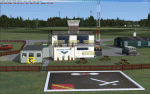
Sleap, near Shrewsbury, is the home of Shropshire Aero Club and in the past it was a satellite of nearby RAF Shawbury and used for training ATC personel.
| Filename: | Alfs_UK_airfields_Volume_34__Sleap_EGCV.zip |
| License: | Freeware |
| Added: | 17th April 2016, 18:59:20 |
| Downloads: | 394 |
| Author: | Alf Denham |
| Size: | 8.59 MB |
| Category: Flight Simulator X - Scenery | |
| RAF Broadwell - Oxfordshire, England |
|
File Description:
RAF Broadwell (ICAO X2BW) is a former Royal Air Force station located 2 miles north of Broadwell and 3 miles southeast of Burford, Oxfordshire, within 2 miles of RAF Brize Norton.
It opened on 15 November 1943 and closed on 31 March 1947, operating under RAF Transport Command. It consisted of 3 concrete runways in triangular configuration.
Broadwell took part in the D-Day assaults with nearby RAF Down Ampney and RAF Blakehill Farm. Broadwell had two such squadrons, No. 512 Squadron RAF and No. 575 Squadron RAF were based here, flying the Douglas Dakota.
In February 1944, No. 512 Squadron was transferred to No. 46 Group at RAF Broadwell, it was a tactical Dakota squadron and started training glider towing and parachute dropping. Its first operation in the new role was a leaflet drop on 5 June 1944 over France, this followed intensive flying in and out of France including dropping parachutists at Arnhem.
On the eve of D-Day No. 575 Squadron dropped 5 Para into the invasion drop zone. On 6 June, it towed 21 Horsa gliders into France. In the next few weeks it started a casualty evacuation service from France back to England. In September 1944, it was involved in operation market garden to Arnhem where it suffered severe casualties.
The airfield continued to be a terminus for long-range transport operations to Europe, the Middle East and India. Source: Wikipedia
| Filename: | RAF_Broadwell__Oxfordshire_England.zip |
| License: | Freeware |
| Added: | 17th April 2016, 19:06:12 |
| Downloads: | 144 |
| Author: | Terry Boissel |
| Size: | 948.66 KB |


© 2001-2026 AVSIM Online
All Rights Reserved
Privacy Policy |