
Where Flight Simulation Enthusiasts Gather from Around the World!
AVSIM Library - Search Results

| Category: Flight Simulator X - Scenery | |
| PACK - Chefornak Airport - Alaska, USA |

|
Images related to this file:
File Description:
Chefornak Airport (IATA: CYF, ICAO: PACK, FAA LID: CFK) is a state-owned public-use airport in Chefornak,a city in the Bethel Census Area of the U.S. state of Alaska. The airport is on the Kinia River.
A new airstrip has been built further out from the village due to concerns with the current airstrip being near the school and pedestrian traffic, however, the runway must settle for several years before it is ready to be used. A new runway designated 5/23 was added.
| Filename: | PACK__Chefornak_Airport___Alaska_USA.zip |
| License: | Freeware |
| Added: | 17th October 2014, 01:26:08 |
| Downloads: | 662 |
| Author: | Wayne Roberts |
| Size: | 451.25 KB |
| Category: Flight Simulator X - Scenery | |
| PGSN - Francisco C. Ada / Saipan International Airport - Mariana Islands - USA - Update |
|
File Description:
This is a small update for Morten's PGSN airport with variation of vegetation heights
You need the PGSN for FSX from Morten Van Der Linden in order to install this update.
| Filename: | PGSN__Francisco_C_Ada__Saipan_International_Airpor.zip |
| License: | Freeware |
| Added: | 18th October 2014, 19:18:19 |
| Downloads: | 2,737 |
| Author: | Morten Van Der Linden |
| Size: | 2.45 MB |
| Category: Flight Simulator X - Scenery | |
| KFLG - Flagstaff Airport - ATIS update |
|
File Description:
These files change the Flagstaff Airport (KFLG) ATIS to 125.825 to allow VATSIM flyers on the Los Angeles Center frequency 125.800 to fly without their comms being drowned out by Flagstaff ATIS. Also includes files for ORBX FTX freeware airport users.
| Filename: | KFLG__Flagstaff_Airport__ATIS_update.zip |
| License: | Freeware, limited distribution |
| Added: | 18th October 2014, 21:28:56 |
| Downloads: | 251 |
| Author: | Shehryar Ansari |
| Size: | 18.06 KB |
| Category: Flight Simulator X - Scenery | |
| PFCL - Clarks Point Airport - Alaska, USA |
|
Images related to this file:
File Description:
Clarks Point Airport (IATA: CLP, ICAO: PFCL, FAA LID: CLP) is a state-owned public-use airport located in Clarks Point, a city in the Dillingham Census Area of the U.S. state of Alaska.
Increased runway length from 2,600 feet to 3,200 feet and renumbered runway to 18/36. Changes were made based on 2004 construction plans.
Created with Airport Design Editor 9x by Scruffy Duck Software using current FAA documentation and Google Earth measurements, this package offers a replacement for FSX's stock airport. All these enhancements are as close to the real airport as I can get with stock library objects and addition of custom models.
| Filename: | PFCL__Clarks_Point_Airport__Alaska_USA.zip |
| License: | Freeware |
| Added: | 18th October 2014, 23:47:21 |
| Downloads: | 632 |
| Author: | Wayne Roberts |
| Size: | 207.9 KB |
| Category: Flight Simulator X - Scenery | |
| YBLT - Ballarat Aerodrome - Victoria, Australia |
|
Images related to this file:
File Description:
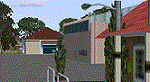
YBLT (Ballarat Aerodrome) is a regional 'airport' in the central west of the State of Victoria, Australia and utilises infrastructure from the days of RAAF operations which lasted till the early 1960's. Thus the buildings are now a bit outdated but this file does not reflect that as I have not done any custom texturing so everything in this package tends to look a bit new and crispy.
Note the name of this 'airport'. The locals are adamant it is an aerodrome, not an airport. I have not found any freeware or commercial offerings for an alternative to the default and so I have put one together.
This is a reasonable approximation of the airport /aerodrome but is not entirely accurate as the hangars/buildings I have modelled myself are generic ones I have done and do not look exactly like the ones at that facility. The connecting road is not in true alignment as I have created it so as it blends into the surrounding default scenery.
| Filename: | YBLT__Ballarat_Aerodrome__Victoria_Australia.zip |
| License: | Freeware |
| Added: | 21st October 2014, 01:51:16 |
| Downloads: | 841 |
| Author: | Robert Budd |
| Size: | 4.43 MB |
| Category: Flight Simulator X - Scenery | |
| Improved and/or New terrains around Dijon, France - Version 2.0 - Update |
|
Images related to this file:
File Description:
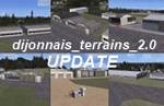
Update for the 2.0 Version of Five FSX Terrains Around Dijon, France, Improved or New. Beaune, Darois, Nuits-Saint-Georges, Pouilly, Til-Chatel. Needs dijonnais_terrains_2.0.zip. Comes with a French readme too. ).**NOTE: A better and easier choice is to install the latest, stand-alone 3.0 version, at "dijonnais_terrains_3.0.zip"!
| Filename: | Improved_andor_New_terrains_around_Dijon_France__V.zip |
| License: | Freeware |
| Added: | 21st October 2014, 15:24:05 |
| Downloads: | 355 |
| Author: | Gerard Guichard |
| Size: | 1.76 MB |
| Category: Flight Simulator X - Scenery | |
| LLBG - Ben Gurion Intl Airport - Tel Aviv, Israel |
|
Images related to this file:
File Description:
This airport update is made only for FSX with two optional files, one version with the Crosswind runways activated and in full operation where all three runways will be used for takeoff and landing and one version as the default runway operation: airlines assigned to their correct terminals, taxiways and taxi signs now updated to the latest charts, runways 3/21 and 8/26 now at their new lengths, ILS added to 8 and 21, PAPI corrected for all runways, extra fuel trucks, support vehicle roads rebuilt, fire station and many other scenery objects added, airport views are from inside the new control tower (when in tower view) please view the readme before installation.
| Filename: | LLBG__Ben_Gurion_Intl_Airport__Tel_Aviv_Israel.zip |
| License: | Freeware, limited distribution |
| Added: | 23rd October 2014, 08:38:48 |
| Downloads: | 25,699 |
| Author: | Craig Scott |
| Size: | 424.38 KB |
| Category: Flight Simulator X - Scenery | |
| CJX - Crooked Creek Airport - Alaska, USA |
|
Images related to this file:
File Description:
Crooked Creek Airport (IATA: CKD, FAA LID: CJX) is a public airport located two miles (3 km) south of the central business district of Crooked Creek, in the U.S. state of Alaska.
Increased runway length from 2,029 feet to 3,300 feet and width from 60 feet to 75 feet. Changes were made based on 2010 construction plans.
Created with Airport Design Editor 9x by ScruffyDuck Software using current FAA documentation and Google Earth measurements, this package offers a replacement for FSX's stock airport. All these enhancements are as close to the real airport as I can get with stock library objects and addition of custom models.
| Filename: | CJX__Crooked_Creek_Airport__Alaska_USA.zip |
| License: | Freeware |
| Added: | 23rd October 2014, 11:00:32 |
| Downloads: | 353 |
| Author: | Wayne Roberts |
| Size: | 244.27 KB |
| Category: Flight Simulator X - Scenery | |
| KSAT - San Antonio Intl - San Antonio, Texas - USA |
|
Images related to this file:
File Description:
This airport update is for KSAT with two optional files made only for FSX: one version with the Crosswind runways operating where all 3 runways will be used for takeoff/landing and one version as the default runway operation: assigned parking as per their website with extra parking, gates now numbered in their correct order, runway 4/22 now at its new length, taxiways and taxi signs updated to the latest charts, airport views are from the roof of the control tower (when in tower view) please view the readme before installation.
| Filename: | KSAT__San_Antonio_Intl__San_Antonio_Texas__USA.zip |
| License: | Freeware, limited distribution |
| Added: | 24th October 2014, 11:38:47 |
| Downloads: | 19,776 |
| Author: | Ray Smith |
| Size: | 587.03 KB |
| Category: Flight Simulator X - Scenery | |
| Area 51 V1.1 |
|
Images related to this file:
File Description:
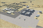
In V1 I added tower comms, taxiways/signs, and deleted start points for all those dirt & other closed runways and made the primary/secondary 14/32.
In V1.1 I have gone through the rest of the airport, aligning and cleaning up scattered oddly placed buildings and placed them in a logical manner - aligned with roads. with parking lots and/or pavement or concrete around their base. Gravel roads added thru the warehouses, sand maintenance roads to water tower and power station, Rec center pool and ballfield touched up. Fire station is in same place but turned towards flight line and added the trucks an ambulance. Fencing all around the flight line.
Also you get the F-117 and Janet 737 WITH traffic file. The Janet 737 is the shuttle aircraft for the Area 51 workers. Watch as the Janet flights arrive each morning from KLAS and depart each night Mon-Fri. KLAS (Las Vegas) Bgl also included with assigned parking at the Janet Terminal.
| Filename: | Area_51_V11.zip |
| License: | Freeware |
| Added: | 24th October 2014, 11:47:01 |
| Downloads: | 2,464 |
| Author: | Jeff Reed |
| Size: | 17.66 MB |


© 2001-2026 AVSIM Online
All Rights Reserved
Privacy Policy |