
Where Flight Simulation Enthusiasts Gather from Around the World!
AVSIM Library - Search Results

| Category: Flight Simulator X - Scenery | |
| NRAO - Karl G. Jansky Very Large Array |

|
Images related to this file:
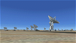
File Description: The VLA or "Jansky Array", managed by the National Radio Astronomy
Observatory (NRAO) consists of 27 independent radio telescope dishes, each with
a diameter of 82 feet and weight of over 200 tons. Each antenna is found along
the three arms of a track shaped in a Y configuration measuring 13 miles long.
Using the rail tracks that follow each of these arms the antennas can be
physically relocated to a number of prepared positions. At one point, the arms
intersect with U.S. Route 60 which passes right through the middle of the array.
It has been featured in numerous films, such as Armageddon, Independence Day,
Terminator Salvation, a Bon Jovi music video, and was featured most prominently
-and correctly- in the Carl Sagan novel Contact, as well as the film of the same
name. Also updated is the closest airport to the VLA - Magdalena, NM - N29. It's
a small dirt strip a few miles to the east, between Socorro and the VLA. It
serves as a nice staging area for flights to the VLA. Includes a helipad startup
location with NM99 ident. Scenery by Jason L. Terry. For FSX Acceleration.
| Filename: | NRAO__Karl_G_Jansky_Very_Large_Array.zip |
| License: | Freeware |
| Added: | 23rd August 2014, 11:18:02 |
| Downloads: | 409 |
| Author: | Jason L. Terry |
| Size: | 3.18 MB |
| Category: Flight Simulator X - Scenery | |
| RCMQ - Taichung International Airport - Taiwan v2 |
|
File Description:
First of all thank you for downloading my project,this project is still growing slowly.
This is the second version of Taichung International Airport.
To install simply add to Scenery Library, make sure to delete the previous version.
I'd deleted the military airside objects since they are not modeled perfectly and lack of images.
The domestic terminal is remade and more frame rate friendly, New International and Apron markings added,
while the apron isn't completed yet and I'll upload a patch when it was done.
In the previous version, players told me that this scenery crashes but I still cannot find the reason that caused crash,
recommend you to use this scenery without crash detects.
| Filename: | RCMQ__Taichung_International_Airport__Taiwan_v2.zip |
| License: | Freeware |
| Added: | 24th August 2014, 14:35:05 |
| Downloads: | 4,491 |
| Author: | Tsai Yueh-Cheng |
| Size: | 24.87 MB |
| Category: Flight Simulator X - Scenery | |
| Skelling Farm |
|
Images related to this file:
File Description:
ORBX England
Skelling Farm home of Eden Soaring Club X5SF
Skirwith Penrith Cumbria.Home to strong rotor known locally as "the Helm"
| Filename: | Skelling_Farm.zip |
| License: | Freeware |
| Added: | 26th August 2014, 07:52:37 |
| Downloads: | 191 |
| Author: | Jon Davidson |
| Size: | 35.15 MB |
| Category: Flight Simulator X - Scenery | |
| AW05 - Elandshoogte Airfield - Mpumalanga, South Africa |
|
Images related to this file:
File Description:
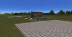
Gmax representation of Elandshoogte Airfield, near the Sappi factory outside Ngodwana, Mpumalanga, South Africa with photoreal textures. Elandshoogte airfield is a small airfield with 2 grass runways both measuring under 700m each. The airfield is situated between the trees of the lush Sappi forests on top of a hill and is used by the "fire-bombers" to fight forest fires.
Visit the Aeroworx Blog for the latest SA Vector file downloads http://aeroworxsa.blogspot.com/
| Filename: | AW05__Elandshoogte_Airfield__Mpumalanga_South_Afri.zip |
| License: | Freeware |
| Added: | 29th August 2014, 16:18:48 |
| Downloads: | 1,049 |
| Author: | Kobus van Wyk, Aeroworx |
| Size: | 8.77 MB |
| Category: Flight Simulator X - Scenery | |
| KPVG - Hampton Roads Executive Airport - Virginia, USA |
|
Images related to this file:
File Description:
FSX Scenery - Hampton Roads Executive Airport (ICAO: KPVG, FAA LID: PVG) is a public-use airport located seven miles (11 km) southwest of the central business district of Norfolk and northwest of Chesapeake, both independent cities in the U.S. state of Virginia. It is privately owned by Virginia Aviation Associates, L.L.C. Although most U.S. airports use the same three-letter location identifier for the FAA and IATA, Hampton Roads Executive Airport is assigned PVG by the FAA but has no designation from the IATA (which assigned PVG to Pudong International Airport in Shanghai, China). All buildings are custom made. AI traffic contains default aircraft. Created for your flight simming pleasure by John B. Loney, Jr.
| Filename: | KPVG__Hampton_Roads_Executive_Airport__Virginia_US.zip |
| License: | Freeware, limited distribution |
| Added: | 7th September 2014, 23:05:56 |
| Downloads: | 850 |
| Author: | John B. Loney, Jr. |
| Size: | 18.89 MB |
| Category: Flight Simulator X - Scenery | |
| KEMV - Emporia-Greenville Regional Airport - Virginia - USA |
|
Images related to this file:
File Description:
The airport is located 3 miles east of Emporia.
The runway was changed from 15/33 to 16/34. AirNav continues to list the runway as 15/33.
Changes were made based on Google Maps. Created with Airport Design Editor by ScruffyDuck Software using current FAA documentation and Google Earth measurements, this package offers a replacement for FSX's stock airport. All these enhancements are as close to the real airport as I can get with stock library objects.
| Filename: | KEMV__EmporiaGreenville_Regional_Airport__Virginia.zip |
| License: | Freeware |
| Added: | 11th September 2014, 00:41:51 |
| Downloads: | 301 |
| Author: | Wayne Roberts |
| Size: | 34.19 KB |
| Category: Flight Simulator X - Scenery | |
| LLFK - Pik Airstrip - Israel |
|
File Description:
Small scenery of Pik Airstrip (LLFK, ex- OS73), Israel.
| Filename: | LLFK__Pik_Airstrip__Israel.zip |
| License: | Freeware, limited distribution |
| Added: | 12th September 2014, 20:45:43 |
| Downloads: | 310 |
| Author: | Stas Harchuk |
| Size: | 3.83 KB |
| Category: Flight Simulator X - Scenery | |
| YPDN - Darwin Intl - Northern Territory, Australia |
|
Images related to this file:
File Description:
This airport update is made only for FSX with two optional files, one version with the Crosswind runway activated and in full operation where both runways will be used for takeoff and landing and one version as the default runway operation: airlines assigned to their gates as per their website with extra parking, taxiways and taxi signs updated to the latest charts, PAPI corrected to both sides of runway 11/29, extra fuel trucks, support vehicle roads rebuilt with many other scenery objects added, airport views are from the roof of the control tower (when in tower view) please view the readme before installation.
| Filename: | YPDN__Darwin_Intl__Northern_Territory_Australia.zip |
| License: | Freeware, limited distribution |
| Added: | 19th September 2014, 03:14:00 |
| Downloads: | 14,419 |
| Author: | Craig Scott |
| Size: | 411.23 KB |
| Category: Flight Simulator X - Scenery | |
| W90 - New London Airport - Virginia |
|
Images related to this file:
File Description:
New London Airport (FAA LID: W90) is a public-use airport located six miles (10 km) southwest of the central business district of Forest, a town in Bedford County, Virginia, United States. It is privately owned by Associated Wheels Inc. It is a public airport, but usually involves GA aircraft only. On Sundays during the summer and early fall, the runway is used as a dragstrip. Originally built in 1957 as a 1/4 mile dragstrip, airport operations were added in 1961 and the facility has served a dual-purpose since. Having been under the continued guidance of Rucker Tibbs, the airport changed hands in December 2005. Changes were made based on Google Maps. Created with Airport Design Editor by ScruffyDuck Software using current FAA documentation and Google Earth measurements, this package offers a replacement for FSX's stock airport. All these enhancements are as close to the real airport as I can get with stock library objects and custom buildings.
| Filename: | W90__New_London_Airport__Virginia.zip |
| License: | Freeware |
| Added: | 20th September 2014, 17:31:45 |
| Downloads: | 253 |
| Author: | Wayne Roberts |
| Size: | 233.02 KB |
| Category: Flight Simulator X - Scenery | |
| KHIO - Hillsboro Airport - Oregon, USA (Part 1 of 3) |
|
Images related to this file:
File Description:
KHIO Hillsboro, home to Hillsboro Aviation, Aero Air, Global Aviation, the Oregon Classic Aircraft Aviation Museum, Premier Space Systems, the Oregon International Air Show and the Nike hangar. The scenery is extremely detailed and has a large photo ground .bgl (KHIO photo ground) that must be joined and added separately.
Part 1 of 3, the remaining 2 parts contain the .BGL file.
| Filename: | KHIO__Hillsboro_Airport__Oregon_USA_Part_1_of_3.zip |
| License: | Freeware, limited distribution |
| Added: | 20th September 2014, 19:56:41 |
| Downloads: | 1,466 |
| Author: | Rick Keller |
| Size: | 195.98 MB |


© 2001-2026 AVSIM Online
All Rights Reserved
Privacy Policy |