
Where Flight Simulation Enthusiasts Gather from Around the World!
AVSIM Library - Search Results

| Category: Flight Simulator X - Scenery | |
| SCIP - Isla de Pascua & Mataveri Intl - Easter Island |

|
Images related to this file:
File Description:
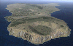
This project rebuilds Easter Island / Isla de Pascua. Mataveri Intl (SCIP) is completely overhauled, and all airport objects are aligned from satellite imagery. Landclass polygons and coastlines were meticulously hand-drawn directly from satellite imagery to provide the most detailed and accurate scenery available for this region. AI road and boat traffic is activated for the region. Accurate coastlines and road data, as well as corrected land and waterclass are provided based on the latest available satellite imagery. GA flights use default aircraft and include an option to add Chilean Air Force planes around the island. Numerous Moai (Easter Island heads) have been placed around the island according to satellite imagery. Scenery was created using Airport Design Editor X v1.61.5298, SBuilderX 3.13, and the FSX Object Placement Tool. Scenery objects were added and modified from stock FSX scenery to resemble as closely as possible the actual airports. The FSX apron lights included are from the terrific set created by Jim Dhaenens.
| Filename: | SCIP__Isla_de_Pascua__Mataveri_Intl___Easter_Islan.zip |
| License: | Freeware |
| Added: | 12th July 2014, 08:17:55 |
| Downloads: | 5,731 |
| Author: | Carlyle Sharpe |
| Size: | 5.33 MB |
| Category: Flight Simulator X - Scenery | |
| New Terminal for default Algiers' Houari Boumediene Airport (DAAG) |
|
File Description:
That freeware FSX scenery is adding the new terminal in FSX default Algiers' Houari Boumediene airport (DAAG), with some more updates. Comes with a French readme too.
| Filename: | New_Terminal_for_default_Algiers_Houari_Boumediene.zip |
| License: | Freeware |
| Added: | 16th July 2014, 16:32:16 |
| Downloads: | 1,027 |
| Author: | Gerard Guichard |
| Size: | 229.41 KB |
| Category: Flight Simulator X - Scenery | |
| Monaco Heliport |
|
Images related to this file:
File Description:
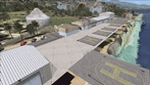
That freeware FSX scenery is adding the Monaco heliport to the Monaco Principalty. Complete with coms. Comes with a French readme too.
| Filename: | Monaco_Heliport.zip |
| License: | Freeware |
| Added: | 16th July 2014, 16:34:25 |
| Downloads: | 329 |
| Author: | Gerard Guichard |
| Size: | 237.86 KB |
| Category: Flight Simulator X - Scenery | |
| Lighthouses on either side of The English Channel Between Dover and Calais |
|
Images related to this file:
File Description:
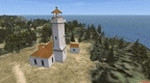
That freeware FSX scenery is adding lighthouses either side of the English Channel Between Dover and Calais. Such lighthouses are the one of the Gris-Nez Cape, France, the one of St Margaret (UK) and too a jetty lightouse for the harbor of Dover (idem). Comes with a French readme too.
| Filename: | Lighthouses_on_either_side_of_The_English_Channel_.zip |
| License: | Freeware |
| Added: | 16th July 2014, 16:35:48 |
| Downloads: | 546 |
| Author: | Gerard Guichard |
| Size: | 178.64 KB |
| Category: Flight Simulator X - Scenery | |
| Patches for Lighthouses of Annaba and Bejaia, Algeria and Corrected Faulty Terrain in Annaba and Oran |
|
Images related to this file:
File Description:
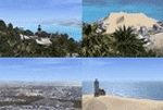
Those patches are setting into FSX the lighthouse of the Cap de Garde, in Annaba, Algeria and the ones of Bejaia. They also flatten two inaccuracies of terrain which are seen in Annaba, on the route to the airport and in Oran, East of the harbour.
| Filename: | Patches_for_Lighthouses_of_Annaba_and_Bejaia_Alger.zip |
| License: | Freeware |
| Added: | 16th July 2014, 16:36:40 |
| Downloads: | 313 |
| Author: | Gerard Guichard |
| Size: | 273.54 KB |
| Category: Flight Simulator X - Scenery | |
| Improved and/or New terrains around Dijon, France |
|
Images related to this file:
File Description:
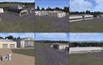
That FSX freeware is adding or improving terrains around Dijon, France, with Beaune-Challanges (LFGF), Dijon-Darois (LFGI), Nuits-Saint-Georges-La Berchere (LFGZ), Pouilly-en-Auxois-Maconge (LFEP), and Til-Chatel (LFET).**NOTE: A better and easier choice is to install the latest, stand-alone 3.0 version, at "dijonnais_terrains_3.0.zip"!
| Filename: | Improved_andor_New_terrains_around_Dijon_France.zip |
| License: | Freeware |
| Added: | 16th July 2014, 16:37:20 |
| Downloads: | 290 |
| Author: | Gerard Guichard |
| Size: | 272.13 KB |
| Category: Flight Simulator X - Scenery | |
| Improved and/or New terrains around Dijon, France - Version 2.0 |
|
Images related to this file:
File Description:
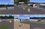
That is our version 2.0 to our FSX freeware adding or improving terrains around Dijon, France, with Beaune-Challanges (LFGF), Dijon-Darois (LFGI), Nuits-Saint-Georges-La Berchere (LFGZ), Pouilly-en-Auxois-Maconge (LFEP), and Til-Chatel (LFET) (dijonnais_terrains.zip). Comes with a French readme too. By G. Guichard.
Note: version 2.0 is a stand-alone version, it does not require version 1.0 to work. A better and easier choice is to install the latest, stand-alone 3.0 version, at "dijonnais_terrains_3.0.zip"!
| Filename: | Improved_andor_New_terrains_around_Dijon_France__V.zip |
| License: | Freeware |
| Added: | 16th July 2014, 16:37:55 |
| Downloads: | 689 |
| Author: | Gerard Guichard |
| Size: | 301.77 KB |
| Category: Flight Simulator X - Scenery | |
| KPWM - Portland Intl Jetport - Portland, Maine, USA |
|
Images related to this file:
File Description:
This airport update is made only for FSX with two optional files, one version with the Crosswind runway activated and in full operation where both runways will be used for takeoff and landing and one version as the default runway operation: airlines assigned to their correct gates, runway 18/36 now at its new lenghth, taxiways and taxi signs updated to the latest charts, terminal updated, extra fuel trucks, support vehicle roads rebuilt, fire station and many other scenery objects added, airport views are from the roof of the control tower (when in tower view) please view the readme before installation
| Filename: | KPWM__Portland_Intl_Jetport__Portland_Maine_USA.zip |
| License: | Freeware, limited distribution |
| Added: | 18th July 2014, 13:51:54 |
| Downloads: | 7,266 |
| Author: | Craig Scott |
| Size: | 548.82 KB |
| Category: Flight Simulator X - Scenery | |
| NY3C - Taylor Field - Hammondsport, New York (Fictional ICAO) |
|
Images related to this file:
File Description:
The airport named Taylor Field (on 1970's sectional charts) is a small 1800' strip not shown in the stock FSX list of airports. There is no ICAO code or other designator I could find with extensive research. I used my own code of NY3C.
This is a part reality part historic scenery as it represents the modern day airport, the Glenn Curtiss Museum, and adjacent to the Airport a facsimile of the original horse racetrack that was used by Glenn Curtiss to fly his June Bug on July 4th 1908. It is a close As I can determine to the original spot using archival photos and conversations with the Director of the Curtiss Museum, Traff Doherty. Extensive use of new land class is also employed to give a better representation of the geographic area.
This will work with FSX stock scenery, but is designed with UTX (Flight One Software) in mind. It will work with ORBX Global and Global Vector as well. With these latter two there may be some missing roads but it won't affect the scenery.
| Filename: | NY3C__Taylor_Field__Hammondsport_New_York_Fictiona.zip |
| License: | Freeware |
| Added: | 24th July 2014, 07:46:29 |
| Downloads: | 343 |
| Author: | Jon Davidson |
| Size: | 9.79 MB |
| Category: Flight Simulator X - Scenery | |
| X5SB - Sutton Bank Yorkshire Soaring Club - North Yorkshire, England |
|
Images related to this file:
File Description: For ORBX England only.
This is a departure for me. away from Appalachia across the pond to Merry
England. This will be the first in a small series of English Glider fields, and
WW2 airfields.
All buildings are made using sketchup. These are exactly sized as all original
buildings and properly located. Improved the area around Hangars.
Sutton Bank, also known as Roulston Scar, is a hill in the Hambleton District of
North Yorkshire in England. The Yorkshire Gliding Club is based at the top of
the hill. A popular slope soaring site since the 1930's, it now is a major site
for aerotowing as well as winch launching sailplanes.
This scenery will appear nicely in the stock FSX, BUT, the field will not be
very flat, use at your own discretion.
| Filename: | X5SB__Sutton_Bank_Yorkshire_Soaring_Club__North_Yo.zip |
| License: | Freeware |
| Added: | 24th July 2014, 08:06:56 |
| Downloads: | 662 |
| Author: | Jon Davidson |
| Size: | 38.16 MB |


© 2001-2026 AVSIM Online
All Rights Reserved
Privacy Policy |