
Where Flight Simulation Enthusiasts Gather from Around the World!
AVSIM Library - Search Results

| Category: Flight Simulator X - Scenery | |
| Sardinia Photoreal 10/14 - Campidano (1/2) |

|
Images related to this file:
File Description:
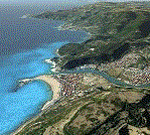
Photoreal coverage of Campidano area in western/central part of Sardinia (Italy), includes Gulf of Oristano, LIER Airport (Oristano - Fenosu), Is Arutas beach, Abbasanta, and Capo Frasca (AWTI - Air Weapons Training Installation).
Credits: Aerial photos summer 2012 courtesy of Microsoft Virtual Earth.
| Filename: | Sardinia_Photoreal_1014__Campidano_12.zip |
| License: | Freeware |
| Added: | 18th June 2013, 04:56:20 |
| Downloads: | 3,160 |
| Author: | Diego PAPARELLA |
| Size: | 233.23 MB |
| Category: Flight Simulator X - Scenery | |
| FYWH - Hosea Kutako International Airport - Windhoek, Nambia |
|
File Description:
Hosea Kutako International Airport (IATA: WDH, ICAO: FYWH) is the main international airport serving the Namibian capital city of Windhoek. Located 45 km (28 mi) east of the city, it is Namibia's primary airport with international
connections and handled 672,582 passengers in 2007. In 2009, the airport handled around 680,000 passengers, just over 4% down on the previous year when over 710,000 passengers were processed. The airport is named after Namibian hero
Hosea Kutako.
Windhoek Hosea Kutako International Airport underwent a modernizing makeover in 2009. It has one terminal with one departure and one arrival hall.
Airport two runways were corrected also the aprons and buildinds. Airport charts thanks to fly uk virtual airways, www.flyuk.aero/en/index.php?page=airport_opsinfo&id=FYWH.
This work is dedicated to West Wind Airlines.
| Filename: | FYWH__Hosea_Kutako_International_Airport__Windhoek.zip |
| License: | Freeware |
| Added: | 18th June 2013, 04:58:07 |
| Downloads: | 4,284 |
| Author: | Anwar Gonzalez |
| Size: | 586.07 KB |
| Category: Flight Simulator X - Scenery | |
| Sardinia Photoreal 11/14 - Campidano (2/2) |
|
Images related to this file:
File Description:
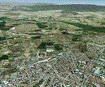
Coverage Campidano area in western/central part of Sardinia (Italy), includes Gulf of Oristano, LIER Airport (Oristano - Fenosu), Bosa, Is Arutas beach, Abbasanta, and Capo Frasca (AWTI - Air Weapons Training Installation).
Credits: Aerial photos summer 2012 courtesy of Microsoft Virtual Earth.
| Filename: | Sardinia_Photoreal_1114__Campidano_22.zip |
| License: | Freeware |
| Added: | 18th June 2013, 08:04:57 |
| Downloads: | 2,906 |
| Author: | Diego PAPARELLA |
| Size: | 407.77 MB |
| Category: Flight Simulator X - Scenery | |
| Sardinia Photoreal 12/14 - Sulcis - Iglesiente |
|
Images related to this file:
File Description:
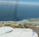
Coverage SULCIS-IGLESIENTE area in south/western part of Sardinia (Italy), includes Sarroch, Iglesias, Carbonia, Sant'Antioco, Carloforte, Pula, Teulada.
Credits: Aerial photos summer 2012 courtesy of Microsoft Virtual Earth.
| Filename: | Sardinia_Photoreal_1214__Sulcis__Iglesiente.zip |
| License: | Freeware |
| Added: | 18th June 2013, 13:58:22 |
| Downloads: | 2,749 |
| Author: | Diego PAPARELLA |
| Size: | 385.07 MB |
| Category: Flight Simulator X - Scenery | |
| Sardinia Photoreal 13/14 - Gulf of Cagliari (1/2) |
|
Images related to this file:
File Description:
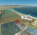
Cagliari is the capital of the Island of Sardinia, located in the south part of the island.
Coverage Gulf of Cagliari and the metropolitan area of Cagliari, including LIEE Airport (Elmas).
Credits: Aerial photos summer 2012 courtesy of Microsoft Virtual Earth.
| Filename: | Sardinia_Photoreal_1314__Gulf_of_Cagliari_12.zip |
| License: | Freeware |
| Added: | 19th June 2013, 11:51:52 |
| Downloads: | 4,096 |
| Author: | Diego PAPARELLA |
| Size: | 443.25 MB |
| Category: Flight Simulator X - Scenery | |
| Sardinia Photoreal 14/14 - Gulf of Cagliari (2/2) |
|
Images related to this file:
File Description:
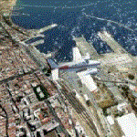
Last package of SARDINIA PHOTOREAL SCENERY. Coverage Gulf of Cagliari and the metropolitan area of Cagliari, include LIEE airport (Elmas). File cagliari2.2.zip required.
Credits: Aerial photos summer 2012 courtesy of Microsoft Virtual Earth.
| Filename: | Sardinia_Photoreal_1414__Gulf_of_Cagliari_22.zip |
| License: | Freeware |
| Added: | 19th June 2013, 18:38:18 |
| Downloads: | 3,211 |
| Author: | Diego PAPARELLA |
| Size: | 395.5 MB |
| Category: Flight Simulator X - Scenery | |
| Bahamas Airfield Package (BAP) |
|
Images related to this file:
File Description:

Get the "full Bahamas"... The "Bahamas Airfield Package" contains ALL 64 airfields and airports in the Bahamas - a complete country especially (re-) designed for VFR pilots!
All required objects libraries are included in the download. Nassau Intl (MYNN) comes as a "free loan" of Menno C. Robert. Big thank you for that, Menno :-)
Look forward to an improved version of ALL Bahamian airfields with a lot of atmosphere, many details and some landclass enhancements.
Since the original FSX didn't contain all existing airfields in the Bahamas, I've added the missing 5 airports. Two of them comes along with a complete new designed island as well. A comprehensive manual is also provided. Requirements: FSX with Acceleration pack and Ultimate Terrain X - The Tropical Americas & Caribbean (= UTX-TAC)!
| Filename: | Bahamas_Airfield_Package_BAP.zip |
| License: | Freeware |
| Added: | 21st June 2013, 07:25:51 |
| Downloads: | 4,941 |
| Author: | Dirk Cremer |
| Size: | 129.09 MB |
| Category: Flight Simulator X - Scenery | |
| TISX - Henry E Rohlsen Airport - Christiansted, St Croix, U.S.V.I. |
|
File Description:
Saint Croix, U.S. Virgin Islands in Caribbean Sea
including
the correct redefinition of coasts and landscape
-airport:Henry E Rohlsen Airport (Christiansted, St Croix, U.S.V.I.) TISX
-Hess fuel storage Hovensa (known also as St. Croix Refinery)
| Filename: | TISX__Henry_E_Rohlsen_Airport__Christiansted_St_Cr.zip |
| License: | Freeware |
| Added: | 22nd June 2013, 17:22:58 |
| Downloads: | 3,450 |
| Author: | Valladier Jean Louis |
| Size: | 6.34 MB |
| Category: Flight Simulator X - Scenery | |
| Governor's Harbour International Airport (MYEM) - The Bahamas |
|
Images related to this file:
File Description:
Central of three airports on Eleuthera Island in the Bahamas just east of Nassau. An abandoned watch tower existing at this airport, and familiar to those who have flown in, has been torn down recently and is not included. The scenery includes custom scenery objects; placement of library objects and landclass changes. Scenery is based on Bing Maps, Google Earth and photos taken locally, and it is optimized for use with UTX-TAC.
| Filename: | Governors_Harbour_International_Airport_MYEM__The_.zip |
| License: | Freeware |
| Added: | 28th June 2013, 00:15:08 |
| Downloads: | 1,266 |
| Author: | Art Poole |
| Size: | 1.61 MB |
| Category: Flight Simulator X - Scenery | |
| Central Massachusetts Airports |
|
Images related to this file:
File Description:
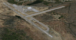
This package contains 25 airports in central Massachusetts. These airports are intended to be used with FSX and the free addon - TileProxy. TileProxy provides real-time photorealistic satellite imagery in place of the stock auto generated FSX scenery or any other scenery package.
The package includes sixteen (16) stock FSX airports which have been modified (re-located runways, buildings, taxiways, etc.) to more accurately re-position them with the real-world scenery. In addition, there are two (2) unlisted airports which are not available in FSX. These airports are existing real private airports. There are also seven (7) "abandoned" airports included (i.e. airports that no longer exist). These airports were active in the 1920s-1970s.
| Filename: | Central_Massachusetts_Airports.zip |
| License: | Freeware |
| Added: | 2nd July 2013, 06:01:25 |
| Downloads: | 426 |
| Author: | John Greenwood |
| Size: | 5.15 MB |


© 2001-2026 AVSIM Online
All Rights Reserved
Privacy Policy |