
Where Flight Simulation Enthusiasts Gather from Around the World!
AVSIM Library - Search Results

| Category: Flight Simulator X - Scenery | |
| KSLE - McNary Field - Salem, Oregon (USA) |

|
Images related to this file:
File Description:
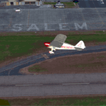
The original AFCAD was created by Kevin Burns, but the airport looked kind of barren in the surrounding coverage area; so I added 650 odd objects and seasonally adjusted photo ground textures to spruce it up a bit, then reworked all the aprons and taxiways to match the photo. Tools used were: Airport Design Editor 1.55, SBuilderX, ModelConverterX.
| Filename: | KSLE__McNary_Field__Salem_Oregon_USA.zip |
| License: | Freeware, limited distribution |
| Added: | 20th April 2013, 04:57:50 |
| Downloads: | 1,478 |
| Author: | Rick Keller |
| Size: | 175.41 MB |
| Category: Flight Simulator X - Scenery | |
| DIAP - Port Bouet Airport - Abidjan, Côte d'Ivoire |
|
File Description:
Port Bouet Airport (IATA: ABJ, ICAO: DIAP), also known as Felix Houphouet-Boigny International Airport, is located 10 miles (16 kilometres) south east of Abidjan, Cote d'Ivoire. It is the largest airport in the country for air traffic. The airport is the main hub of the national airline Air Cote d'Ivoire
This work is dedicated to West Wind Airlines.
| Filename: | DIAP__Port_Bouet_Airport__Abidjan_Cte_dIvoire.zip |
| License: | Freeware |
| Added: | 20th April 2013, 20:15:20 |
| Downloads: | 4,774 |
| Author: | Anwar Gonzalez |
| Size: | 1.06 MB |
| Category: Flight Simulator X - Scenery | |
| Mayaguana (MYMM) - The Bahamas |
|
Images related to this file:
File Description:
Mayaguana is the easternmost island in the Bahamas with Bahamasair providing Nassau and Inagua air connections. The airport utilizes part of an abandoned 11,000 foot USAF runway. The runway is listed as 7300 foot long, but 2400 feet on the east end is closed indefinitely. A new terminal building was completed, but no apron or taxiway connects it to the runway so it is unoccupied. Construction was started on another terminal, apron and taxiway as well as runway repaving, but the project is currently abandoned. All of the aforegoing is represented by this scenery. The scenery includes custom scenery objects; placement of library objects and landclass changes. Scenery is based on Bing Maps and photos taken locally, and it is optimized for use with UTX-TAC.
| Filename: | Mayaguana_MYMM__The_Bahamas.zip |
| License: | Freeware |
| Added: | 20th April 2013, 20:18:45 |
| Downloads: | 1,127 |
| Author: | Art Poole |
| Size: | 1.04 MB |
| Category: Flight Simulator X - Scenery | |
| DAAT - Aguenar / Hadj Bey Akhamok Airport - Tamanrasset, Algeria |
|
File Description:
Aguenar - Hadj Bey Akhamok Airport (French: Aeroport de Tamanrasset / Aguenar - Hadj Bey Akhamok) (IATA: TMR, ICAO: DAAT), also known as Aguenar Airport or Tamanrasset Airport, is an airport serving Tamanrasset, a city in the Tamanrasset Province of southern Algeria. It is located 3.6 nautical miles (6.7 km) northwest of the city. The airport was an alternative landing site for NASA's Space Shuttle, and have been used for American military operations.
In the mid-2000s it was extensively upgraded to serve additionally as a military base, with 10 hardened aircraft shelters, aprons, personnel accommodation and other facilities. Please note that runway 08-26 and ILS are out of service at this time. This work is dedicated to West Wind Airlines.
| Filename: | DAAT__Aguenar__Hadj_Bey_Akhamok_Airport__Tamanrass.zip |
| License: | Freeware |
| Added: | 21st April 2013, 22:09:29 |
| Downloads: | 2,115 |
| Author: | Anwar Gonzalez |
| Size: | 7.17 MB |
| Category: Flight Simulator X - Scenery | |
| DAAE - Bejaia, Algeria - VFR |
|
Images related to this file:
File Description:
fly one of the most beautiful coast in the East part of Algeria.
This scenery has a High resolution ground texture.
The city of Bejaia
West part (Yemma gouraya - Cap Carbon - Pic des singes - zegwatt creeq)
to the East (Touristic zone Capritour) - Tichy - Aowkas - souk ett'nine and Malbou Beach
Includes also night texture
| Filename: | DAAE__Bejaia_Algeria__VFR.zip |
| License: | Freeware |
| Added: | 25th April 2013, 20:35:00 |
| Downloads: | 4,008 |
| Author: | Zoheir BENMERADI |
| Size: | 97.76 MB |
| Category: Flight Simulator X - Scenery | |
| HLTD Ghadames Airport |
|
File Description:
Ghadames Airport (IATA: LTD, ICAO: HLTD) is located 12.1 miles (19.5 km) east of Ghadames, Libya, currently only Libyan Airlines uses the airport as a scheduled service to Tripoli.
Please note that the runways do not have any ilumination service at this time. Daytime service only.
This work is dedicated to West Wind Airlines.
| Filename: | HLTD_Ghadames_Airport.zip |
| License: | Freeware |
| Added: | 26th April 2013, 23:51:48 |
| Downloads: | 544 |
| Author: | Anwar Gonzalez |
| Size: | 215.37 KB |
| Category: Flight Simulator X - Scenery | |
| HLGT - Ghat Airport - Ghat, LIbya |
|
File Description:
Ghat Airport (IATA: GHT, ICAO: HLGT) is located at east of Ghat, Libya, currently only Libyan Airlines uses the airport as a scheduled service to Tripoli.
This work is dedicated to West Wind Airlines.
| Filename: | HLGT__Ghat_Airport__Ghat_LIbya.zip |
| License: | Freeware |
| Added: | 27th April 2013, 19:12:27 |
| Downloads: | 571 |
| Author: | Anwar Gonzalez |
| Size: | 302.47 KB |
| Category: Flight Simulator X - Scenery | |
| 3S8 Grants Pass OR. v2 |
|
Images related to this file:
File Description:
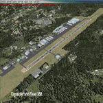
This is a much more accurate version of 3S8 Grants Pass OR. than default FSX,(using default buildings)
NOTE; This is a Fixed version!. Some FlightSim fan's pointed out some issues to me,
1, Corrected the vasi lights from west side to east side of runway.
2, Fixed the "UTX" house on the east side of the field issue.
3, Added the lighter soil around the runway.
4, Corrected runway signs, changed from "30-12" to "31-13".(oops)
| Filename: | 3S8_Grants_Pass_OR_v2.zip |
| License: | Freeware |
| Added: | 29th April 2013, 01:09:45 |
| Downloads: | 624 |
| Author: | Darrell Meadr |
| Size: | 760.05 KB |
| Category: Flight Simulator X - Scenery | |
| KDMW - Carroll County Regional Airport - Westminster, Maryland (USA) |
|
Images related to this file:
File Description:
Carroll County Regional Airport is an airport roughly on the edge of the town of Westminster, in Carroll County, Maryland (MD), USA. This quiet little airport is home to many general aviation flights in the mid-Maryland area. Using photo-realistic ground textures and moving hangars and static aircraft, this is a low frame impact high quality scenery
| Filename: | KDMW__Carroll_County_Regional_Airport__Westminster.zip |
| License: | Freeware |
| Added: | 29th April 2013, 16:12:26 |
| Downloads: | 539 |
| Author: | Tom Neubauer |
| Size: | 10.88 MB |
| Category: Flight Simulator X - Scenery | |
| Neubrandenburg-Trollenhagen (ETNU) |
|
Images related to this file:
File Description:
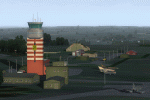
Neubrandenburg-Trollenhagen 2012. Neubrandenburg Airport (ETNU) is a public airport and military airbase located in Trollenhagen, 6 km northeast of Neubrandenburg in Mecklenburg-Vorpommern, Germany. This is the FSX adjustment of the FS9 Scenery by Frithjof Koch, Volker Loew, Rainer Mehlin. FSX adaption by Henry Baumann.
| Filename: | NeubrandenburgTrollenhagen_ETNU.zip |
| License: | Freeware |
| Added: | 30th April 2013, 18:55:07 |
| Downloads: | 976 |
| Author: | Henry Baumann |
| Size: | 29.4 MB |


© 2001-2026 AVSIM Online
All Rights Reserved
Privacy Policy |