
Where Flight Simulation Enthusiasts Gather from Around the World!
AVSIM Library - Search Results

| Category: Flight Simulator X - Scenery | |
| KTMA - Henry Tift Myers Airport - Tifton, Georgia (V1.1 Update) |

|
Images related to this file:
File Description:
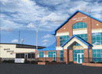
The scenery represents KTMA FA08 Henry Tift Myers Airport in Tifton, Tift county, Georgia, USA. Used for training by the USSAC in WWII it returned to civil authorities in 1947. The airport was renamed Henry Tift Myers Airport in honour of Tifton native Colonel Henry T. "Hank" Myers, who was the first pilot of Air Force One.
The scenery includes custom built objects representing the characteristic terminal and T-hangars. The surrounding grounds are made by land class polygons.
v1.1 fixed some flickering on rwy15.
| Filename: | KTMA__Henry_Tift_Myers_Airport__Tifton_Georgia__V11_Update.zip |
| License: | Freeware |
| Added: | 16th October 2012, 08:43:22 |
| Downloads: | 1,113 |
| Author: | Vassilios Dimoulas |
| Size: | 1.2 MB |
| Category: Flight Simulator X - Scenery | |
| KSKF - Kelly-Lackland AFB - San Antonio, Texas |
|
Images related to this file:
File Description:
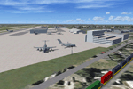
Scenery for Kelly-Lackland AFB, San Antonio, Texas
in FSX. Includes Custom built hangars, buildings,
facilities for C-5's, Boeing building, Wilford Hall
Medical Center, and more. Added fuel trucks and GSE.
AFCAD parking coded for MAIW C-5 and F-16 packages.
EZ scenery,Dan French Core LibrariesVol2_FSX or
higher, ggse_j3.zip by John Stinstrom, and Loney's
Hangars and Buildings required.
By Dan French.
| Filename: | KSKF__KellyLackland_AFB__San_Antonio_Texas.zip |
| License: | Freeware, limited distribution |
| Added: | 17th October 2012, 22:18:57 |
| Downloads: | 1,575 |
| Author: | Dan French |
| Size: | 2.14 MB |
| Category: Flight Simulator X - Scenery | |
| Detailed Terrain Features for Southern Africa, Update 1 |
|
Images related to this file:
File Description:
Scenery consist of updated coastlines, rivers, dams, streams, roads, traffic, railroads, power lines and extrusion bridges for Southern Africa countries South of the Equator. The scenery was updated by utilizing satellite image backgrounds. This scenery is important and will be needed with release of future scenery by Aeroworx. Please Install the previous release fsxWorx01.zip before this update.
| Filename: | Detailed_Terrain_Features_for_Southern_Africa_Upda.zip |
| License: | Freeware, limited distribution |
| Added: | 19th October 2012, 10:56:29 |
| Downloads: | 4,721 |
| Author: | Hannes Steyn, Aeroworx |
| Size: | 18.86 MB |
| Category: Flight Simulator X - Scenery | |
| Dam Walls for Southern Africa |
|
Images related to this file:
File Description:

Scenery consists of a few Dam walls for Southern Africa countries. To help as reference points when flying VFR and to enhance you Southern Africa scenery. Please install fsxWorx01.zip and the updates before this scenery.
| Filename: | Dam_Walls_for_Southern_Africa.zip |
| License: | Freeware |
| Added: | 19th October 2012, 20:41:49 |
| Downloads: | 4,011 |
| Author: | Hannes Steyn, Aeroworx |
| Size: | 5.44 MB |
| Category: Flight Simulator X - Scenery | |
| LATI - Tirana Intlnational Airport Nene Tereza - Tirana, Albania |
|
File Description:
Tirana International Airport Nene Tereza (IATA: TIA, ICAO: LATI) is Albania's only international airport. It is commonly known as Rinas International Airport, as it is located 6 NM (11 km; 6.9 mi) northwest of Tirana, in the village of
Rinas. In 2001, the airport was named after Mother Teresa. Tirana International Airport Nene Tereza was constructed in a period of two years, from 1955 to 1957.
After the fall of communism political and social changes caused an increase in the number of airlines operating in the airport. Notably its reconstruction, started in 2005 and terminated in 2008, made possible a relevant increase in
the processing capacity of the airport, which saw its number of passengers per year doubling from 2005 to 2010, when it reached 1.5M. The airport currently has a capacity to process 1.8M passengers per year and it is thought that such
capacity will suffice to handle the expected increase given the visa liberalization for the citizens of Albania in the Schengen Area, which started at the end of 2010.
This file has the right coordenates, with the apron and characteristics of the airport and buildings, also it is set to the correct altitud of 126 feet or 38 meters.
| Filename: | LATI__Tirana_Intlnational_Airport_Nene_Tereza__Tir.zip |
| License: | Freeware |
| Added: | 24th October 2012, 22:31:54 |
| Downloads: | 6,436 |
| Author: | Anwar Gonzalez |
| Size: | 5.62 MB |
| Category: Flight Simulator X - Scenery | |
| LWSK Skopje "Alexander the Great" Airport |
|
File Description:
Skopje "Alexander the Great" Airport (IATA: SKP, ICAO: LWSK)[2] (is the larger and busier of the two international airports in the Republic of Macedonia. It is located 17 km (11 mi) southeast of the national capital Skopje
in the Municipality of Petrovec.
This is a humble tribute to Macedonian people for all the culture that they inhered to us.
This file has the right coordenates, with the apron and characteristics of the airport and buildings and jetways.
| Filename: | LWSK_Skopje_Alexander_the_Great_Airport.zip |
| License: | Freeware |
| Added: | 27th October 2012, 00:40:17 |
| Downloads: | 1,349 |
| Author: | Anwar Gonzalez |
| Size: | 11.22 MB |
| Category: Flight Simulator X - Scenery | |
| Doncaster Xtreme |
|
Images related to this file:
File Description:
Extremely accurate scenery for Doncaster-sheffield airport (robin hood airport).Includes night lighting, animation vehicles,replacement AFCAD file, XH558 Vulcan aircraft. All textures made to the highest standard based on actual photographs. This is a DEMO version only, for full version please see authors website
| Filename: | Doncaster_Xtreme.zip |
| License: | Commercial demo |
| Added: | 27th October 2012, 20:52:51 |
| Downloads: | 1,041 |
| Author: | Gary Summons - UK2000 Scenery |
| Size: | 97.18 MB |
| Category: Flight Simulator X - Scenery | |
| Cape Spencer Lihthouse |
|
Images related to this file:
File Description:
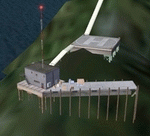
A small scenery which adds the Cape Spencer Lighthouse facility operated and maintained by the US Coast Gaurd. It is 80 nm west of Jeneau, Alaska with an NDB @ 322.0, a landable helipad and many objects. There was no actual land at the actual coordinates so I used rocks in three different sizes from the default FSX object library to create as best I could the rocks which the lighthouse is built on. It is small but adds something to this bare area and adds something to your flying adventures. By savageagle. Enjoy.
| Filename: | Cape_Spencer_Lihthouse.zip |
| License: | Freeware |
| Added: | 28th October 2012, 12:59:54 |
| Downloads: | 572 |
| Author: | Tim Durham |
| Size: | 1.35 MB |
| Category: Flight Simulator X - Scenery | |
| Greece - Ikaria Photoreal |
|
File Description:
Greece - Ikaria photoreal scenery for FSX.
| Filename: | Greece__Ikaria_Photoreal.zip |
| License: | Freeware |
| Added: | 29th October 2012, 18:39:48 |
| Downloads: | 2,137 |
| Author: | Dimitris Ntaskas |
| Size: | 91.16 MB |
| Category: Flight Simulator X - Scenery | |
| LYPG Podgorica Airport, Montenegro |
|
File Description:
Podgorica Airport (IATA: TGD, ICAO: LYPG) is an international airport located 11 km (6.8 mi) south of Podgorica, Montenegro. It is the main hub for Montenegro Airlines.
It is one of two public airports in Montenegro, the other being Tivat Airport. Both are operated by the state-owned company Airports of Montenegro. The airport is sometimes called Golubovci Airport by the locals, as the town of
Golubovci is in close proximity. Airports Council International awarded Podgorica the best airport under 1 million passengers in 2007.
The IATA code of the airport is still TGD because Podgorica was named Titograd (after Josip Broz Tito) from 1946 to 1992, during which time the airport opened.
The airport handles domestic flights within Montenegro as well as international flights. As Montenegro's two main airports are merely 80 km apart, there are no regular passenger domestic flights. Domestic flights have been reduced to
charter flights and general aviation, and all scheduled traffic is international.
There are daily scheduled flights to various European destinations. During the summer season, there are many charter flights and air connections to various major cities in the world. The flight to Belgrade airport has traditionally
accounted for majority of the traffic at the airport, but the percentage is decreasing.
VIP and taxi airlines Vektra Aviation, Di Air and OKI Air are based at the airport. Serbian VIP airlines Air Pink and Prince Aviation also use the airport.
Podgorica Airport served 538,477 passengers in 2008. However, due to global economic downturn, passenger numbers declined to 450,504 in 2009. In 2010, strong growth was recorded, so numbers passed the 600,000 mark.
Thanks to Serbia And Montenegro Virtual Area Control Center for the airport charts.
This file has the right coordinates, with the apron and characteristics of the airport, airport vehicles and buildings, also it is set to the correct altitude of 126 feet or 38 meters.
| Filename: | LYPG_Podgorica_Airport_Montenegro.zip |
| License: | Freeware |
| Added: | 29th October 2012, 21:41:37 |
| Downloads: | 4,668 |
| Author: | Anwar Gonzalez |
| Size: | 10.52 MB |


© 2001-2026 AVSIM Online
All Rights Reserved
Privacy Policy |