
Where Flight Simulation Enthusiasts Gather from Around the World!
AVSIM Library - Search Results

| Category: Flight Simulator X - Scenery | |
| Kissimmee, FL Gateway Airport (KISM) |

|
Images related to this file:
File Description:
Kissimmee Municipal Airport is the closest land-based general aviation airport to Walt Disney World. It contains several FBOs and Warbird Adventures. All are depicted in this scenery as they appear in Google Earth and Bing Maps at a point in time during 2009. Construction is ongoing, as occurs at many airports, so there will be some variations from what is current. Changes include runway, taxiway and apron adjustments; custom replications of buildings; added roads and parking; placement of library objects; and landclass changes in the airport vicinity.
| Filename: | Kissimmee_FL_Gateway_Airport_KISM.zip |
| License: | Freeware |
| Added: | 4th January 2010, 22:46:20 |
| Downloads: | 2,104 |
| Author: | Art Poole |
| Size: | 1.29 MB |
| Category: Flight Simulator X - Scenery | |
| Kissimmee Fix (KISM) |
|
File Description:
This is a replacement ADE .bgl file to add a fuel truck serving the west aircraft parking apron (Atlantic Aviation) to supplement the Kissimmee, FL Gateway Airport (KISM) scenery. kissimmee_gateway_airport.zip is required.
| Filename: | Kissimmee_Fix_KISM.zip |
| License: | Freeware |
| Added: | 5th January 2010, 03:00:41 |
| Downloads: | 1,347 |
| Author: | Art Poole |
| Size: | 25 KB |
| Category: Flight Simulator X - Scenery | |
| California Central Coast with Megascenery Earth and FSGenesis Mesh |
|
Images related to this file:
File Description:
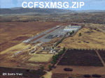
California Central Coast Scenery for FSX with Megascenery Earth and FSGenesis mesh. CCFSXMSG.ZIP covers the California coastal region from N36° 10' (Coalinga) to N34° 25' (Santa Barbara) and from the coast East to W119° 40'. It is a version of my previously created California Central Coast scenery redesigned and expanded to work with FSX MegaScenery Earth and FSGenesis USA Terrain Mesh for FSX V2 by Justin Tyme. Airstrips in the area covered by this scenery have been added for a total of 27 airports and airstrips. 6 imaginary water runways are also added for AI float plane traffic. Several other areas of interest such as the Santa Barbara marina, Morro Bay, etc. are included for a total of 41 points of interest. All airports, airstrips and related structures have been adjusted and realigned to conform to actual positions and dimensions as indicated by the MegaScenery Earth satellite textures. Megascenery Earth California-13, -14 and -15 are required and -12, -28 and -29 are recommended. By Al Wheeler 9/25/09.
| Filename: | California_Central_Coast_with_Megascenery_Earth_an.zip |
| License: | Freeware |
| Added: | 7th January 2010, 19:54:57 |
| Downloads: | 872 |
| Author: | Al Wheeler |
| Size: | 8.13 MB |
| Category: Flight Simulator X - Scenery | |
| California Central Coast Scenery for FSX with Megascenery Earth (Default Mesh Terrain) |
|
Images related to this file:
File Description:
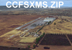
Revised 1/7/10 for upload to Avsim.COM. CCFSXMSFix is incorporated so not required.
This is an earlier version of CCC Megascenery Earth scenery that doesn't require FSGenesis Mesh Terrain. See CCFSXMSG.ZIP for the FSGenesis Mesh version.
This scenery covers the California coastal region from N36���°10' (Coalinga) to N34���°25' (Santa Barbara) and from the coast East to W119���°40'. It is a version of my previous California Central Coast scenery redesigned and expanded to work with MegaScenery Earth from PC Aviator Inc. Many airstrips in the area covered by this scenery have been added or enhanced for a total of 27 airports/airstrips in the area. Several areas of interest such as the Santa Barbara marina, Morro Bay, etc. are also included for a total of 41 points of interest. All airports/airstrips and related structures have been adjusted and realigned to conform to actual positions and dimensions as indicated by the MegaScenery satellite textures. In addition, there are 6 invisible water runways for use by AI floatplane traffic. MegaScenery California-13, -14 and -15 are required for this scenery to make sense. I also used California-12, -28 and -29 when constructing the scenery but they could be considered optional.
| Filename: | California_Central_Coast_Scenery_for_FSX_with_Mega.zip |
| License: | Freeware |
| Added: | 7th January 2010, 21:28:45 |
| Downloads: | 1,560 |
| Author: | Al Wheeler |
| Size: | 8.12 MB |
| Category: Flight Simulator X - Scenery | |
| Crosswind Runways for California Central Coast Scenery for FSX with CCFSXMSG.ZIP or CCFSXMS.ZIP Installed |
|
Images related to this file:
File Description:
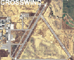
This scenery contains several revised files for my previously uploaded California Central Coast sceneries CCFSXMSG.ZIP and CCFSXMS.ZIP. These are the versions of my CCC scenery for FSX with MegaScenery Earth. The "G" version also requires Genesis Terrain Mesh but is the most complete version. Included here are revised AFCAD files for the major airports in those sceneries which will add interesting crosswind capability to C80, PRB, SBP, SMX and SBA airports. Additionaly, revised AFCAD and associated files for IZA, LPC, L52 and VBG are included. In some cases ground traffic has been added, a few glitches repaired and minor improvements effected. The crosswind AFCAD's for the 5 airports with tangential or crossing runways were revised using the technique developed by Jim Vile and executed by Airport Design Editor (ADEX). This procedure will unavoidably bolix up the ATIS runway advisories at the 3 tower controlled airports with ATIS (SBA, SBP and SMX) but will make all of the runways useable for AI traffic depending on wind conditions. This is not a problem at C80 and PRB since they are uncontrolled fields and have no ATIS available. Therefore, I've included revised AFCADs for SBA, SBP and SMX that do not have crosswind provisions that can be substituted if desired.
| Filename: | Crosswind_Runways_for_California_Central_Coast_Sce.zip |
| License: | Freeware |
| Added: | 7th January 2010, 22:05:25 |
| Downloads: | 514 |
| Author: | Al Wheeler |
| Size: | 194.42 KB |
| Category: Flight Simulator X - Scenery | |
| Quebec Elevation 38m (LOD10) (2/5) |
|
File Description:
FSX 38m (Lod10) terrain mesh files of the province of Quebec, Canada (range : N45-N52, W56-W80) (5 zip files).
**********************
Donnees d'elevation de terrain (FSX - 38 metres) de la province de Quebec, Canada (couverture : N45-N52, W56-W80)
| Filename: | Quebec_Elevation_38m_LOD10_25.zip |
| License: | Freeware, limited distribution |
| Added: | 22nd December 2009, 12:28:21 |
| Downloads: | 6,474 |
| Author: | Gilles Gauthier |
| Size: | 44.94 MB |
| Category: Flight Simulator X - Scenery | |
| Quebec Elevation 38m (LOD10) (4/5) |
|
File Description:
FSX 38m (Lod10) terrain mesh files of the province of Quebec, Canada (range : N45-N52, W56-W80) (5 zip files).
*************************
Donnees d'elevation de terrain (FSX - 38 metres) de la province de Quebec, Canada (couverture : N45-N52, W56-W80)
| Filename: | Quebec_Elevation_38m_LOD10_45.zip |
| License: | Freeware, limited distribution |
| Added: | 22nd December 2009, 12:33:37 |
| Downloads: | 2,940 |
| Author: | Gilles Gauthier |
| Size: | 43.2 MB |
| Category: Flight Simulator X - Scenery | |
| Everglades Airpark Florida U.S.A |
|
Images related to this file:
File Description:
This is Everglades airpark in Florida U.S.A.It is freeware and made from custom designed hangars and buildings.I also used default FSX scenery librarys.Everglades Airpark is situated in the Everglades region (Colier County) in Florida U.S.A.Immediately outside the environs of this 29-acre airpark are a number of environmentally sensitive, protected lands. The airpark is situated immediately southwest of the Big Cypress National Preserve, and is surrounded on three sides by the waters of Everglades National Park.
| Filename: | Everglades_Airpark_Florida_USA.zip |
| License: | Freeware |
| Added: | 26th December 2009, 02:14:05 |
| Downloads: | 1,029 |
| Author: | Jacques Botha |
| Size: | 301.37 KB |
| Category: Flight Simulator X - Scenery | |
| SBCC - The Cachimbo Air Base - Photoreal - Re-uploaded |
|
Images related to this file:
File Description:
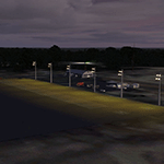
The Cachimbo Air Base is a support base located in Serra do Cachimbo, south of Para State, in the Amazon Forest - Brazil. The unit was created with the main objective of serving as a base of support for aircrafts operations in the traffic link between the north and southeast of Brazil. Previously, the path could only be secure realized following the coast, a much longer way. Now you can fly this great scenery today and feel like how is operating in the middle of the Amazon Forest.
| Filename: | SBCC__The_Cachimbo_Air_Base__Photoreal__Reuploaded.zip |
| License: | Freeware, limited distribution |
| Added: | 27th December 2009, 09:02:24 |
| Downloads: | 2,951 |
| Author: | Jorge Amengol |
| Size: | 8.25 MB |
| Category: Flight Simulator X - Scenery | |
| Springhill Aerodrome (New Zealand) |
|
Images related to this file:
File Description:
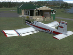
SpringHill (ICAO: NZSL) is a small airstrip between Warkworth and Wellsford, north of Auckland in New Zealand. It is privately owned tarseal strip with offset thresholds giving usable landing lengths of 680m and 700m for RWY 16 and 34 respectively, a width of 10m and a group rating of 5. The runway is aligned 16/34. The tar seal strip is supplemented by a grass strip of the same length but 30m wide. No night lighting or fuel is available.
I decided to model it after doing a roadtrip north of Auckland and taking lots of reference photos of the smaller airfields suitable for the size of aircraft I fly in real life. I am also planning to model Parakai aerodrome in the near future and Kaipara flats has already been modelled.
It contains fully custom Gmax buildings and phototextures.
| Filename: | Springhill_Aerodrome_New_Zealand.zip |
| License: | Freeware, limited distribution |
| Added: | 28th December 2009, 11:49:01 |
| Downloads: | 1,142 |
| Author: | Tim Barnes (Visualise IT) |
| Size: | 1.11 MB |


© 2001-2026 AVSIM Online
All Rights Reserved
Privacy Policy |