
Where Flight Simulation Enthusiasts Gather from Around the World!
AVSIM Library - Search Results

| Category: Flight Simulator X - Scenery | |
| Victoria, Canada including US Southern Gulf Islands and San Juan Islands - Part 1 of 2 |

|
Images related to this file:
File Description:
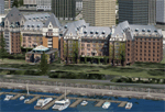
FSX-only version of Victoria, Canada area scenery including the Southern Gulf Islands and the San Juan Islands of the US. Includes automated installer and configurator by Scot Fraser.
Features:
-accurate shorelines, lakes and streams;
-landclass;
-FSX multi-LOD mesh with 10m maximum resolution;
-complete road network with moving traffic;
-railroads;
-utility corridors;
-marinas and ferry terminals;
-many static boats, including a custom model of the Canada Coast Guard ship Sir Wilfred Laurier;
-detailed models of major buildings and the Ogden Point Terminal;
-many bridges;
-nearly 300 marine lights; and corrected antennae locations.
Facilities include Don Grovestine's famous CYYJ (Victoria International Airport); 12 other Canadian land-based airports: Butler Field, Duncan (CAM3), Gaines, Hastings, Hudson Island, James Island, Thomas, Village Bay, Raven Field (CML2), Saltspring, Sidney Island, Whiskey Point; 20 US airports Blakely (38WA), Burden (61WA), Center Island (79WA), Clam Harbor (WA35), Crane Island, Decatur Shores (WN07), Decatur-Jones (WA18), Waldronaire (90WA), Orcas Island (KORS), Friday Harbour (KFHR), Lopez Island (S31), Pile Point, Roche Harbor (WA09), Shaw Island, Stuart Island Airpark (7WA5), Stuart Island West (2WA3), Wilding (6WA5), Windsock (4WA4); 12 floatplane facilities: Bedwell (CAB3), Fisherman's Bay (WA81), Friday Harbor (W33), Ganges (CAX6), Maple Bay, Mayne (CAW7), Port Washington (CAP8), Roche Harbor (W39), Rosario (W49), Shawnigan Lake (CAV8), Victoria Harbour (CYWH), Victoria International (CAP5) and Westsound, Orcas (WA83) - many with AI traffic; 9 heliports: Ganges (CAL7), Mayne (CBF5), Camel Point (CBF7), Jubilee (CBK8), Victoria General (CBW7) Madrona Bay (CBW9), Shoal Point (CBZ7), Mount Belcher (CMBH).
AI models include the DHC-2 floatplane in local liveries, a cruise ship model (by Mitsuya Hamaguchi) and two repaints, pilot boat, and small boats (by Larry Silsbee).
Ultimate Terrain X compatible (not required). Users of Vancouver+ for FSX will also get additional cruise ship traffic and additional floatplane and helicopter traffic. Full documentation. By Don Grovestine, Jon Patch and Holger Sandmann. Many other contributors: see documentation. Part 1 of 2 - you also need file vicenh7b.zip
| Filename: | Victoria_Canada_including_US_Southern_Gulf_Islands.zip |
| License: | Check within download |
| Added: | 29th January 2010, 21:23:17 |
| Downloads: | 23,166 |
| Author: | Don Grovestine, Jon Patch and Holger Sandmann |
| Size: | 56.8 MB |
| Category: Flight Simulator X - Scenery | |
| NSFA Faleolo International Airport Apia Samoa |
|
Images related to this file:
File Description:
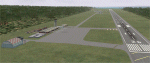
NSFA Faleolo International Airport Apia Samoa . Complete re-build of the airport adding a terminal and so on . Stock FSX objects used .
| Filename: | NSFA_Faleolo_International_Airport_Apia_Samoa.zip |
| License: | Freeware |
| Added: | 31st January 2010, 00:54:46 |
| Downloads: | 2,082 |
| Author: | Lee Marrow |
| Size: | 813.55 KB |
| Category: Flight Simulator X - Scenery | |
| LHKH - Kiskunfelegyhaza Airport |
|
File Description:
Kiskunfelegyhaza Airport is small sport airport in Hungary, used by gliders, light aircrafts, agricultural planes / helicopters..
| Filename: | LHKH__Kiskunfelegyhaza_Airport.zip |
| License: | Freeware |
| Added: | 10th December 2009, 00:28:41 |
| Downloads: | 955 |
| Author: | Krisztian Pinter |
| Size: | 2.64 KB |
| Category: Flight Simulator X - Scenery | |
| Barbuda scenery |
|
File Description:
Scenery of Barbuda
Coasts and land class more accurate Codrington (TAPH)
Citys : Codrington and et Coco Point Lodge
Roads and traffic adjust with land class
| Filename: | Barbuda_scenery.zip |
| License: | Freeware |
| Added: | 10th December 2009, 12:40:51 |
| Downloads: | 2,672 |
| Author: | Valladier Jean Louis |
| Size: | 12.07 MB |
| Category: Flight Simulator X - Scenery | |
| SeaTac Area Airports |
|
Images related to this file:
File Description:
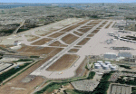
This scenery is a revision of the default Seattle-Tacoma (SeaTac), Boeing Field, Renton and Paine Field airports to work with MegaScenery Earth. The artificial plateau that Seatac is built on has been expanded and the new 3rd runway added. Runways, taxiways and various structures have been revised and/or relocated to match MegaScenery Earth ground textures. Default objects have been used in many cases to minimize FPS impact. MegaScenery Earth Washington-001 (KSEA, KBFI, KRNT) and -002 (KPAE) are required.
| Filename: | SeaTac_Area_Airports.zip |
| License: | Freeware |
| Added: | 11th December 2009, 09:51:46 |
| Downloads: | 5,563 |
| Author: | Al Wheeler |
| Size: | 2.48 MB |
| Category: Flight Simulator X - Scenery | |
| Barbuda upgrade sound effect |
|
File Description:
Correct sound effect on Barbuda scenery
| Filename: | Barbuda_upgrade_sound_effect.zip |
| License: | Freeware |
| Added: | 11th December 2009, 21:45:58 |
| Downloads: | 1,752 |
| Author: | valladier Jean Louis |
| Size: | 1.78 KB |
| Category: Flight Simulator X - Scenery | |
| LSPD - Dittingen Airfield Switzerland |
|
File Description:
The Dittingen Airfield is located in the northwest of Switzerland, about 20km away from LFSB - Basle-Mulhouse and missing in default FSX. It has one grass runway of 620m length. Dittingen Airfield is famous for it's glider activity and it's airshow which is hold every 2nd year (The last was in August 2009). Further, in real life, it is quite difficult to fly to Dittingen. This airport was designed with ADE 9x and default FSX-objects.
| Filename: | LSPD__Dittingen_Airfield_Switzerland.zip |
| License: | Freeware |
| Added: | 12th December 2009, 02:33:59 |
| Downloads: | 1,929 |
| Author: | Lukas Koeng |
| Size: | 82.83 KB |
| Category: Flight Simulator X - Scenery | |
| Montecristo Island_1_1 |
|
Images related to this file:
File Description:
The island is mountainous with several rocky ledges overlooking the sea and consists almost exclusively of granite.
42.34 N, 10.32 E. Volcano type unknown. This fixes default scenery. The island was not visible
Montecristo Island is located halfway between Corsica and Italy.
| Filename: | Montecristo_Island_1_1.zip |
| License: | Freeware |
| Added: | 15th December 2009, 00:43:51 |
| Downloads: | 1,175 |
| Author: | Giovanni Miduri |
| Size: | 311.48 KB |
| Category: Flight Simulator X - Scenery | |
| Hawaii - Niihau |
|
Images related to this file:
File Description:
Niihau, the westernmost of the inhabited Hawaiian Islands, is privately owned and used primarily to raise cattle. It's small population works the ranch. Because it is so isolated, it is the last of the Hawaiian Islands where Hawaiian is the primary language.
Niihau has no airport of its own. You get there by taking off from Kauai and flying west. I'd recommend using Port Allen (PAK). Unless visibility is limited, you can see Niihau across the water from the airport. Just take off and fly a heading of 270 degrees. However, a saved flight which places you just off Niihau's shore is included in the package should you need it.
| Filename: | Hawaii__Niihau.zip |
| License: | Freeware |
| Added: | 15th December 2009, 23:19:34 |
| Downloads: | 2,526 |
| Author: | Richard Sorochak |
| Size: | 36.49 MB |
| Category: Flight Simulator X - Scenery | |
| Palm Beach County Park Airport - Lantana, FL (KLNA) |
|
File Description:
This is a complete redo of the default FSX airport with surrounding landclass changes; updated taxiways, aprons and hangers. Also includes library objects and a library of airport buildings.
| Filename: | Palm_Beach_County_Park_Airport__Lantana_FL_KLNA.zip |
| License: | Freeware |
| Added: | 17th December 2009, 03:30:22 |
| Downloads: | 982 |
| Author: | Art Poole |
| Size: | 350.37 KB |


© 2001-2026 AVSIM Online
All Rights Reserved
Privacy Policy |