
Where Flight Simulation Enthusiasts Gather from Around the World!
AVSIM Library - Search Results

| Category: Flight Simulator X - AFCAD Files | |
| Wide Sky Airpark Airport (JY31), NJ |

|
File Description:
Located 03 miles NW of Bridgeton, New Jersey on 23 acres of land, Wide Sky Airpark Airport is a private turf field 2550' in length. There is no fuel available, but there is tiedown space by the main hangar in the middle of the field to the west. You can start in the parking spot there if you have a plane with 40' or less wingspan (collision with static aircraft is disabled so you can put a bigger plane there if you wish with no trouble). The windsock is not lit at night and is located atop the south end of then main hangar's roof. The field is hedged in to the east with bushes but they do not cause aircraft collisions. The runway is lit for night VFR operations. There is no hard surfaced runway so set your terrain mesh settings as high as possible to enjoy rolling around on bare bumpy terrain.
Scenery constructed with use of satellite images/streetview/aerial photos - the author has not been there in person.
This scenery is meant to be used in conjunction with MegaScenery Earth New Jersey/Delaware 004. It is not required, but apron use is minimized to allow satellite scenery to show through as much as possible, and objects are placed based on the MSE textures - lack of it may make scenery look out of place.
| Filename: | Wide_Sky_Airpark_Airport_JY31_NJ.zip |
| License: | Freeware |
| Added: | 10th May 2011, 13:40:36 |
| Downloads: | 157 |
| Author: | Drew Sikora |
| Size: | 1.27 MB |
| Category: Flight Simulator X - AFCAD Files | |
| Woodcrest Farms Airstrip Airport (JY17), NJ |
|
File Description:
Located 02 miles NE of Shiloh, New Jersey, Woodcrest Farms Airstrip Airport is a private turf field 2303' in length. There are no services offered for transient aircraft and the field is not lit, so daytime VFR operations only are recommended. There is no hard-surfaced runway so make sure your terrain mesh is set as high as possible. You can start on the runway or parked next to the hangar east of the field
Scenery constructed with use of satellite images/streetview/aerial photos - the author has not been there in person.
This scenery is meant to be used in conjunction with MegaScenery Earth New Jersey/Delaware 004. It is not required, but apron use is minimized to allow satellite scenery to show through as much as possible, and objects are placed based on the MSE textures - lack of it may make scenery look out of place.
| Filename: | Woodcrest_Farms_Airstrip_Airport_JY17_NJ.zip |
| License: | Freeware |
| Added: | 11th May 2011, 03:29:54 |
| Downloads: | 170 |
| Author: | Drew Sikora |
| Size: | 443.09 KB |
| Category: Flight Simulator X - AFCAD Files | |
| Rainbow's End Airport (JY39), NJ |
|
File Description:
Located 07 miles S of Salem, New Jersey on 20 acres of land, Rainbow's End Airport is a private turf strip 2200' in length. There are no services for transient aircraft and the airport is not lit at night, so daytime VFR operations only are recommended. If you have an aircraft with 40' or less of wingspan you can start at one of the parking spaces east or west of the runway by the hangars. Otherwise it is suggested you start on the runway. There is no hard surfaced runway so set your terrain mesh as high as possible.
Scenery constructed with use of satellite images/streetview/aerial photos - the author has not been there in person.
This scenery is meant to be used in conjunction with MegaScenery Earth New Jersey/Delaware 005 & New Jersey/Delaware 004. It is not required, but apron use is minimized to allow satellite scenery to show through as much as possible, and objects are placed based on the MSE textures - lack of it may make scenery look out of place.
| Filename: | Rainbows_End_Airport_JY39_NJ.zip |
| License: | Freeware |
| Added: | 12th May 2011, 00:58:29 |
| Downloads: | 173 |
| Author: | Drew Sikora |
| Size: | 626.46 KB |
| Category: Flight Simulator X - AFCAD Files | |
| Hackettstown Airport (N05), NJ |
|
File Description:
Located 03 miles SW of Hackettstown, New Jersey on 65 acres of land, Hackettstown Airport is a public asphalt strip 2200' in length. Fuel, tiedowns and hangars are all available for transient aircraft. For fuel, stop on the concrete pad next to the fuel tank northeast of the runway - 100LL only. Tiedowns are available both east and west of the runway - note that west parking faces the trees and if you start in one of the West Parking spots you will either need to pushback or slew to give yourself room to turn out - static aircraft collisions are off but vegetation is not. The one hangar north of the airport is open for parking, you can start there with the DOCK type parking location. This airport is not lit so daytime VFR operations only are recommended.
Scenery constructed with use of satellite images/streetview/aerial photos - the author has not been there in person.
This scenery is meant to be used in conjunction with MegaScenery Earth New York 007. It is not required, but apron use is minimized to allow satellite scenery to show through as much as possible, and objects are placed based on the MSE textures - lack of it may make scenery look out of place.
| Filename: | Hackettstown_Airport_N05_NJ.zip |
| License: | Freeware |
| Added: | 13th May 2011, 09:16:30 |
| Downloads: | 208 |
| Author: | Drew Sikora |
| Size: | 557.98 KB |
| Category: Flight Simulator X - AFCAD Files | |
| NZAA Auckland Airport, New Zealand |
|
File Description:
This is an update of Ray Smith's file nzaa_ade_rs_fsx.zip, modified with Ray Smith's kind permission. Ray has also given me permission to upload this update to AVSIM. The enclosed files form an update to the default FSX Auckland International Airport (NZAA). It is not add-on scenery as such but intended to reflect changes made at the real-life NZAA after FSX was released.
| Filename: | NZAA_Auckland_Airport_New_Zealand.zip |
| License: | Freeware |
| Added: | 22nd May 2011, 12:42:10 |
| Downloads: | 1,360 |
| Author: | Emile Bax |
| Size: | 33.36 KB |
| Category: Flight Simulator X - AFCAD Files | |
| KTPA Tampa International (redux) - xwind |
|
File Description:
FlyTampa-Tampa (redux) xwind AFCAD.
This modified AFCAD for the fantastic Tampa airport scenery (redux), by the talented folks at FlyTampa, opens the airport for xwind operations and effectively makes runway 9/27 available. The main runways (18R/36L and 18L/36R) are now used predominantly by airline traffic while GA mostly makes use of 9/27. This is quite convenient because of parking locations, but more importantly reduces go arounds and long hold short waits (or annoying disappearances). This is my first upload to the AVSIM library; hope you'll like it.
| Filename: | KTPA_Tampa_International_redux__xwind.zip |
| License: | Freeware |
| Added: | 23rd May 2011, 14:49:55 |
| Downloads: | 471 |
| Author: | George Robertson |
| Size: | 44.96 KB |
| Category: Flight Simulator X - AFCAD Files | |
| Hammonton Municipal Airport (N81) NJ |
|
File Description:
Located 03 miles NE of Hammonton, New Jersey on 107 acres of land, Hammonton Municipal Airport is a public asphalt strip 3601' in length. It has recently been renovated with all-new taxiways and aprons and this update is depicted in this version with the big change being the extension of the main apron to join the previously-separated north and south tarmacs. The airport's magnetic variation, traffic pattern height, and PAPI glide slope and location have also all been accurately adjusted. All tie down parking locations are located on either the North or South tarmacs. Parking spots marked as RAMP_GA are occupied by static aircraft/objects and should not be chosen to start in (although all static objects have collision disabled). North parking spots can accommodate wingspans up to 50' while South parking spots should only be used by aircraft with wingspans of 40' or less. The one DOCK_GA location in the hangar start that can accommodate aircraft with wingspans up to 45'. The helicopter start location will place you on the North tarmac in front of the main hangar. Fuel is available by stopping on the concrete area on the North tarmac or by the fuel truck on the South tarmac in front of the hangars. Please see the ReadMe for known issues regarding AI aircraft parking.
Scenery constructed with use of satellite images/streetview/aerial photos - the author has not been there in person.
This scenery is meant to be used in conjunction with MegaScenery Earth New Jersey/Delaware 003. It is not required, but apron use is minimized to allow satellite scenery to show through as much as possible, and objects are placed based on the MSE textures - lack of it may make scenery look out of place.
| Filename: | Hammonton_Municipal_Airport_N81_NJ.zip |
| License: | Freeware |
| Added: | 5th June 2011, 06:22:53 |
| Downloads: | 202 |
| Author: | Drew Sikora |
| Size: | 897.82 KB |
| Category: Flight Simulator X - AFCAD Files | |
| Basel-Mulhouse - LFSB - France |
|
Images related to this file:
File Description:
This airport update was designed with the latest version of ADE (Airport Design Editor) and made only for the default FSX airport: one file with the Crosswind runway operating where both main runway's will be used for takeoff/landing and one file as the default runway operation: new control tower in its correct location, assigned parking with extra parking, taxiways and taxi signs updated, runways corrected and navaids updated for them, JAPAT and AMAC aprons and buildings added, extra fuel trucks, support vehicle roads rebuilt and many other improvements, airport views are from the roof of the control tower (when in tower view) please view the readme before installation
| Filename: | BaselMulhouse__LFSB__France.zip |
| License: | Freeware |
| Added: | 7th June 2011, 01:10:13 |
| Downloads: | 2,352 |
| Author: | Ray Smith |
| Size: | 232.41 KB |
| Category: Flight Simulator X - AFCAD Files | |
| Toulouse-Blagnac Airport Scenery (LFBO) |
|
Images related to this file:
File Description:
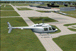
This is an FSX addon scenery of the Toulouse-Blagnac Airport (LFBO). It has been made using the excellent freeware tool ADE. It includes the new terminal gates, the A380 production line (using Lagardere) at the north of the airport, the new delivery center called Aire Ziegler where the brand new A380s are delivered. I modified taxiways and parking to make them look like in the reality. There are two landing pads for helicopters like in reality. I have changed the parking assignment to make sure that the usual traffic will park on the parkings E, F D AB, V and U, as it is on the reality. Finally, the close surroundings of the airport were modified to display the Airbus facilities as far as possible with generic buildings.
| Filename: | ToulouseBlagnac_Airport_Scenery_LFBO.zip |
| License: | Freeware |
| Added: | 13th June 2011, 03:32:00 |
| Downloads: | 1,392 |
| Author: | Jose Mauriz |
| Size: | 220.42 KB |
| Category: Flight Simulator X - AFCAD Files | |
| B J Farms Airport (NJ06), NJ |
|
File Description:
Located 03 miles E of Shiloh, New Jersey, B J Farms Airport is an undefined grass strip 1500' in length. Because it is not a visible strip, this scenery removes the default grass runway that is located there. If you are looking to visit this area, JY17 is less than 1 mile away. (http://www.mseairports.com/index.php?page_id=781)
Scenery constructed with use of satellite images/streetview/aerial photos - the author has not been there in person.
This scenery is meant to be used in conjunction with MegaScenery Earth New Jersey/Delaware 004. It is not required, but apron use is minimized to allow satellite scenery to show through as much as possible, and objects are placed based on the MSE textures - lack of it may make scenery look out of place.
| Filename: | B_J_Farms_Airport_NJ06_NJ.zip |
| License: | Freeware |
| Added: | 14th June 2011, 02:15:45 |
| Downloads: | 163 |
| Author: | Drew Sikora |
| Size: | 179.16 KB |


© 2001-2026 AVSIM Online
All Rights Reserved
Privacy Policy |