
Where Flight Simulation Enthusiasts Gather from Around the World!
AVSIM Library - Search Results

| Category: Flight Simulator 2004 - Scenery | |
| Beijing Capital International Airport Scenery |

|
Images related to this file:
File Description:
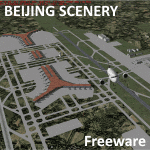
Includes Beijing (city) scenery, converted from FSX. Features Terminal 3!
| Filename: | Beijing_Capital_International_Airport_Scenery.zip |
| License: | Freeware |
| Added: | 23rd May 2019, 16:14:18 |
| Downloads: | 1,143 |
| Author: | Bobby Santos |
| Size: | 6.3 MB |
| Category: Flight Simulator 2004 - Scenery | |
| Entebbe International Airport (HUEN) V1 |
|
Images related to this file:
File Description:
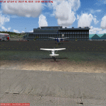
This is Entebbe International Airport (EBB/HUEN), the Main International Airport in Uganda. Built using Sketchup, ADE v1.76, Sbuilder. Needs RWY12 Objects available in avsim and flightsim. See Readme file for installation instructions.
| Filename: | Entebbe_International_Airport_HUEN_V1.zip |
| License: | Freeware |
| Added: | 12th June 2019, 17:11:50 |
| Downloads: | 1,029 |
| Author: | Emmanuel Mwandosya |
| Size: | 33.93 MB |
| Category: Flight Simulator 2004 - Scenery | |
| Indore Airport India |
|
Images related to this file:
File Description:

Devi Ahilya Bai Airport (Indore/India)
Indore Airport is my first work with Airport scenery design. I hope FS enthusiasts would appreciate it.
| Filename: | Indore_Airport_India.zip |
| License: | Freeware |
| Added: | 28th June 2019, 22:10:36 |
| Downloads: | 152 |
| Author: | Tushar Deshpande |
| Size: | 1.33 MB |
| Category: Flight Simulator 2004 - Scenery | |
| Ksat San Antonio 2019 Edition - Fix & Update |
|
Images related to this file:
File Description:
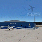
Texture Fix. This is a fix to the the scenery available here at Avsim called: ksat_san_anto__2019.zip.
Issue resolved: Black squares displaying where airplanes park near gates. Alpha channel was missing. In addition, a brand new Afcad file authored by Troy Salisbury provides for crosswind landings added along with proper runway operations.
| Filename: | Ksat_San_Antonio_2019_Edition__Fix__Update.zip |
| License: | Freeware, limited distribution |
| Added: | 2nd July 2019, 23:52:34 |
| Downloads: | 619 |
| Author: | Michael Lehkamp & Troy Salisbury |
| Size: | 149.26 KB |
| Category: Flight Simulator 2004 - Scenery | |
| Port Blair Airport / India |
|
Images related to this file:
File Description:

I am a novice with Airport scenery design. I hope FS enthusiasts would appreciate my work.
Port Blair is the capital of the Andaman and Nicobar Islands, a union territory of India situated in the Bay of Bengal. It is an airport located 2 km (1.2 mi) south of Port Blair and is the main airport of the Andaman and Nicobar Islands.
| Filename: | Port_Blair_Airport__India.zip |
| License: | Freeware |
| Added: | 5th July 2019, 17:31:43 |
| Downloads: | 302 |
| Author: | Tushar Deshpande |
| Size: | 1008.78 KB |
| Category: Flight Simulator 2004 - Scenery | |
| Pittsburgh Int. Airport - 2019 Edition |
|
Images related to this file:
File Description:

This is a re-worked version from the original Mach1 series. This version, while still quite accurate, was intended to add some "life" to the much dated version - 10 years old.
New textures are applied to concourses including parking garages, individual airline buildings, and much more. In addition, the night environment is much more "alive".
| Filename: | Pittsburgh_Int_Airport__2019_Edition.zip |
| License: | Freeware, limited distribution |
| Added: | 14th July 2019, 16:11:53 |
| Downloads: | 857 |
| Author: | Michael Lehkamp |
| Size: | 3.41 MB |
| Category: Flight Simulator 2004 - Scenery | |
| Tiemcen, Algeria - DAON |
|
File Description:
The FS2004 default looks outdated and not accurate right ramps and taxiways. I created more improvement detailed.
| Filename: | Tiemcen_Algeria__DAON.zip |
| License: | Freeware |
| Added: | 16th July 2019, 00:34:45 |
| Downloads: | 248 |
| Author: | Stuart John Gilbert II |
| Size: | 1.55 MB |
| Category: Flight Simulator 2004 - Scenery | |
| Ranchi Airport/ India |
|
Images related to this file:
File Description:

Birsa Munda Airport (VERC), also known as Ranchi Airport, is the primary airport serving the city of Ranchi, the capital city of the Indian state of Jharkhand. It is named after Indian tribal freedom fighter Birsa Munda and is currently managed by Airports Authority of India. The whole airport sprawls over an area of 1568 acres. The airport is used by more than 2.2 million passengers annually and is the 26th busiest airport in India.
| Filename: | Ranchi_Airport_India.zip |
| License: | Freeware |
| Added: | 19th July 2019, 17:06:09 |
| Downloads: | 152 |
| Author: | Tushar Deshpande |
| Size: | 1.16 MB |
| Category: Flight Simulator 2004 - Scenery | |
| Backcountry USFS fields for 19m terrain mesh in Idaho |
|
Images related to this file:
File Description:
These backcountry airfields are for use with the FSGenesis 19m mesh of Idaho; they almost certainly do not work without it. I also have Ultimate Terrain installed, with the settings as noted. The 15 airfields included here are almost all United States Forestry Service fields: 1U1 Moose Creek, 2ID7 Cayuse Creek, 2U5 Shearer, 3U1 Warren, 12ID Flying B Ranch, 24K Krassel, 75c Orogrande, I08 Cabin Creek, ID67 Lower Loon Creek, ID76 Wilson Bar, S81 Indian Creek, S92 Fish Lake, U54 Bernard, U79 Chamberlain, U81 Cold Meadows. There is also a 85U bgl included to remove the remnants of Soldier Bar which is impossible to make into a scenery with the terrain mesh, and spoiled the surroundings if left untouched and intact. The screenshots are typical examples giving a good impression of the terrain.
| Filename: | Backcountry_USFS_fields_for_19m_terrain_mesh_in_Id.zip |
| License: | Freeware, limited distribution |
| Added: | 22nd July 2019, 16:38:48 |
| Downloads: | 102 |
| Author: | Roger Wensley |
| Size: | 22.2 MB |
| Category: Flight Simulator 2004 - Scenery | |
| Altitude adjustment for Dawson City CYDA |
|
Images related to this file:
File Description:
I discovered that the Northern Canada Terrain Mesh that I installed a while back was dumping part of my Dawson City Airport CYDA into a deep hole. I tried making a flatten to reduce the height of the terrain mesh land but that did not look at all realistic. So, the solution is to raise CYDA to 1,457 feet above sea level instead of the correct (correct according to the Nav Canada Supplement) level of 1,215 feet so that it melts into the surrounding terrain. There are still some rocky faces but at least they are not in the airfield. Do you need it? Not if your version looks ok. If it doesn't look ok then try this, but save your current version so you can go back to it if you need to.
| Filename: | Altitude_adjustment_for_Dawson_City_CYDA.zip |
| License: | Freeware, limited distribution |
| Added: | 23rd July 2019, 17:24:26 |
| Downloads: | 104 |
| Author: | Roger Wensley |
| Size: | 855.58 KB |


© 2001-2026 AVSIM Online
All Rights Reserved
Privacy Policy |