
Where Flight Simulation Enthusiasts Gather from Around the World!
AVSIM Library - Search Results

| Category: Flight Simulator 2004 - Scenery | |
| Suriname some airports and airstrips |

|
File Description:
There were missing mostly airports and airstrips in Suriname country. I created most missing and some aren't links in data. They have Blue Wings Airlines and Gum Air flying in Suriname area.
| Filename: | Suriname_some_airports_and_airstrips.zip |
| License: | Freeware |
| Added: | 14th October 2018, 17:02:15 |
| Downloads: | 378 |
| Author: | Stuart John Gilbert II |
| Size: | 8.57 MB |
| Category: Flight Simulator 2004 - Scenery | |
| Invermere CAA8 in British Columbia, Canada |
|
Images related to this file:
File Description:
This airfield is in the Columbia Mountains (which are part of the Rockies) on the border between BC and Alberta. Invermere is in the same valley as Golden, 65 miles south and midway between Golden and Cranbrook. The town is at the northern end of Lake Windermere, on the western side, with a population of around 3,400. The main touristic feature of Invermere appears to be the provision of a wide choice of golf courses. These are included in the scenery, as are some of the surrounding commercial buildings including a nearby hotel and retail units. Invermere CAA8 is half a mile northeast of the lake, and is home to the non-profit Canadian Rockies Soaring Club that trains pilots during the summer months. The Invermere Soaring Centre, a separate organisation, provides glider towing services and rides for the general public. During the summer the airfield can only be described as busy, with gliders taking advantage of the terrain for ridge soaring. The AI here includes gliders that will take off and then circle around north of the field. The take off is not a realistic glider style launch, and the wind should be from the north; these gliders do not taxi and then turn around at the far end of a runway too well. Once again, like Golden, there is no runway or taxiway lighting, so daylight use only. There are GA visitors to CAA8 between the gliders, presumably carrying golfers and clubs. Due to the surrounding terrain AI aircraft might impact high ground before landing and then just show up on their parking spot.
| Filename: | Invermere_CAA8_in_British_Columbia_Canada.zip |
| License: | Freeware, limited distribution |
| Added: | 16th October 2018, 02:11:34 |
| Downloads: | 171 |
| Author: | Roger Wensley |
| Size: | 6.11 MB |
| Category: Flight Simulator 2004 - Scenery | |
| Julius Nyerere International Airport V2 |
|
Images related to this file:
File Description:
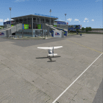
Thanks for downloading Julius Nyerere International Airport (HTDA) Version 2. This is the Largest Airport in Tanzania. The Airport scenery was built from Sketchup, SBUILDER and ADE v1.76 utilizing Google Earth for correct positions. Objects placed with Instant Scenery 3. This is version 2, it includes Terminal 1, Terminal 2, Terminal 3 (underconstruction), VIP trminal, Fire Station and Radar and Control tower in the correct position. and the "correct" afcad. More improvements will come once Terminal 3 is opened . Needs RWY12 Object library.
| Filename: | Julius_Nyerere_International_Airport_V2.zip |
| License: | Freeware |
| Added: | 16th October 2018, 15:36:32 |
| Downloads: | 1,177 |
| Author: | Emmanuel Mwandosya |
| Size: | 102.6 MB |
| Category: Flight Simulator 2004 - Scenery | |
| FS2004 Scenery--LIMG ALBENGA AIRPORT |
|
Images related to this file:
File Description:
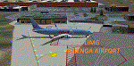
FS2004 Scenery--LIMG ALBENGA AIRPORT (AIRAC 1811).
Only use with IVAO or VATSIM; no AI possible.
This scenery was built from the official maps for the runway and taxiways with Google Maps as a background image as support.
The different signs were positioned without any documentation or references.
By Serge Libon.
| Filename: | FS2004_SceneryLIMG_ALBENGA_AIRPORT.zip |
| License: | Freeware |
| Added: | 22nd October 2018, 16:42:03 |
| Downloads: | 514 |
| Author: | Libon Serge |
| Size: | 36.57 MB |
| Category: Flight Simulator 2004 - Scenery | |
| Bella Coola CYBD in British Columbia, Canada |
|
Images related to this file:
File Description:
Bella Coola is in one of the deep east-west fjords amid the Coastal Range on the coast of BC, approximately mid way between Vancouver and the Alaskan border and some 70 miles inland from the open ocean. The town of Bella Coola has a small population of around 150, while the population of the whole Bella Coola Valley is around 2,000. The valley is warmer in both summer and winter than the surrounding area, and tourism flourishes along with forestry, fishing, and local government administration. Although there is road access, the ferry service is the main connection to larger coastal towns or cities such as Vancouver. The airport, 7 miles east of the town, is connected by daily Pacific Coastal flights to Vancouver and Anahim Lake (to the east). The asphalt runway is 4,200 feet long and aligned 04-22 in FS9 (by 2010 this had changed to 05-23 in reality) and is without lighting of any sort, so it is restricted to daylight hours only. At the eastern end is the terminal building and in the middle the West Coast Helicopter hangar, which has a large fenced paddock-like enclosure in front of it. The helicopters hop over the three feet high fence as they "taxi" to the apron in front of the hanger (but not in FS9!). Between the two there are four other company hangars spread out along the roadway beside the fence. I have never seen the airfield in Summer, and I have not attempted to replicate the apron as it now shows in Google Earth. The screenshots show the main and overwhelming feature of Bella Coola, the large valley amid the steep mountains. This terrain has an inevitable effect on the ai, in that you will never see a plane land as it hits solid rock before it makes it to the runway. You will, however, see them take off. Pacific Coastal currently flies Beechcraft 1900's to Bella Coola; I have used the Saab 340 which I have seen there some years ago and which I prefer.
| Filename: | Bella_Coola_CYBD_in_British_Columbia_Canada.zip |
| License: | Freeware, limited distribution |
| Added: | 25th October 2018, 17:57:06 |
| Downloads: | 286 |
| Author: | Roger Wensley |
| Size: | 14.57 MB |
| Category: Flight Simulator 2004 - Scenery | |
| Port Hardy CYZT in British Columbia, Canada |
|
Images related to this file:
File Description:
Port Hardy airport is on the coast of Vancouver Island in BC, at the far northern end and 5 miles east of the town. The town and the airport are both gateways to local touristic attractions such as Cape Scott Provincial Park, the North Coast and BC Marine Trails, and kayaking, caving, surfing, fishing, camping, and scuba diving (and I discovered just how big orca are). Fishing, logging, and mining have been important and to an extent still are for the town population of just over 4,000. The airport, along with the ferries, connects Port Hardy to the rest of the west coast with Pacific Coastal Saab 340 or Beechcraft 1900C flights to and from Vancouver at least twice a day. There are also Grumman Goose amphibious flights to local float bases such as Port McNeill, Alert Bay, Whaletown, Surge Narrows, Echo Bay, and Minstrel Island. These are all included in the AI and previously posted. There are three runways: 11-29 of 5,000 feet with ILS on 11 and righthand circuits on 29, 07-25 of 4,000 feet with righthand circuits on 25, and 16-34 with a much shortened 3,500 feet on 34 due to a displaced threshold. There is a control tower but it is not manned 24 hours a day; a "mandatory frequency" (MF for short and a Canadian invention) is used by the tower when it is manned, and when there is no tower response the aircraft continues to announce intentions and position. Something I have been meaning to explain to those who query it, is that in real life as well as in FS9 helicopters at a mixed use airport or airfield will act as if they are planes and join downwind, turn on base and then finals, "land" along the runway and then use the taxiway to the parking. This means all aircraft are doing the same thing and an orderly queue avoids collisions. This is one of a series connected in some way with Pacific Coastal airline destinations, the first being Bella Coola. There is AI available for Pacific Coastal online.
| Filename: | Port_Hardy_CYZT_in_British_Columbia_Canada.zip |
| License: | Freeware, limited distribution |
| Added: | 11th November 2018, 16:48:50 |
| Downloads: | 236 |
| Author: | Roger Wensley |
| Size: | 19.26 MB |
| Category: Flight Simulator 2004 - Scenery | |
| Port McNeill CAT5 in British Columbia, Canada |
|
Images related to this file:
File Description:
Port McNeill is at the northern end of Vancouver Island, on the coast and around 20 miles east of Port Hardy. The town population is just over 2,000 and the main industry is logging, followed by sand and gravel quarrying and exporting for the construction industry. Tourism rates third.
The airport, a mile or so east of the town, provides a swift connection for nearby islands and the surrounding area to the rest of the west coast, and serves as the HQ main base for West Coast Helicopters. Their newly built large hangar and office accommodation is next to their older hangar to one side of the central public parking area, opposite the club house cum terminal and hangars. There are two runways: 06-24 which is asphalt, 2,400 feet long, and lit; and 11-29 of gravel, 3,650 feet long and also lit. There is some taxiway lighting, but not, for instance, for the connection between runways, which is in real life a ramp up to the gravel runway which is 15 feet higher. There are no regularly scheduled flights and traffic consists mainly of the West Coast helicopters, plus GA and irregular charters, the latter being mostly from Port Hardy.
| Filename: | Port_McNeill_CAT5_in_British_Columbia_Canada.zip |
| License: | Freeware, limited distribution |
| Added: | 18th November 2018, 05:49:13 |
| Downloads: | 138 |
| Author: | Roger Wensley |
| Size: | 13.29 MB |
| Category: Flight Simulator 2004 - Scenery | |
| Campbell River CAE3 in BC Canada, textures and revised AI with Beaver aircraft |
|
Images related to this file:
File Description:
Campbell River CAE3 float base is in the middle of the eastern shore of Vancouver Island, six miles from the airport of the same name and where the channel between island and coast narrows down. Coril Air and Vancouver Island Air are both based there, but any number of other company planes can be seen on a daily basis, for instance Harbour Air which runs a regular service from Vancouver. This post provides all the textures required for the original post (some were missing, as I was told recently after some years had passed) plus a revised traffic file for Campbell River which has Beaver float planes flying between Campbell River and Vancouver Harbour. The Beaver planes are included, with permission, from the payware Alaska scenery by FSAddon. The layout of the dock moorings has been revised and the AFCAD included here replaces the one previously provided. The date of the scenery is around 2010, before a lot of the holiday trailers had been removed.
| Filename: | Campbell_River_CAE3_in_BC_Canada_textures_and_revi.zip |
| License: | Freeware, limited distribution |
| Added: | 19th November 2018, 18:06:42 |
| Downloads: | 253 |
| Author: | Roger Wensley |
| Size: | 7.68 MB |
| Category: Flight Simulator 2004 - Scenery | |
| Alert Bay CYAL in British Columbia, Canada |
|
Images related to this file:
File Description:
Alert Bay is a small village on the small Cormorant Island, offshore from Port McNeill near the northern end of Vancouver Island. There is an airfield at the eastern end of the island with an asphalt runway 2,900 feet long aligned 09-27, without lights. Two houses have access with hangars at the edge of the field and at the end of their gardens. Nothing special about it but it completes the local scenery around Port McNeill.
| Filename: | Alert_Bay_CYAL_in_British_Columbia_Canada.zip |
| License: | Freeware, limited distribution |
| Added: | 25th November 2018, 00:35:01 |
| Downloads: | 156 |
| Author: | Roger Wensley |
| Size: | 4.19 MB |
| Category: Flight Simulator 2004 - Scenery | |
| Whaletown CAW9 in British Columbia, Canada |
|
Images related to this file:
File Description:
Whaletown is a float base serving a village on Cortes Island, another one of the many islands squeezed between Vancouver Island and the mainland at this northern end. At this island passengers are delivered by amphibious Grumman Goose from Port Hardy, the main airport of the northern half of Vancouver Island with daily scheduled flights onward to and from Vancouver International. The AI was included with the post of Port Hardy. Regretably, the amphibious Goose behaves as if it is on land and moves on the water with it's wheels extended; there is no way around this. This scenery is a modification of a post made some years ago that did not support AI. In my FS9, close to Whaletown, there was an FS9 or Ultimate Terrain fault consisting of a long straight beach sticking out into the sea for a few thousand feet. This scenery now deletes that.
| Filename: | Whaletown_CAW9_in_British_Columbia_Canada.zip |
| License: | Freeware, limited distribution |
| Added: | 28th November 2018, 22:43:21 |
| Downloads: | 107 |
| Author: | Roger Wensley |
| Size: | 1.67 MB |


© 2001-2026 AVSIM Online
All Rights Reserved
Privacy Policy |