
Where Flight Simulation Enthusiasts Gather from Around the World!
AVSIM Library - Search Results

| Category: Flight Simulator 2004 - Scenery | |
| Kasba Lake CJL8 Northwest Territories Canada |

|
Images related to this file:
File Description:
This is a sixth airfield with links to Lake Athabasca, which is in Alberta and Saskatchewan. Kasba Lake is some 135 miles northeast of Stony Rapids and is in the Northwest Territories. The airfield is owned and run by and for Kasba Lake Lodge and it is one of several fishing vacation spots that are serviced by flights from Stony Rapids. It is these flights to the north that explain the number of regular scheduled flights into Stony Rapids from the south. The Kasba Lake Lodge has docks for boats and also for clients that want to arrive in their own floatplanes. The ai is for both Kasba Lake and Obre Lake and replaces the porpoising plane that I had used for Obre Lake. Norilor flies the weekend package-deal-long-distance delivery flights for Kasba Lake direct from Winnipeg, and now also for Obre Lake.
| Filename: | Kasba_Lake_CJL8_Northwest_Territories_Canada.zip |
| License: | Freeware, limited distribution |
| Added: | 9th August 2018, 14:21:17 |
| Downloads: | 153 |
| Author: | Roger Wensley |
| Size: | 2.48 MB |
| Category: Flight Simulator 2004 - Scenery | |
| Songwe International Airport (HTGW) V2 |
|
Images related to this file:
File Description:
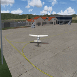
This is Songwe International Airport (HTGW)V2. Located in Mbeya, Tanzania, It is one of Tanzania's newest Airport. The Main Terminal is still under construction but the Airport is Operational. Update includes Airport Fence and Photo Airport Background. Built by Sketchup and ADE v1.70. Needs Lens EZ library, "Warehouse Airport and Vehicles", ESDG Ramp Lights (RWY12 library) and Parking Lots Large SS FS9 scenery objects for FS9 By Sidney Schwartz & Lars Hoyer. See Readme for Install Instructions
| Filename: | Songwe_International_Airport_HTGW_V2.zip |
| License: | Freeware |
| Added: | 11th August 2018, 22:57:10 |
| Downloads: | 205 |
| Author: | Emmanuel Mwandosya |
| Size: | 4.56 MB |
| Category: Flight Simulator 2004 - Scenery | |
| Northern Canada Mining CYOA & CHB3 in Canada |
|
Images related to this file:
File Description:
These are two airfields in northern Canada, serving two mining operations. The furthest north is Hope Bay CHB3 in Nunavut. It is in a sheltered inlet less than 3 miles from the northern mainland coast and around 65 miles southwest of Cambridge Bay. The owner is Hope Bay Mining Ltd, and their operation mines gold out of a tunnel rather than open cast. The airfield is incorporated into the road that leads north to the sea; traffic is halted by traffic lights when a flight is expected. The runway is 3,000 feet of gravel aligned 01-19 and with PAPI at both ends.
The second airfield serves the Ekati diamond mine and is some 265 miles southwest of Hope Bay, in the Northwest Territories. Ekati was the first Canadian diamond mine and is 195 miles northeast of Yellowknife and less than 20 miles north of a later mine, Diavik (by Sid and Pete). CYOA reflects the relative value of the two mining operations and is far better equipped than Hope Bay. It can be described as an airport while Hope Bay remains an airfield. The runway is 6,400 feet of gravel aligned 36-18 with PAPI and strobe approach lights at both ends. The scale of the mining operation can only be described as huge.
| Filename: | Northern_Canada_Mining_CYOA__CHB3_in_Canada.zip |
| License: | Freeware, limited distribution |
| Added: | 11th August 2018, 22:59:06 |
| Downloads: | 218 |
| Author: | Roger Wensley |
| Size: | 8.24 MB |
| Category: Flight Simulator 2004 - Scenery | |
| Georgian Bay Airfields CYEM & CNR4 in Ontario, Canada |
|
Images related to this file:
File Description:
These are two airfields in Ontario around Georgian Bay, which is off the east side of Lake Huron in the Great Lakes. Manitoulin East Muni CYEM is at the northern end of the Bay in an area of coves and lakes, on what is actually an island that is almost but not quite connected to the mainland in several places. There is no immediately adjacent town and the field serves the county area. The runway is 3,500 feet of asphalt aligned 02-20 with PAPI at both ends. The second airfield is Tobermory CNR4, which is just south of the small town and ferry terminal of the same name on the northern end of the peninsula that forms Georgian Bay. The runway is 3,180 feet long and aligned 12-30; there is no longer a 450 feet displacement to the 30 threshold.
| Filename: | Georgian_Bay_Airfields_CYEM__CNR4_in_Ontario_Canad.zip |
| License: | Freeware, limited distribution |
| Added: | 12th August 2018, 19:31:18 |
| Downloads: | 140 |
| Author: | Roger Wensley |
| Size: | 17.45 MB |
| Category: Flight Simulator 2004 - Scenery | |
| Bar River CPF2 in Ontario, Canada |
|
Images related to this file:
File Description:
Bar River is an airfield in Ontario, some 20 miles east of Sault Ste Marie. It is owned and operated by Springer Aerospace, an aircraft maintenance company. They specialise in turboprop aircraft and carry out work for several northern airlines plus private owners; they also have a paintshop and have painted planes for a number of airlines including Air Canada. There used to be two runways but one is now only a taxiway and the one remaining is aligned 36-18 and 4,415 feet long. Adjacent to this runway is "the ditch", a 2,000 feet long water runway; there is no way put of the ditch except by fork lift or by take off. In the winter a number of float planes are stored on the airfield for maintenance until the flying season opens again. There are no runway or taxiway lights, and no signage. There is a windsock.
| Filename: | Bar_River_CPF2_in_Ontario_Canada.zip |
| License: | Freeware, limited distribution |
| Added: | 14th August 2018, 21:31:58 |
| Downloads: | 116 |
| Author: | Roger Wensley |
| Size: | 18.44 MB |
| Category: Flight Simulator 2004 - Scenery | |
| Mary River CMR2 on Baffin Island in Nunavut Canada |
|
Images related to this file:
File Description:
This is a very early version of an airfield in Nunavut built to serve an iron ore mine some 100 miles south of Pond Inlet on Baffin Island. In 2004 the airstrip was just being built, with a very basic camp set up for the construction crew who then went on to develop the roads etc in the immediate area. The original plan was for an opencast mine, with ore being transported south on a new (and expensive) railroad link to a new port on the south shore of Baffin Island. This plan was later changed to a (much cheaper) road to Milne Inlet, north of Mary River. And there my story rests, as although production has now started I have no further information about the operating mine. Nolinor currently flies regular supply flights into the camp; the AI here is for the early days. The gravel runway is 4,800 feet long and 150 feet wide, aligned 124T-304T as all runway headings in the north are given as true rather than the unreliable magnetic, which would be 12-30. Runway lighting and PAPI was installed early on and is included here; signage is not and the apron is the early version.
| Filename: | Mary_River_CMR2_on_Baffin_Island_in_Nunavut_Canada.zip |
| License: | Freeware, limited distribution |
| Added: | 18th August 2018, 02:57:19 |
| Downloads: | 136 |
| Author: | Roger Wensley |
| Size: | 4.82 MB |
| Category: Flight Simulator 2004 - Scenery | |
| FS9 Bar River CPF2 in Ontario, Canada UPDATE |
|
Images related to this file:
File Description:
This is an update for Bar River, the missing textures for a parked Norseman. There would have been an error message when you ran the scenery, but this was reported to me by only one down-loader. As I have previously stated, there is no way for me to easily check that I have included everything needed, and I (and other designers) rely on end-user participation for information when I have erred from the straight and narrow. A response rate of less than 1% is way short of "participation".
| Filename: | FS9_Bar_River_CPF2_in_Ontario_Canada_UPDATE.zip |
| License: | Freeware, limited distribution |
| Added: | 24th August 2018, 03:07:28 |
| Downloads: | 86 |
| Author: | Roger Wensley |
| Size: | 1.61 MB |
| Category: Flight Simulator 2004 - Scenery | |
| Repulse Bay CYUT in Nunavut Canada |
|
Images related to this file:
File Description:
This is a scenery that I started in 2013, temporarily abandoned when I found there was a fault in the coastline that reduced it all to straight lines, and then totally forgot about. Until now, when I discovered that while I had made the Repulse Bay terminal building I had mysteriously not made the scenery. Investigation revealed the reason why and here it is with a coastline that has been repaired to the extent that the fault allowed. Repulse Bay has a population of around 1,100 and since 2015 has been officially named Naujaat, the traditional Inuit name. It is located exactly on the arctic circle on the northern extension of the western side of Hudson Bay, in a large bay off the northern tip of Southampton Island. Coral Harbour is on the far side of the island, 180 miles to the south. The airfield is alongside the town and the coast, with the runway 3,400 feet of gravel with PAPI at both ends, aligned 161T-341T with "T" standing for true as opposed to the unreliable magnetic bearing this far north. The regular scheduled flights are by Air Baffin (an Air Nunavut subsiduary), connecting to Iqaluit some 550 miles to the east. The helicopters are there in the summer with their own fuel in drums around their own parking apron. They land directly on the apron, which cannot be replicated in AI, so they are present only as parked choppers and not flying ones.
| Filename: | Repulse_Bay_CYUT_in_Nunavut_Canada.zip |
| License: | Freeware, limited distribution |
| Added: | 6th September 2018, 00:34:38 |
| Downloads: | 180 |
| Author: | Roger Wensley |
| Size: | 7.87 MB |
| Category: Flight Simulator 2004 - Scenery | |
| London, England - Luton Airport - EGGW |
|
File Description:
London, UK - Luton airport hasn't updated scenery in FS2004. I created scenery for better more details. It looks great.
| Filename: | London_England__Luton_Airport__EGGW.zip |
| License: | Freeware |
| Added: | 9th September 2018, 03:42:45 |
| Downloads: | 765 |
| Author: | Stuart John Gilbert II |
| Size: | 4.27 MB |
| Category: Flight Simulator 2004 - Scenery | |
| Akulivik CYKO in northern Quebec Canada |
|
Images related to this file:
File Description:
This is another of the many airfields that are all around the coast of Hudson Bay, this one being on the eastern, Quebec side. Akulivik is around 110 miles south of Ivujivik, which is on the northeastern corner of the Bay, and some 60 miles north of Puvirnituq. The population is 630 or so and the village grew from a move back to the area by one family in 1973, followed by others in the following years; the closure of the Hudson Bay trading post post in 1952 had pushed all residents to move south to Puvirnituq. The village is unusual in that it has a built harbour instead of the usual beached storage of boats. The village is built on the central prong of a three pronged spear of headlands (from which the village name is derived) while the airfield is a mile or so further inland. I have no information regarding what I think may be a new terminal building, so this includes only the old original one. The runway is just under 3,500 feet of gravel aligned 09-27, and the ai includes the scheduled flight by an Air Inuit Dash 8-300, plus GA.
| Filename: | Akulivik_CYKO_in_northern_Quebec_Canada.zip |
| License: | Freeware, limited distribution |
| Added: | 9th September 2018, 03:43:25 |
| Downloads: | 162 |
| Author: | Roger Wensley |
| Size: | 4.69 MB |


© 2001-2026 AVSIM Online
All Rights Reserved
Privacy Policy |