
Where Flight Simulation Enthusiasts Gather from Around the World!
AVSIM Library - Search Results

| Category: Flight Simulator 2004 - Scenery | |
| Central Appalachia Land Class |

|
Images related to this file:
File Description:
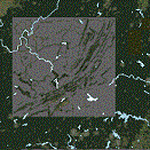
I've used default textures (tiles) for villages MS left out of the sim. I didn't place all of the missing villages on the project sheet, though. I did not need to make custom tiles, neither. Most highways are connected the default villages now. I was satisfied with the default tiles MS uses. Most highways are connected the default villages now. Mountain ridge lines better contrast with valleys now. But, I did get it all...
| Filename: | Central_Appalachia_Land_Class.zip |
| License: | Freeware |
| Added: | 9th July 2015, 01:47:21 |
| Downloads: | 147 |
| Author: | Rick Connolly |
| Size: | 1.31 MB |
| Category: Flight Simulator 2004 - Scenery | |
| KCRW - Kanawha River Valley - West Virginia, USA |
|
Images related to this file:
File Description:

This scenery is made to blend with autogen scenery and the defaults of FS9. Transits crossing the southern Allegheny Mountains will follow this valley seeing some of the landmark bridges and dams of the central WV area. The New river bridge scenery is not included in this package because (not only my own version which works default mesh), but another fellow has made one. It also fits with this package and looks real good. This package blends well with default or compliments my Land Class Central Appalachia package.
| Filename: | KCRW__Kanawha_River_Valley__West_Virginia_USA.zip |
| License: | Freeware |
| Added: | 9th July 2015, 17:26:13 |
| Downloads: | 228 |
| Author: | Rick Connolly |
| Size: | 2.33 MB |
| Category: Flight Simulator 2004 - Scenery | |
| WV71 - Lieving Airport - West Virginia, USA |
|
Images related to this file:
File Description:
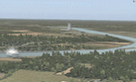
Racine Locks & Dam is a local vfr landmark for transits across the lower Allegheny Plateau. Included files are xml autogen, ezlandclass and custom bgl files with textures. I've named the files so that they are self explainable. This scenery is made to blend with autogen scenery (default) for FS9 and my Central Appalachia Land Class project. I've added the lower Big Sandy Valley project, too. It corrects a few default mistakes and adds bridges like at I-64 and in the Ashland Kentucky and Huntington WV area.
| Filename: | WV71__Lieving_Airport__West_Virginia_USA.zip |
| License: | Freeware |
| Added: | 9th July 2015, 17:29:21 |
| Downloads: | 213 |
| Author: | Rick Connolly |
| Size: | 5.64 MB |
| Category: Flight Simulator 2004 - Scenery | |
| 4NC9 - Lake Norman - North Carolina, USA |
|
Images related to this file:
File Description:
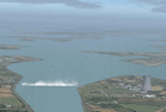
This float plane scene is based on the terra server. Lake Norman is in close proximity to the city of Charlotte, NC. The dam has dynamic spray and adjoining industry. A map of the state camp ground is included for your adding to my custom made scenery. I pulled this from my personal archives...
| Filename: | 4NC9__Lake_Norman__North_Carolina_USA.zip |
| License: | Freeware |
| Added: | 11th July 2015, 11:20:14 |
| Downloads: | 235 |
| Author: | Rick Connolly |
| Size: | 3.02 MB |
| Category: Flight Simulator 2004 - Scenery | |
| O12 - Grand Lake St. Marys Seaplane Base - Ohio, USA |
|
Images related to this file:
File Description:
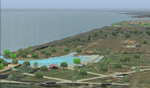
Grand Lake St. Marys Seaport O12 rests in Ohio's largest inland lake at Celina, Ohio. Float and soar plane enthusiasts will find thermals (several are placed within about a 60 mile radius) and plenty of docks or moors around the lake for your Amphib and afcads. Grand Lake St. Marys Seaport O12 scenery is made to blend with autogen scenery and default mesh. I used custom made objects & default objects. Grand_thermals.BGL is the troublesome file with winds aloft for sail planning thermals. Some people may want to remove it for smoother landing at one of the airports. Airports: Lakefield KCQA - Mulholland OI99 - Fortman 1OH4 and Grand Lake St Marys O12. I pulled this from my old archives.
| Filename: | O12__Grand_Lake_St_Marys_Seaplane_Base__Ohio_USA.zip |
| License: | Freeware |
| Added: | 11th July 2015, 11:22:45 |
| Downloads: | 242 |
| Author: | Rick Connolly |
| Size: | 13.53 MB |
| Category: Flight Simulator 2004 - Scenery | |
| Smith Mountain Lake, two private seaports - Virginia, USA |
|
Images related to this file:
File Description:
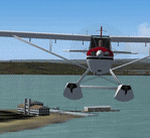
Smith Mountain Lake scenery is made to blend with autogen scenery (default). VA48 & 7VA7 seaports are left default so one may add their own AFCAD & AI traffic. Included is an EZ-landclass SmithMtnLake.bgl, its' EZL & RAW files (source files) so one may edit the area using EZ-landclass that's available as freeware download. Another distinction besides a very popular vacation lake is American Electric Powers' hydro-electric dam.
| Filename: | Smith_Mountain_Lake_two_private_seaports__Virginia.zip |
| License: | Freeware |
| Added: | 11th July 2015, 11:24:40 |
| Downloads: | 185 |
| Author: | Rick Connolly |
| Size: | 14.93 MB |
| Category: Flight Simulator 2004 - Scenery | |
| KLVK - Livermore Municipal Airport - California, USA |
|
Images related to this file:
File Description:
FS9 Scenery - Livermore Municipal Airport (IATA: LVK, ICAO: KLVK) is in Livermore, California, USA, east of San Francisco Bay. The airport is three miles northwest of the downtown area. Near the 650-acre airport are the Water Reclamation Plant and the Las Positas Golf Course. There are two parallel asphalt runways. The main lighted runway is 5,250 ft long and the second runway, unlighted, built in 1985, is 2,700 ft long is used mainly for training. Besides the 2,400 sq ft Terminal building, built in 1969, there are nearly 400 aircraft storage hangar units as well as a corporate-style hangar building containing 20,000 sq ft of space along with an aircraft storage shelter. About 600 aircraft are based on Livermore Airport. For your flying pleasure by John B. Loney, Jr.
| Filename: | KLVK__Livermore_Municipal_Airport____California_USA.zip |
| License: | Freeware, limited distribution |
| Added: | 17th July 2015, 17:11:29 |
| Downloads: | 264 |
| Author: | John B. Loney, Jr. |
| Size: | 11.46 MB |
| Category: Flight Simulator 2004 - Scenery | |
| Ontario Small Fields in Canada: #01 Leamington (CLM2) |
|
Images related to this file:
File Description:
This is the first of a series of small airfields in southern Ontario, Canada. It is Leamington CLM2, a field near a small town of the same name beside Lake Erie. The airfield has an asphalt runway of 3,820 feet, though with displaced thresholds at each end due to electric cable strung along the roads for an effective landing length of around 2,800. Right-hand circuits for runway 19 to avoid over-flying a nature reserve around a stretch of shallow water to the northeast. The intention is that downloaders will add further posts to the first, which will avoid unnecessary texture duplication (for instance for parked cars or planes) and avoid adding yet another small field to the FS9 scenery library. The second airfield will probably be Harrow CGL2, a grass field to the west of Leamington.
| Filename: | Ontario_Small_Fields_in_Canada_01_Leamington_CLM2.zip |
| License: | Freeware, limited distribution |
| Added: | 18th July 2015, 15:03:26 |
| Downloads: | 163 |
| Author: | Roger Wensley |
| Size: | 3.23 MB |
| Category: Flight Simulator 2004 - Scenery | |
| Ontario Small Fields in Canada: #02 Harrow CGL2 |
|
Images related to this file:
File Description:
This is the second in a series of small airfields in southern Ontario, Canada. It is Harrow CGL2, a field near a small town of the same name close to Lake Erie. The airfield has a grass runway of 3,000 feet, with short displaced thresholds (400 feet) at each end; the south due to the trees and the north due to a road and fence. The electric cable strung along this road (unlike Leamington, with it's warning visibility spheres) is buried for a short stretch the width of the runway, but avoid the poles. The intention is that downloaders will add further posts to the earlier ones, which will avoid unnecessary texture duplication (for instance for parked cars or planes) and avoid adding yet another small field to the FS9 scenery library. The third airfield will probably be Essex CNE9, a grass field to the west of Harrow.
| Filename: | Ontario_Small_Fields_in_Canada_02_Harrow_CGL2.zip |
| License: | Freeware, limited distribution |
| Added: | 19th July 2015, 19:44:00 |
| Downloads: | 182 |
| Author: | Roger Wensley |
| Size: | 1.54 MB |
| Category: Flight Simulator 2004 - Scenery | |
| Ontario Small Fields in Canada: #03 Essex CNE9 |
|
Images related to this file:
File Description:
This is the third in a series of small airfields in southern Ontario, Canada. It is Essex CNE9, a field near a small town of the same name close to Lake Erie and just northwest of Harrow (visible in one of the screenshots). The airfield has a grass runway of just 1,935 feet, with electric cables strung along the west side of the road on the approach to 09, buried for a short stretch the width of the runway (but avoid the poles). The airfield has three hangars, not the first farm strip to have more than the expected one-for-the-farmer. The intention is that downloaders will add further posts to the earlier ones, which will avoid uneccesary texture duplication etc. The fourth airfield will probably be Stoney Point CRML, a grass field to the northeast of Essex, close to Lake St. Clair.
| Filename: | Ontario_Small_Fields_in_Canada_03_Essex_CNE9.zip |
| License: | Freeware, limited distribution |
| Added: | 21st July 2015, 16:11:05 |
| Downloads: | 154 |
| Author: | Roger Wensley |
| Size: | 3.64 MB |


© 2001-2026 AVSIM Online
All Rights Reserved
Privacy Policy |