
Where Flight Simulation Enthusiasts Gather from Around the World!
AVSIM Library - Search Results

| Category: Flight Simulator 2004 - Scenery | |
| RPMR - General Santos Airport - South Cotabato, Philippines |

|
File Description:
There is default FS2004 was all wrong. There is no major taxiways and ramps in the past. I found there is current corrected scenery that I created updated.
| Filename: | RPMR__General_Santos_Airport__South_Cotabato_Phili.zip |
| License: | Freeware |
| Added: | 19th January 2015, 18:58:41 |
| Downloads: | 1,048 |
| Author: | Stuart John Gilbert II |
| Size: | 1.01 MB |
| Category: Flight Simulator 2004 - Scenery | |
| PACD - Cold Bay - Aleutian Islands, Alaska, USA |
|
Images related to this file:
File Description:
Cold Bay is in the eastern third of the Aleutian chain of islands in Alaska, around 175 miles east of Dutch Harbor. The small town has a population of just over 100 and is in existance solely because of the airport with its long runways, one just over 6,000 feet and the other over 10,000 feet and with an ILS. Goods are flown here for local redistribution. The airport was originally built to this size for use in WW2 and there are still quonset huts from this time visible in the area, though the majority of the rough-and-ready housing has now been cleared away. There are scheduled flights by Grant Aviation to neighbouring local airfields and flights to and from Anchorage by Peninsula Air (included in the AI posted with Adak) and Grant Aviation have space attached to their hangar that serves as a terminal. The Coastguard also make use of Cold Bay.
| Filename: | PACD__Cold_Bay___Aleutian_Islands_Alaska_USA.zip |
| License: | Freeware, limited distribution |
| Added: | 21st January 2015, 10:01:50 |
| Downloads: | 425 |
| Author: | Roger Wensley |
| Size: | 4.88 MB |
| Category: Flight Simulator 2004 - Scenery | |
| Cameri and Turbigo sceneries (rev. 3) - north Italy |
|
Images related to this file:
File Description:
The following files are required by this file:
http://library.avsim.net/esearch.php?DLID=163723&UploadID=&Name=&FileName=&Author=&CatID=root
http://library.avsim.net/esearch.php?DLID=186350&UploadID=&Name=&FileName=&Author=&CatID=root
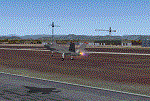
This scenery includes a global review of the previous Sceneries of Cameri Military airport (rev.2 Oct 2011), Cameri Museum (rev. 2 Oct 2011), Cameri Babini (rev. 2 oct 2011), Turbigo power station (rev. 2 Sep 2011 and update rev. 2.1 Oct 2014). All the above ARE NOW INCLUDED in this new unique scenery. Contents: Terrain in new version photo-realistic multi-seasons/night; adapted to Western Europe special elevation meshes; cover area of over 120 sqkm from Bellinzago-Oleggio (NW) to Magnago-Bienate (NE), from Novara (SW) to Cuggiono-Inveruno (SE); all the terrain has been restorated with 3D buildings, either through autogen that with specific dedicated objects (by GMax) and with significant addition of library objects ("dva51" and other existings). This scenery (located on the final approach to the Milan Malpensa international airport) includes the Cameri's Mil Airport with the Babini closed Army area and the planes of the Historical Museum of the airport; it is also included the thermoelectric power station of Turbigo. All the buildings are placed to recreate cities and villages covered in the photo-realistic terrain, including Bellinzago, Bienate, Buscate, Caltignaga, Cameri, Castano Primo, Castelletto Ticino, Cuggiono, Galliate, Inveruno, Magnago, Malvaglio, Nibbia, Novara, Oleggio, Pernate, Robecchetto, Romentino, Sant'Anna, San Pietro Mosezzo, Turbigo , Vanzaghello, and the covered Turin-Milan highway.
Details of the new buildings for the care and maintenance to F35 completely recreated, as obtainable from the current satellite view.
It REQUIRES the use of the following, to be downloaded separately :
- the libraries dva51 - the system of vegetations TreePlanter - the West Europe Meshes of Daniele Lanfranchi. See the Readme file. Enjoy!
Videos available here:
https://dl.dropboxusercontent.com/u/38829151/FS9/Cameri_Turbigo_v3%20shots.WMV
http://youtu.be/yVI2KeJKS5o
http://youtu.be/oKa0e_5kxIk
| Filename: | Cameri_and_Turbigo_sceneries_rev_3__north_Italy.zip |
| License: | Freeware |
| Added: | 21st January 2015, 21:32:36 |
| Downloads: | 996 |
| Author: | Aldo Della Vedova, Daniele Lanfranchi and Gian Mario Verga |
| Size: | 103.7 MB |
| Category: Flight Simulator 2004 - Scenery | |
| PASD - Sand Point - Aleutians Alaska USA |
|
Images related to this file:
File Description:
Sand Point is in the eastern third of the Aleutian chain of islands in Alaska, around 85 miles east of Cold Bay on Popof Island. The town has a population of around 1,000 and it's economy is solidly based on fishing. There is, in the town, a fish processing plant owned by Trident (their largest plant is in Akutan, east of Dutch Harbor) and the area close to the airport is used for crab pot storage etc. The single runway is aligned 13-31 (with right hand circuits on 13) and 6,000 feet long. There are scheduled flights by Grant Aviation to neighbouring local airfields and flights to and from Anchorage by Peninsula Air (included in the AI posted with Adak). The Coastguard also make occasional visits.
| Filename: | PASD__Sand_Point__Aleutians_Alaska_USA.zip |
| License: | Freeware, limited distribution |
| Added: | 22nd January 2015, 23:59:35 |
| Downloads: | 366 |
| Author: | Roger Wensley |
| Size: | 6.38 MB |
| Category: Flight Simulator 2004 - Scenery | |
| KDYS - Dyess AFB - Abilene, Texas |
|
Images related to this file:
File Description:

Dyess Air Force Base is located approximately 7 miles (11km) southwest of Abilene, Texas. It is home to the 7th Bomb Wing, which consists of four groups of which two squadrons, the 9th and 28th, fly the B-1B. In addition, the 28th Bomb Squadron is the Air Force schoolhouse for all B-1B aircrew members. Scenery contains photo-real all-season ground textures as well as custom objects. Scenery is stand-alone but additional downloads may be useful (see readme.doc for details).
| Filename: | KDYS__Dyess_AFB__Abilene_Texas.zip |
| License: | Freeware, limited distribution |
| Added: | 25th January 2015, 07:13:19 |
| Downloads: | 1,404 |
| Author: | John Stinstrom |
| Size: | 6.82 MB |
| Category: Flight Simulator 2004 - Scenery | |
| PAUT - Akun Island - Alaska, USA |
|
Images related to this file:
File Description:
Akun Island is close to Akutan, only 7 miles away from the village and the Trident fish processing plant that is just west of the village. Unfortunately those 7 miles are over the sea, as the airport has been built on a different island where there are fewer hills. The link is by hovercraft, which is included as AI in this post along with a "seaport" that boasts only an apron down by the beach. PAUT has a single runway aligned 09-27 which is 4,500 feet long and has a surrounding gravel base. There are daily flights from Dutch Harbor by Grant Aviation, more than one if more are required. The Ai contains these flights, plus a late afternoon Coastguard helicopter flight is added to the revised St Paul Island AI included here. Adjacent to the airport there is a camp for housing labour who were employed on the airport construction, and this is now available for wildlife survey teams or whoever else needs to find accommodation while working on Akun Island.
| Filename: | PAUT__Akun_Island__Alaska_USA.zip |
| License: | Freeware, limited distribution |
| Added: | 27th January 2015, 23:11:43 |
| Downloads: | 475 |
| Author: | Roger Wensley |
| Size: | 4.13 MB |
| Category: Flight Simulator 2004 - Scenery | |
| KPMD - Palmdale AF Plant 42 |
|
Images related to this file:
File Description:
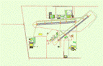
FS2004 Scenery for KPMD Palmdale AF A huge 5,800 acres/23 km² airfield that has somehow been overlooked by addon developers. almost all hangers and buildings are custom built due to their uniqueness to KPMD. Most of the facilities are owned by private contractors and serve as a manufacturing plant
for aircraft used by the United States .Rockwell's Palmdale assembly facility is where Space Shuttle came together
and were assembled and tested. Upon completion, the Shuttles were turned over to NASA for transport overland
to Edwards Air Force Base, California.
The airfield was opened in the early 1930s.At the outbreak of the Korean War in 1950, the U.S. Air Force realized a need
for a location for use in final assembly and flight testing of military jet aircraft, away from major population centers but close enough to the major
centers of aircraft design and production .Year round excellent flying weather was also a prerequisite. The land which
became AF Plant 42 fit all these criteria. Therefore the USAF bought the facility in in 1951.In the 1960's Lockheed
relocated to Plant 42 from its original Burbank, Ca .
| Filename: | KPMD__Palmdale_AF_Plant_42.zip |
| License: | Freeware |
| Added: | 29th January 2015, 21:22:39 |
| Downloads: | 828 |
| Author: | Brian Sturrock |
| Size: | 1.43 MB |
| Category: Flight Simulator 2004 - Scenery | |
| TVSU - Union Island - Grenadines, Eastern Caribbean ** Version 1.2 ** |
|
Images related to this file:
File Description:
This is a texture for the terminal paths shown in the screen shot, and presumes you have already installed my Union Island TVSU version 1.1. Just put it in the texture folder of your previous installation. Why does it take two years for someone to tell me the texture is missing from the post? Frederic wins the prize, which is a pint of Youngs Bitter in Le Bombardier pub in the 5eme in Paris.
| Filename: | TVSU__Union_Island__Grenadines_Eastern_Caribbean__.zip |
| License: | Freeware, limited distribution |
| Added: | 3rd February 2015, 09:08:27 |
| Downloads: | 247 |
| Author: | Roger Wensley |
| Size: | 191.97 KB |
| Category: Flight Simulator 2004 - Scenery | |
| PAHT - Amchitka - Aleutians, Alaska - USA |
|
Images related to this file:
File Description:
Amchitka is near the western end of the Aleutian chain of islands in Alaska, around 180 miles west of Adak, and was not included in FS9. There is no small town on Amchitka Island, which is why it was used for atom bomb testing after being closed down as an Air Force base. There are three runways from the 1940's, the largest of which is aligned 07-25 and just over 10,000 feet of overgrown asphalt 300 feet wide. The second runway is aligned 15-33 and 6,000 feet (also 300 feet wide) and the third is 05-23 and 5,000 feet. The whole eastern end of the island is crowded with old munitions storage areas and other military paraphernalia, including old quonset huts; some of those are included here. There are also some old buildings still standing but on their way to becoming piles of old wood or rust, and some of these are included. There is almost no visual information available about Amchitka; even Google Earth has snow obscuring what buildings still exist and where they are, so much of this is at best only approximate apart from the two large hangars. There are no markings, lights, signage, or a control tower.
| Filename: | PAHT__Amchitka__Aleutians_Alaska__USA.zip |
| License: | Freeware, limited distribution |
| Added: | 6th February 2015, 00:06:26 |
| Downloads: | 269 |
| Author: | Roger Wensley |
| Size: | 2.6 MB |
| Category: Flight Simulator 2004 - Scenery | |
| USA Landclass Vegetation Part I ** UPDATE ** |
|
Images related to this file:
File Description:
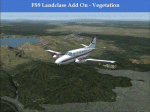
UPDATE:
Some small Cities, the Area around KAOC, Uinta Mountains.
Landclass Improvements for the USA, specialy the western Part of the USA:
Colorado, Yellow Stone, little Part of Idaho, Montana and from LA to Seattle, also some Testscenery's for the eastern Part of the USA.
The LC Scenery's are for further devolpment, including the *.inf & *raw files of the folder USA_SBX1.
| Filename: | USA_Landclass_Vegetation_Part_I__UPDATE_.zip |
| License: | Freeware |
| Added: | 13th February 2015, 10:06:20 |
| Downloads: | 483 |
| Author: | Markus Balz |
| Size: | 3.51 MB |


© 2001-2026 AVSIM Online
All Rights Reserved
Privacy Policy |