
Where Flight Simulation Enthusiasts Gather from Around the World!
AVSIM Library - Search Results

| Category: Flight Simulator 2004 - Scenery | |
| CYZG - Salluit - Hudson Strait, Quebec, Canada, Modified V1 |

|
Images related to this file:
File Description:
This modified version installs new taxiway lights and windsocks, and updates the AI. This is a complete version and does not require you to have installed the original. Salluit is a village of 1,250 or so inhabitants at N 62 W 75 40 on the shore of Sugluk Inlet, which is in northern Quebec off the Hudson Strait. It's name means "Skinny Ones" in Inuit, and refers to a time when there was not enough to eat, which is a rather scary reminder of just how fragile Inuit survival used to be. The airfield runway is 3,510 feet of gravel 100 feet wide aligned 03-21, and is some 740 feet higher than the village on the shoreline.
| Filename: | CYZG__Salluit__Hudson_Strait_Quebec_Canada_Modifie.zip |
| License: | Freeware, limited distribution |
| Added: | 23rd August 2014, 11:26:53 |
| Downloads: | 255 |
| Author: | Roger Wensley |
| Size: | 11.13 MB |
| Category: Flight Simulator 2004 - Scenery | |
| CYPX - Puvirnituq - Hudson Bay - Quebec, Canada, Modified V1 |
|
Images related to this file:
File Description:
This modified version installs new taxiway lights and windsocks, and the PAPI that has been recently installed at the airport, plus it modifies the AI. This is a complete version and does not require you to have installed the original. A new terminal building was opened in 2013, but as I unfortunately have not been there to take recent photos I am unable to model it, so this scenery is as it was in 2011. Puvirnituq is a village of 1,300 or so inhabitants at N60 W77 on the east shore of Hudson Bay in Quebec. It's name means "Putrid" in Inuit, and there are two different stories about how it got the name. The runway is a very generous 6,300 feet of gravel 148 feet wide aligned 01-19, which should be enough for almost anything.
| Filename: | CYPX__Puvirnituq__Hudson_Bay__Quebec_Canada_Modifi.zip |
| License: | Freeware, limited distribution |
| Added: | 23rd August 2014, 11:27:59 |
| Downloads: | 235 |
| Author: | Roger Wensley |
| Size: | 11.08 MB |
| Category: Flight Simulator 2004 - Scenery | |
| KRDD - Redding Municipal - Redding, California - USA |
|
File Description:
Scenery for KRDD Redding Municipal airport. See readme.txt and preview pics.
| Filename: | KRDD__Redding_Municipal__Redding_California__USA.zip |
| License: | Freeware |
| Added: | 4th September 2014, 20:27:15 |
| Downloads: | 704 |
| Author: | Sidney Schwartz & Peter Ham |
| Size: | 24.88 MB |
| Category: Flight Simulator 2004 - Scenery | |
| KPVG - Hampton Roads Executive Airport - Virginia, USA |
|
Images related to this file:
File Description:
FS2004 Scenery - Hampton Roads Executive Airport (ICAO: KPVG, FAA LID: PVG) is a public-use airport
located seven miles (11 km) southwest of the central business district of Norfolk and northwest of Chesapeake, both independent cities in the U.S. state of Virginia. It is privately owned by Virginia Aviation Associates, L.L.C. Although most U.S. airports use the same three-letter location identifier for the FAA and IATA, Hampton Roads Executive Airport is assigned PVG by the FAA but has no designation from the IATA (which assigned PVG to Pudong International Airport in Shanghai, China). All buildings are custom made. AI traffic contains default aircraft. Created for your flight simming pleasure by John B. Loney, Jr.
| Filename: | KPVG__Hampton_Roads_Executive_Airport__Virginia_US.zip |
| License: | Freeware, limited distribution |
| Added: | 7th September 2014, 23:06:07 |
| Downloads: | 528 |
| Author: | John B. Loney, Jr. |
| Size: | 18.79 MB |
| Category: Flight Simulator 2004 - Scenery | |
| KSUU - Travis AFB - Fairfield, CA - USA |
|
Images related to this file:
File Description:

This is an updated version of this scenery to correct texturing errors. My thanks to the the good folks on the MAIW forums for catching and correcting this error. Situated in the San Francisco Bay Area and known as the "Gateway to the Pacific", Travis Air Force Base handles more cargo and passenger traffic through its airport than any other military air terminal in the United States. Originally laid out as a SAC base for long range bombers, the original hangar line and facilities for B-36 and B-52 aircraft have been largely rebuilt over the years to accommodate the current cargo operations of the 60th Air Mobility Wing (host at Travis). The 60th supports and deploys both the C-5 Galaxy and C-17 Globemaster as well as its own refueling squadrons of KC-10 Tankers. In addition, the base's former SAC alert facility now supports 2 transient Navy E-6B Mercury TACAMO aircraft detached from Tinker AFB, Oklahoma.
| Filename: | KSUU__Travis_AFB__Fairfield_CA__USA.zip |
| License: | Freeware, limited distribution |
| Added: | 10th September 2014, 01:20:26 |
| Downloads: | 2,481 |
| Author: | John Stinstrom |
| Size: | 6.08 MB |
| Category: Flight Simulator 2004 - Scenery | |
| Colombian Airports - Update |
|
File Description:
This is an update to my previous Colombian Airports upload colapts1.zip.
The update contains mainly some navaid corrections to SKFL, SKIB, and SKVP, and adds the airport SKSJ Jorge E. Gonzales of San Jose del Guaviare; this is now at the correct location and altitude and has buildings, objects, and landclass added. It is for FS9 default scenery and the Colombia freeware mesh by Raimondo Taburet. However, the scenery should also work with the default or any other mesh but I have not tested it.
However, please NOTE:
that in the default scenery without mesh the airport SKSJ will be below the rest of the surface whereas with the mesh, the airport will be at the same altitude as the rest of the scenery with the exception of the river which now runs at a higher (the default) altitude (see screenshots). For me flying without the mesh does not make any sense, so I live with that restriction. If you don't like it, you can always delete or deactivate the files starting with "SKSJ".
| Filename: | Colombian_Airports__Update.zip |
| License: | Freeware |
| Added: | 10th September 2014, 14:50:05 |
| Downloads: | 1,438 |
| Author: | Detlev J. Rohmer |
| Size: | 5.4 MB |
| Category: Flight Simulator 2004 - Scenery | |
| CYXD - Edmonton City Centre - Alberta, Canada V1 |
|
Images related to this file:
File Description:
Edmonton is in central Alberta, Canada. The City Centre airport has had other names (Edmonton Municipal, Blatchford Field) and was the first licensed airfield in Canada, in 1929. The history of aviation in northern Canada would not be complete if Edmonton was not included as a chapter in its own right. Unfortunately progress takes little notice of past glory and CYXD has now been closed and will be "redeveloped", in sharp contrast to the thriving City Centre airport in Toronto. This version for FS9 includes in the AI a 737 of Western Pacific, an airline that became Canadian Airlines in a merger in 1987. So this CYXD is maybe in the middle eighties, or perhaps the middle nineties with a vintage 737 being used for short haul to Calgary for sentimental reasons. Scheduled flights were in fact stopped in 1995, with the field being used for GA, charter flights, and medical evacuations etc since then. I have included many of the surrounding buildings, as the "City Centre Airport" really is surrounded by and part of the neighbourhood.
| Filename: | CYXD__Edmonton_City_Centre__Alberta_Canada_V1.zip |
| License: | Freeware, limited distribution |
| Added: | 14th September 2014, 21:13:01 |
| Downloads: | 1,639 |
| Author: | Roger Wensley |
| Size: | 54.85 MB |
| Category: Flight Simulator 2004 - Scenery | |
| LFBI - Poitiers-Biard Airport - Biard, France |
|
File Description:
Poitiers-Biard airport (LFBI) only for FS2004. Located west of the city of poitier this is as close as the Futuroscope airport.
http://www.poitiers.aeroport.fr/
This scenery is a freeware thank you to all those who provide assistance especially my F-BMPL for the permission to use the models of his FSX scenery for the creation of this scenery. It is not entirely realistic but allows you to use the Poitier platform in FS2004.
| Filename: | LFBI__PoitiersBiard_Airport__Biard_France.zip |
| License: | Freeware |
| Added: | 19th September 2014, 00:10:01 |
| Downloads: | 874 |
| Author: | Rambeau Philippe |
| Size: | 10.94 MB |
| Category: Flight Simulator 2004 - Scenery | |
| FASZ - Skukuza Airport - Mpumalanga, South Africa |
|
Images related to this file:
File Description:
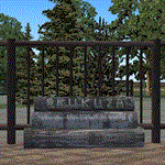
A Gmax representation of Skukuza Airport (FASZ), Kruger National Park, Mpumalanga, South Africa with photoreal textures.
Skukuza airport is situated inside the Kruger National Park and is served twice daily by commercial flights form Johannesburg and once a day by a commercial flight from Cape Town (operated by Airlink).
Located in close proximity to Skukuza main camp and the adjoining Sabi Sand Conservancy, the airport is unique in providing direct access into one of the world's largest protected wildlife areas.
| Filename: | FASZ__Skukuza_Airport__Mpumalanga_South_Africa.zip |
| License: | Freeware, limited distribution |
| Added: | 19th September 2014, 08:50:51 |
| Downloads: | 922 |
| Author: | Kobus van Wyk, Aeroworx |
| Size: | 4.35 MB |
| Category: Flight Simulator 2004 - Scenery | |
| Trecate - SanMartino scenery, NW Italy |
|
Images related to this file:
File Description:
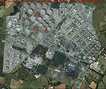
This is a VFR scenery for the industrial pole (refinery) S. Martino di Trecate (NO - NW Italy). In reality, all of the scheduled flights approaching Malpensa (LIMN) cross this area, aligning to route 350, for the two runways 35L and 35R. The scenery DOES NOT INCLUDE any airport.
- It requests application of libraries "dva51" (mainly used) and Treeplanter system libraries. Enjoy!
Video available here https://youtu.be/qJkBnAJrYZo
| Filename: | Trecate__SanMartino_scenery_NW_Italy.zip |
| License: | Freeware |
| Added: | 21st September 2014, 23:26:38 |
| Downloads: | 1,187 |
| Author: | Aldo Della Vedova, Daniele Lanfranchi |
| Size: | 22.3 MB |


© 2001-2026 AVSIM Online
All Rights Reserved
Privacy Policy |