
Where Flight Simulation Enthusiasts Gather from Around the World!
AVSIM Library - Search Results

| Category: Flight Simulator 2004 - Scenery | |
| OIKM - Bam Airport - Bam, Iran |

|
File Description:
Bam Airport is an airport to the east of Bam, Iran.
| Filename: | OIKM__Bam_Airport__Bam_Iran.zip |
| License: | Freeware |
| Added: | 25th September 2013, 21:31:18 |
| Downloads: | 274 |
| Author: | Billy Guo |
| Size: | 385.63 KB |
| Category: Flight Simulator 2004 - Scenery | |
| VFR of Lario, Area A4 - Como lake, Italy |
|
Images related to this file:
File Description:
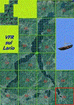
This 15th scenery of the project covers approximately an area of 7.5x6 kmt, from Pescate (NW) to Fracchio, Valsecca, Gromo (NE), from mountains around S. Genesio hamlet(SW) to Careggia, Opreno (SE); specific building is included as the Oggiono weir. Nice flights on Lario.
Check video available here: http://youtu.be/rDBA9_W6ci0
| Filename: | VFR_of_Lario_Area_A4__Como_lake_Italy.zip |
| License: | Freeware |
| Added: | 27th September 2013, 01:35:08 |
| Downloads: | 655 |
| Author: | Aldo Della Vedova, Daniele Lanfranchi, Gian Mario Verga |
| Size: | 10.94 MB |
| Category: Flight Simulator 2004 - Scenery | |
| London City Airport (EGLC), UK - "Masterplan Concept" Version 2 |
|
Images related to this file:
File Description:

The masterplan for London City has been around for a while so we have developed a concept to reflect it. This airport is compatible with the default traffic file, and handles added traffic well. This concepts adds a full parallel taxiway, extra parking and more high speed exits to the runway to handle more traffic.
New in V2 extra parking for GA and small jets, "RWY AHEAD" markings on the taxiways and parking area markings.
| Filename: | London_City_Airport_EGLC_UK__Masterplan_Concept_Ve.zip |
| License: | Freeware, limited distribution |
| Added: | 28th September 2013, 12:33:53 |
| Downloads: | 588 |
| Author: | Mark Piccolo - Soarfly Concepts |
| Size: | 894.96 KB |
| Category: Flight Simulator 2004 - Scenery | |
| VIBR - Kullu Manali Airport - Bhuntar, India |
|
File Description:
Bhuntar Airport, alternatively known as Kullu Manali Airport or Kullu Airport, (IATA: KUU, ICAO: VIBR) is an airport located in Bhuntar in the Indian state of Himachal Pradesh. Bhuntar is considered a challenging airport for pilots because of its single runway set in a deep valley whose peaks rise several thousand feet higher than the runway. Also, the airport is located on the banks of the river Beas.
| Filename: | VIBR__Kullu_Manali_Airport__Bhuntar_India.zip |
| License: | Freeware |
| Added: | 28th September 2013, 12:39:15 |
| Downloads: | 409 |
| Author: | Billy Guo |
| Size: | 1.13 MB |
| Category: Flight Simulator 2004 - Scenery | |
| VIDF - Pithorgarh Airport - Pithorgarh, India |
|
File Description:
A small airport in Pithorgarh, India.
| Filename: | VIDF__Pithorgarh_Airport__Pithorgarh_India.zip |
| License: | Freeware |
| Added: | 28th September 2013, 21:07:30 |
| Downloads: | 239 |
| Author: | Billy Guo |
| Size: | 1.06 MB |
| Category: Flight Simulator 2004 - Scenery | |
| Central Europe 1961 - Belgium Airports |
|
Images related to this file:
File Description:

This scenery contains 4 Belgian airports as they were in 1961, EBBR Brussels - Zaventem, EBEH Evere-Haren (closed), EBOS Ostend, and EBAW Antwerp - Deurne. The harbor at Antwerp is also modeled. There are moving crash tenders at the active airports. Some estimation was used when pictures could not be obtained. This scenery is intended to supplement the earlier Central Europe 1961 scenery, but is installed into a separate folder. Please install Central Europe 1961 to see all the objects in this scenery.
Requires Central Europe 1961 (central_europe_1961.zip) to be installed first.
| Filename: | Central_Europe_1961__Belgium_Airports.zip |
| License: | Freeware, limited distribution |
| Added: | 29th September 2013, 18:26:41 |
| Downloads: | 3,379 |
| Author: | Harry Biard, Nikko Yaginuma, Jaap de Baare, Wolfgang Gersch, Tom Gibson and Bernard Leuenberger |
| Size: | 16.2 MB |
| Category: Flight Simulator 2004 - Scenery | |
| AVL gliders airport - Alzate Brianza, Italy |
|
Images related to this file:
File Description:
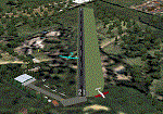
"free version" of the same airport for gliders, that will be included inside the A2 scenery of "VFR on Lario" project. It is made for the use on FS9 standard, without any addition of photo-realistic terrain and/or specific extra meshes. It requests the use of "dva51" free library and the "TreePlanter" use.
This scenery represents the AVL airport, dedicated to Giancarlo Maestri, and seat of the homonymous Lariano Glider Aeroclub and related gliding school. It is situated inland SE Como, between the Alserio and Montorfano small lakes, in the municipality of Verzago. It has an asphalt runway of 1890x50 feet, ground communication frequency 123.50; ICAO code: LILB (Alzate Brianza).
Video available here: https://youtu.be/huKdtYar_uQ
| Filename: | AVL_gliders_airport__Alzate_Brianza_Italy.zip |
| License: | Freeware |
| Added: | 30th September 2013, 23:34:42 |
| Downloads: | 566 |
| Author: | Aldo Della Vedova, Daniele Lanfranchi, Gian Mario Verga |
| Size: | 5.84 MB |
| Category: Flight Simulator 2004 - Scenery | |
| Fort Resolution CYFR in the Northwest Territories, Canada |
|
Images related to this file:
File Description:
Fort Resolution is on the south side of Great Slave Lake, 75 miles east of Hay River and just west of where the Slave River flows into the lake from Fort Smith. Fort Resolution, the oldest community in the Territories and once a vital link in the fur trade business, is a small town with a population of around 500. It was not included in the original FS9 or Ultimate Terrain so I have added it here.
The airfield is next to the town on the lakeshore. The runway is 4,000 feet of gravel with a displaced threshold at the southern (town) end; it is lit and there is PAPI. There are no scheduled flights to Fort Resolution, just occasional charters; the AI includes a stock FS9 Cessna and a Wasaya Airways PC12.
| Filename: | Fort_Resolution_CYFR_in_the_Northwest_Territories_.zip |
| License: | Freeware, limited distribution |
| Added: | 4th October 2013, 22:11:26 |
| Downloads: | 294 |
| Author: | Roger Wensley |
| Size: | 2.31 MB |
| Category: Flight Simulator 2004 - Scenery | |
| Albian CAL4, Firebag CFG6, Horizon CYNR, Mildred Lake CER4, and Muskeg Tower CFW4 in Alberta Canada |
|
Images related to this file:
File Description:
All of these airfields are in or close to the Athabasca Tar Sands in Alberta, modelled here along with the airfields. The tar sands workings extend along the Athabasca River for over 60 miles north of Fort McMurray in northern Alberta, and the huge cleared areas, surface mining, tailings ponds, and refineries along the Athabasca are right up there as Alberta's biggest VFR landmark. One look at a tailings pond (sea? ocean?) makes it clear that someone was worried about public reaction to the size. As well as the surface mining there are also large areas where there is underground extraction with a grid of dirt tracks between equipment installations. There are four airfields associated with the tar sands. Horizon CYNR is a public service airport operated by Canadian Natural Reources Ltd. Mildred Lake CER4 is owned and operated by Syncrude. Albian CAL4 is owned and operated by Shell Canada, and Firebag CFG6 is owned and operated by Suncor Energy. The fifth airfield is the nearby Muskeg Tower CFW4, which is there solely to support folks during their fire watch in the 120 feet tall tower. There is also a sixth airfield east of Horizon across the river and still visible, Bitumount; this is no longer in use. There is Ai included involving Canadian North, North Cariboo, Wasaya, HTS, First Air, Suncor, etc.
| Filename: | Albian_CAL4_Firebag_CFG6_Horizon_CYNR_Mildred_Lake.zip |
| License: | Freeware, limited distribution |
| Added: | 4th October 2013, 22:12:42 |
| Downloads: | 939 |
| Author: | Roger Wensley |
| Size: | 16.75 MB |
| Category: Flight Simulator 2004 - Scenery | |
| FS2004 Terra Emergence Project v1.0 |
|
Images related to this file:
File Description:
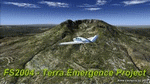
This is a new set of ground textures for FS2004. In this version, 100% forests, 80% interzones and 90% desert have been reworked. These textures are inspired by my work from FSX. Forests, rocks, mountains and intermediates zones for all the world and all seasons. See FS2004 Avsim forum for more info. See also my website https://sites.google.com/site/aimecreations/freeware-fs2004/fs2004ter
| Filename: | FS2004_Terra_Emergence_Project_v10.zip |
| License: | Freeware |
| Added: | 5th October 2013, 18:22:33 |
| Downloads: | 10,242 |
| Author: | Aime Leclercq |
| Size: | 39.48 MB |


© 2001-2026 AVSIM Online
All Rights Reserved
Privacy Policy |