
Where Flight Simulation Enthusiasts Gather from Around the World!
AVSIM Library - Search Results

| Category: Flight Simulator 2004 - Scenery | |
| Kangiqsujuaq CYKF in northern Quebec, Canada |

|
Images related to this file:
File Description:
Kangiqsujuaq is on the north coast of Quebec, 85 miles west of Quaqtaq and 125 miles east of Salluit, while across the Hudson Strait and 100 miles away on Baffin Island is Kimmirut. The town grew around two trading posts, the first opened by Revillon Freres in 1910, and the second by the Hudson Bay Company in 1914. A school was opened in 1960, and a clinic in 1961. The town was known as Wakeham Bay until 1961, and now has a population of around 700. The airport is to the south of the town and up on the hill at 511 feet ASL (this has been remeasured since 2004 and is now known to be 501). The gravel runway is just over 3,500 feet long and aligned 15/33; there is no PAPI, but there is fuel available, both 100LL and JetA. There are flights by Air Inuit.
| Filename: | Kangiqsujuaq_CYKF_in_northern_Quebec_Canada.zip |
| License: | Freeware, limited distribution |
| Added: | 27th January 2013, 00:55:00 |
| Downloads: | 232 |
| Author: | Roger Wensley |
| Size: | 2.31 MB |
| Category: Flight Simulator 2004 - Scenery | |
| New Doha International Airport or Hamad International Airport (OTHH/HHH) in Qatar |
|
File Description:
New Doha International Airport or Hamad International Airport (OTHH/HHH) in Qatar for default FS9 made by
Google Earth and Airport Charts
2.Versions are included:
1 current Airport Layout and 1 Layout by Masterplan
Includes simple detailed Terminal, Current Airport has over 130 Parking spots , Masterplan Vers. has over
170 Parking spots, detailed Hangar, a new DOHA Landclass files are included, Blue Lagoon Bay, The Pearl Islands,
Doha Harbour,Approaches for RWY16L/34R are included, also in real theres only one runway in use for Landing by the
charts of OTHH. But i have made the RWY 16R/34L aviable for landings too, for better traffic results.
| Filename: | New_Doha_International_Airport_or_Hamad_Internatio.zip |
| License: | Freeware |
| Added: | 27th January 2013, 00:56:43 |
| Downloads: | 3,839 |
| Author: | Hendrik Klon |
| Size: | 23.13 MB |
| Category: Flight Simulator 2004 - Scenery | |
| CYYC by Masterplan |
|
File Description:
Calgary International Airport (CYYC/YYC) by future Masterplan for default FS9.
Includes simple detailed Mainterminal with planned expansion, new ILS for RWY16L/34R, over 140 Parkingspots.
All Runways are active, new Landclass around the Airport.
| Filename: | CYYC_by_Masterplan.zip |
| License: | Freeware |
| Added: | 27th January 2013, 00:59:05 |
| Downloads: | 826 |
| Author: | Hendrik Klon |
| Size: | 5.12 MB |
| Category: Flight Simulator 2004 - Scenery | |
| KLAW - Lawton-Ft. Sill Regional, Oklahoma |
|
Images related to this file:
File Description:
Completely redone version of KLAW Oklahoma. All custom buildings, though the terminal uses the default FS9 textures. If you have American Eagle ai installed, you should see it here.
| Filename: | KLAW__LawtonFt_Sill_Regional_Oklahoma.zip |
| License: | Freeware, limited distribution |
| Added: | 28th January 2013, 09:25:23 |
| Downloads: | 417 |
| Author: | Sidney Schwartz |
| Size: | 1.07 MB |
| Category: Flight Simulator 2004 - Scenery | |
| Type12M Rothesay Class Frigates Fs9 |
|
Images related to this file:
File Description:
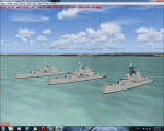
Type12M Rothesay Class Frigates, for static use. Intended as stand alone or escort vessels for Carriers. Three versions are provided, Rothesay, Yarmouth, and Plymouth, depicting the vessels at various stages in their life. Two are helicopter landable.
A separate Rwy12 file is provided. By Mike Hudson
| Filename: | Type12M_Rothesay_Class_Frigates_Fs9.zip |
| License: | Freeware |
| Added: | 31st January 2013, 16:02:07 |
| Downloads: | 173 |
| Author: | Mike Hudson |
| Size: | 3.29 MB |
| Category: Flight Simulator 2004 - Scenery | |
| Aerodromo ULM da Tojeira (Magoito) - Portugal |
|
Images related to this file:
File Description:
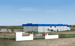
Tojeira ULM Airfield. This scenery is fully compatible with Portugal Terrain from PTSIM (http://www.ptsim.com) and is based on digital pictures, accurate real measures by Aerodromos de Portugal (http://www.pelicano.com.pt/zmapa.html) and Google Earth. Freeware. For Microsoft FS2004. NOT tested for FSX
| Filename: | Aerodromo_ULM_da_Tojeira_Magoito__Portugal.zip |
| License: | Freeware |
| Added: | 31st January 2013, 20:18:12 |
| Downloads: | 457 |
| Author: | Joao A. Graca Ferreira |
| Size: | 7.78 MB |
| Category: Flight Simulator 2004 - Scenery | |
| Patch for ISD Milan Orio al Serio LIME update 2013! |
|
Images related to this file:
File Description:
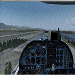
Dear friends, with this update of the '"update", I corrected some flaws of' Orio al serio 2013
I published. With this patch, you will have a better graphic performance at night, and the addition
of new parking areas with better cars and new viw of Bergma Hight City from the airport.
I also entered the hut ILS in the airport area and I corrected the position of several objects within the Scenery.
I believe that as long as I am not going, I or someone else's hand to complete reconstruction of the Scenery linate, this
will be my last job for this airport. Happy Flights alive and go Atalanta Bergamo!
Fabio Ferrari castione of presolana [email protected]
| Filename: | Patch_for_ISD_Milan_Orio_al_Serio_LIME_update_2013.zip |
| License: | Freeware |
| Added: | 1st February 2013, 00:50:24 |
| Downloads: | 3,127 |
| Author: | Fabio Ferrari |
| Size: | 1.26 MB |
| Category: Flight Simulator 2004 - Scenery | |
| Kangiqsualujjuaq CYLU in northern Quebec, Canada |
|
Images related to this file:
File Description:
Kangiqsualujjuaq is in northern Quebec on the east side of Ungava Bay, which is to the east of Hudson Bay and around 150 miles wide and 120 miles deep. Kuujjuaq, the administrative capital of northern Quebec, is 100 miles to the southwest. The town is on the bank of the George River, and has also been known as Fort George River, George River, etc. There was a Hudson Bay trading post at the town's location as early as 1838, though it was closed and reopened more than once and the town did not grow because of the trading post; the Inuit lived on the coast during the summer but moved 30 miles inland in winter for trapping. A cooperative was formed in 1959 to market fish, and this was the creative force that brought about establishment of the town; a school was built in 1963.
The airport is to the north of the town in a valley between the surrounding hills at 215 feet ASL. The gravel runway is just over 3,500 feet long and aligned 16/34; there is no PAPI, but there is fuel available, both 100LL and JetA. There are flights by Air Inuit and a warning of caribou on the runway during October and November.
| Filename: | Kangiqsualujjuaq_CYLU_in_northern_Quebec_Canada.zip |
| License: | Freeware, limited distribution |
| Added: | 1st February 2013, 21:24:55 |
| Downloads: | 277 |
| Author: | Roger Wensley |
| Size: | 2.76 MB |
| Category: Flight Simulator 2004 - Scenery | |
| VFR of Lario, Area E1 - Como Lake, Italy |
|
Images related to this file:
File Description:
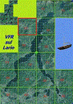
This 11th scenery of the project covers approximately an area of 7.5x6 kmt, from Stabiello mountain (NW) to Germasino (NE), from Mel (SW) to Santa Maria (SE); one dedicated building is included, as the San Bernardo little church (mountain ridge over Musso); GMax object as above and other buildings, with autogen/libraries buildings and trees are fully spreaded on the scenery.
Check video available here: http://youtu.be/5Q7KeoSljPc
| Filename: | VFR_of_Lario_Area_E1__Como_Lake_Italy.zip |
| License: | Freeware |
| Added: | 9th February 2013, 16:21:58 |
| Downloads: | 883 |
| Author: | Aldo Della Vedova, Daniele Lanfranchi, Gian Mario Verga |
| Size: | 11.53 MB |
| Category: Flight Simulator 2004 - Scenery | |
| CYVP - Kuujjuaq - Quebec, Canada |
|
Images related to this file:
File Description:
Kuujjuaq is in northern Quebec at the southern end of Ungava Bay, and 30 miles up the Koksoak River. Kuujjuaq has a population of around 2,400; it was previously called Fort Chimo and in 1830 there was a Hudson Bay trading post established close by, but on the other bank of the river. A nursing station and a school were established in 1948 and the Hudson Bay post moved across the river to the current location. The airport is to the south of the town and, unusally for northern airfields, has two runways. The asphalt runway is 6,000 feet long and aligned 07/25, and the gravel runway is 5,000 feet long and aligned 13/31; 07 has ILS. There is fuel available, both 100LL and JetA, but the 100LL will be in drums and you are required to have your own pump. There are numerous flights that stop at Kuujjuaq; the AI included here has Air Creebec, First Air, Wasaya Airways, and Air Inuit (Kuujjuaq is a maintenance centre for Air Inuit) plus private flights by various aircraft. There is also a flight by my poor representation of a Helicopter Transport Services chopper. There is a float base on the nearby Stewart Lake during the summer months. The base is within the Kuujjuaq control zone, and normally you would talk to the tower and inform them of your intentions, but in FS9 this cannot be replicated.
| Filename: | CYVP__Kuujjuaq__Quebec_Canada.zip |
| License: | Freeware, limited distribution |
| Added: | 11th February 2013, 06:22:50 |
| Downloads: | 815 |
| Author: | Roger Wensley |
| Size: | 5.92 MB |


© 2001-2026 AVSIM Online
All Rights Reserved
Privacy Policy |