
Where Flight Simulation Enthusiasts Gather from Around the World!
AVSIM Library - Search Results

| Category: Flight Simulator 2004 - Scenery | |
| Grass for Palermo (LICJ ) and Rimini (LIPR) Scenery |

|
File Description:
Easy upgrade for LICJ Palermo and LIPR rimini airport, with the addition of grass in flower beds airport.
installation:
Activate the folder LiCJLIPR grass from'addon scenery of fs 2004 as normal one.
It work also the great sceneries of:
(Make a back up before)
fS2004 Scenery--Airport Rimini-Miramare (LIPR).By Harry Urben and Ulrich Buergler.
Palermo Airport (LICJ) 2012 ver. 1.1 by Francesco Salsano
Best regards
Fabio Ferrari
[email protected]
| Filename: | Grass_for_Palermo_LICJ__and_Rimini_LIPR__Scenery.zip |
| License: | Freeware |
| Added: | 24th December 2012, 22:11:53 |
| Downloads: | 1,833 |
| Author: | fabio ferrari |
| Size: | 2.45 MB |
| Category: Flight Simulator 2004 - Scenery | |
| CWCP - Cape Parry - Northwest Territories, Canada |
|
Images related to this file:
File Description:
This is a DEW line Main Station on the shore of the Canadian mainland at the far northern tip of Cape Parry. It is 60 miles north of Paulatuk, which is at the base of the Parry Peninsula, and 120 miles south of Sachs Harbour on Banks Island. The station ceased operations in 1989 and a North Warning System automated station was opened in the same year; the NWS station is not shown in this scenery as I have no information regarding it's location or layout. The runway is just over 5,000 feet of gravel 150 feet wide, aligned 037T at an elevation of 119 feet ASL. There is a large apron with a large hangar and a small shelter building for passengers. There are of course no lights, signage, or windsock. The station is up on the hill at 210 feet ASL. This is one of the more interesting stations in terms of size and complexity.
| Filename: | CWCP__Cape_Parry__Northwest_Territories_Canada.zip |
| License: | Freeware, limited distribution |
| Added: | 25th December 2012, 19:07:24 |
| Downloads: | 302 |
| Author: | Roger Wensley |
| Size: | 1.61 MB |
| Category: Flight Simulator 2004 - Scenery | |
| Dry Tortugas National Park V1.0 |
|
File Description: Dry Tortugas NP is a large collection of tiny keys located about 70 nm west
of Key West. The two main keys are Garden Key, which is the location of the 19th
Century Fort Jefferson, and Loggerhead Key which enjoys the presence of a
lighthouse and a number of scientific stations. To have the fort present, you
must install Toni Hiltunen's drytort.zip and drytortx.zip. There are docks
for large and small water craft and for seaplanes.
| Filename: | Dry_Tortugas_National_Park_V10.zip |
| License: | Freeware, limited distribution |
| Added: | 25th December 2012, 19:11:00 |
| Downloads: | 328 |
| Author: | Major Robert J. Stew Stewart, Jr. |
| Size: | 10.59 MB |
| Category: Flight Simulator 2004 - Scenery | |
| FAGR Graaff Reinet Airport, South Africa |
|
File Description:
Graaff Reinet Airport (FAGR), South Africa.
Detailed airport scenery, containing photo realistic hangars and buildings.
| Filename: | FAGR_Graaff_Reinet_Airport_South_Africa.zip |
| License: | Freeware, limited distribution |
| Added: | 26th December 2012, 19:20:50 |
| Downloads: | 830 |
| Author: | Johan van Wyk, Aeroworx |
| Size: | 2.82 MB |
| Category: Flight Simulator 2004 - Scenery | |
| Peawanuck CYPO / Winisk CYWN - Northern Ontario, Canada |
|
Images related to this file:
File Description:
Peawanuck is on the bank of the Winisk River, 23 miles upstream from where the river empties into the Hudson Bay just west of James Bay. It has a population of around 240, and was established in 1986 when the original settlement (Winisk) at the mouth of the river was destroyed by a flood. The airport is on a bluff in a corner of the river at 171 feet ASL, with a gravel runway just over 3,500 feet long and aligned 11-29. There is only basic runway lighting, with no ILS, VASI, or PAPI; there is also no apron lighting, or fuel. Service is provided by Air Creebec with connector flights to Moosonee and Timmins, and on to Montreal. A search of their timetable did not provide any information regarding timings but I made the AI flight from Timmins a daily one; it is probably only once or twice a week. There is also a daily private Cessna from Moosonee. Winisk, at the mouth of the river, has another gravel runway which is over 6,000 feet long. There is also a large hangar and to the north the remaining buildings and fuel tanks etc of a Radar Control site which was closed in 1965 after only 7 years of use.
| Filename: | Peawanuck_CYPO__Winisk_CYWN__Northern_Ontario_Cana.zip |
| License: | Freeware, limited distribution |
| Added: | 29th December 2012, 09:14:03 |
| Downloads: | 281 |
| Author: | Roger Wensley |
| Size: | 2.61 MB |
| Category: Flight Simulator 2004 - Scenery | |
| PANC / ANC Ted Stevens Anchorage International Airport, Alaska - Version 6.0 |
|
Images related to this file:
File Description:

This is a major rebuild of Ted Stevens International airport. All terminals have been heavily upgraded from the default form. Terminals A & B have been resized and relocated to be more accurately placed. Terminal C, the newest terminal, has been rebuilt from scratch, and the cargo ramps received special treatment as well. As usual, there is plenty of eye candy placed around the airport including plenty of static general aviation aircraft. The included AFCAD has been extensively reworked, and all gates are laid out per the ANC website and sat photos.
Update: Version 6 contains various changes to the scenery which make it more accurate. There are jetway updates, afcad changes, and various structure changes. Airline parking assignments have also been updated as well as a missing taxiway. The connecting walkway between the international terminal and terminal C has been added. The cargo ramps near terminal C have been expanded and made more accurate to real life. The jetways on terminal A have been removed, and the jetways on Terminal C have also been modified for accuracy.
| Filename: | PANC__ANC_Ted_Stevens_Anchorage_International_Airp.zip |
| License: | Freeware |
| Added: | 29th December 2012, 20:34:30 |
| Downloads: | 18,412 |
| Author: | FRFStudio.net, William Morgan |
| Size: | 6.13 MB |
| Category: Flight Simulator 2004 - Scenery | |
| Attawapiskat CYAT in northern Ontario, Canada |
|
Images related to this file:
File Description:
Attawapiskat is on the north bank of the river of the same name, around 7 miles upstream from where the river meets the west shore of James Bay at its mid point. The top end of the Bay is around 140 miles north, Moosonee is around the same to the south, and the east shore 140 miles to the east. The town has a population of around 1,600, although this varies with the seasons as hunting and the traditional way of life on the land is still important to the Cree-speaking inhabitants. The airport is just to the north of the town with a gravel runway almost 3,500 feet long, and I have included the recently installed PAPI. The Canada Flight Supplement does not say anything about fuel being available so I presume the tanks beside the apron are no longer in use. There is also no apron lighting, unless it has been installed recently. There are flights by Air Creebec and by several other smaller airlines and I have included both Air Creebec and Wasaya; their textures are available for download and the planes are as listed in the AI folder.
| Filename: | Attawapiskat_CYAT_in_northern_Ontario_Canada.zip |
| License: | Freeware, limited distribution |
| Added: | 3rd January 2013, 01:37:50 |
| Downloads: | 377 |
| Author: | Roger Wensley |
| Size: | 3.54 MB |
| Category: Flight Simulator 2004 - Scenery | |
| ZSNT - Nantong Xingdong Airport |
|
Images related to this file:
File Description:

Skysoft Simulation ZSNT Nantong Xingdong Airport Scenery. The civilian airport is located in Tongzhou District, Nantong, Jiangsu Province. There are various destinations with flights commenced from ZSNT, such as Beijing Capital, Guangzhou and Kunming. As the airport is only 120 kilometers from Shanghai, China Eastern Airlines and Shanghai Airlines made ZSNT as their training base for new pilots. Due to frequent military air traffic movement in adjacent airports, the airspace is highly restricted. Departing and arriving planes must strictly follow the ATC's instructions.
Please refer to the readme file before installing, and read the manuals once they are extracted. We wish you a pleasant flight!
**Require removal of the ZSNT files in China Airport Scenery Package made by ai-china, if applicable**
| Filename: | ZSNT__Nantong_Xingdong_Airport.zip |
| License: | Freeware, limited distribution |
| Added: | 3rd January 2013, 01:41:48 |
| Downloads: | 2,900 |
| Author: | Alex Chao, Skysoft Simulation |
| Size: | 43 MB |
| Category: Flight Simulator 2004 - Scenery | |
| EETN - Tallinn, Estonia (v2.4) |
|
Images related to this file:
File Description:
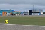
This software package contains the latest version of Tallinn airport and surrounding obstacles. The scenery was highly optimized to allow all-weather operations. NAV data including waypoints within Tallinn FIR are up to date (effective date 07 FEB 2013).
| Filename: | EETN__Tallinn_Estonia_v24.zip |
| License: | Freeware |
| Added: | 3rd January 2013, 15:07:31 |
| Downloads: | 7,052 |
| Author: | Stas Neznamov |
| Size: | 6.06 MB |
| Category: Flight Simulator 2004 - Scenery | |
| Waskaganish CYKQ in northern Quebec, Canada - revised |
|
Images related to this file:
File Description:
Waskaganish is at the southern end of James Bay, in Quebec, and this is a revised version. It deletes a hold short that should not have been showing on the gravel, and adds in signage, runway lights, taxiway lights, terminal night textures, and revised AI. I have no idea why I didn't include the night textures before. It presumes you have already installed my October 2010 Waskaganish.
| Filename: | Waskaganish_CYKQ_in_northern_Quebec_Canada__revise.zip |
| License: | Freeware, limited distribution |
| Added: | 6th January 2013, 00:08:58 |
| Downloads: | 222 |
| Author: | Roger Wensley |
| Size: | 1.49 MB |


© 2001-2026 AVSIM Online
All Rights Reserved
Privacy Policy |