
Where Flight Simulation Enthusiasts Gather from Around the World!
AVSIM Library - Search Results

| Category: Flight Simulator 2004 - Scenery | |
| Mulhouse - Centre Hospiatlier Emile Muller, France |

|
Images related to this file:
File Description:
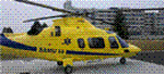
Scenery add-on for France VFR Alsace VFR base pack.
The Centre Hospitalier Emile Muller is the main hospital of Mulhouse. The helipad can support an helicopter up to 10 tons and is the home base of the Agusta A109 Power from SAMU 68.
Not tested without France VFR Alsace VFR base pack but should be compatible with default scenery.
By HAUGER Fredo.
| Filename: | Mulhouse__Centre_Hospiatlier_Emile_Muller_France.zip |
| License: | Freeware |
| Added: | 16th July 2012, 19:04:13 |
| Downloads: | 525 |
| Author: | HAUGER Fredo |
| Size: | 3.67 MB |
| Category: Flight Simulator 2004 - Scenery | |
| Missing ILS Frequency for VDSR Siem Reap Airport, Cambodia |
|
File Description:
This BGL file when installed, will add the missing ILS radio frequency to the landing runway (05) found in the FS9 (FS2004) payware Siem Reap International Airport scenery (VDSR) in Cambodia, published by THAI CREATION. Created with Lee Swordy's AFCAD 2.21 utility.
Full instructions included. NOTE - YOU MUST OWN THE COMMERCIAL PAYWARE VDSR SCENERY FROM THAI CREATION FOR FS9 (FS2004) FOR THIS TO WORK.
| Filename: | Missing_ILS_Frequency_for_VDSR_Siem_Reap_Airport_C.zip |
| License: | Freeware |
| Added: | 17th July 2012, 18:33:01 |
| Downloads: | 252 |
| Author: | Lee James |
| Size: | 2.43 KB |
| Category: Flight Simulator 2004 - Scenery | |
| Nicholson Peninsula CWNP & Liverpool Bay CWLB DEW sites in Northwest Territories, Canada |
|
Images related to this file:
File Description:
These are DEW line sites in northern mainland Canada, to the east of Tuktoyaktuk.
Nicholson Peninsula is 100 miles east of Tuktoyaktuk and was not included in FS9. The peninsula is sometimes more like an island than a peninsula as it is barely connected to the mainland and at times is not connected at all (see the current Gogle Earth!). At the northern end there is another long and narrow gravel bar that is formed by the tide and currents and the gravel runway is on the top of this. It is now officially closed, but is still usable. The annual refuelling and maintenance to the NSW station up on the hills is carried out from a barge that lands tanker trucks onto the shore for the drive up the existing gravel roads that have been there since the early DEW station was established.
Liverpool Bay is 50 miles east of Tuktoyaktuk, up on higher land at around 300 feet ASL. The NWS (there was no previous DEW station at this site) is serviced by helicopter from Tuktoyaktuk or from a barge a mile away on the beach. There is a gravel landing pad on the north side of the station. To answer your question, the three little houses on stilts are actually fuel tanks for the generators, shaped to shed snow.
| Filename: | Nicholson_Peninsula_CWNP__Liverpool_Bay_CWLB_DEW_s.zip |
| License: | Freeware, limited distribution |
| Added: | 17th July 2012, 18:55:24 |
| Downloads: | 238 |
| Author: | Roger Wensley |
| Size: | 1.84 MB |
| Category: Flight Simulator 2004 - Scenery | |
| Clinton Point CWCP, Horton River CWHR & Keats Point CWKP; DEW sites in Northwest Territories, Canada |
|
Images related to this file:
File Description:
These are three DEW line sites in northern mainland Canada, to the east of Tuktoyaktuk.
Clinton Point is almost 300 miles east of Tuktoyaktuk and on the Northwest Territories and Nunavut border. It is the site of a closed DEW station (closed in 1993) and all the buildings have been removed, unlike many other sites where buildings are still almost complete. The roads and the gravel runway down by the beach are still there.
Horton River is 150 miles east of Tuktoyaktuk, up on higher land above the cliffs at around 500 feet ASL. The NWS (North Warning System) replaced the I site which was there previously and which ceased operations in 1963. The NWS is serviced by helicopter from a barge 400 yards away on the beach.
Keats Point is 270 miles east of Tuktoyaktuk, 7 miles from the coast but significantly close to a lake, which was probably used for float plane delivery in the summer (or ski plane delivery in the winter) of NWS station elements during construction.
| Filename: | Clinton_Point_CWCP_Horton_River_CWHR__Keats_Point_.zip |
| License: | Freeware, limited distribution |
| Added: | 17th July 2012, 18:57:08 |
| Downloads: | 283 |
| Author: | Roger Wensley |
| Size: | 2.07 MB |
| Category: Flight Simulator 2004 - Scenery | |
| LIRA Ciampino, ver.1.0 |
|
Images related to this file:
File Description:
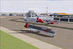
Ciampino airport is located southeast of Rome, is the second airport of the capital and is used for low cost flights. is also used by A.M. and civil protection.
This LIRA Ciampino ver. 1.0 is compatible with FS2004. Support forum (Italian only): http://www.hesperiaairlines.com For further information or feedback feel free to contact us (details in Readme).
| Filename: | LIRA_Ciampino_ver10.zip |
| License: | Freeware |
| Added: | 19th July 2012, 20:03:24 |
| Downloads: | 7,938 |
| Author: | Luciano Sartor, Ivan Cabrini |
| Size: | 18.58 MB |
| Category: Flight Simulator 2004 - Scenery | |
| VFR of Lario, Area D2 - Como lake, Italy |
|
Images related to this file:
File Description:
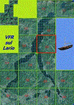
This is the seventh scenery of the "VFR of Lario" project, made with photorealistic terrain and some 3D GMax realistic objects. This scenery covers approximately an area of 7.5x6 kmt, from
north of Bellano (NW) to Casargo (NE), and from Fiumelatte (SW) to Cortenova (SE) and includes the NLC piers of Varenna and Bellano; it includes several dedicated buildings as Vezio castle (Perledo), villa Monastero, S.Giorgio church, marina, piers, hotel Olivedo, and some villas (Varenna), Tommaso Grossi square with pier and light fountain, S.Nazaro-Celso and S.Rocco-Sebastiano churches, Cantoni old cotton mill, group of houses by the lake (Bellano). There are also included four viaducts between the tunnels of the freeway 36, with moted traffic. Hydrofoil G. Marconi at Bellano pier together with other minor boats and docks alongside the lake coast; a moted traffic of motorboats is placed between Varenna's piers.
| Filename: | VFR_of_Lario_Area_D2__Como_lake_Italy.zip |
| License: | Freeware |
| Added: | 23rd July 2012, 15:45:14 |
| Downloads: | 1,261 |
| Author: | Aldo Della Vedova, Daniele Lanfranchi, Gian Mario Verga |
| Size: | 17.95 MB |
| Category: Flight Simulator 2004 - Scenery | |
| Auckland City - Photo Scenery |
|
File Description:
The 'Real New Zealand' Auckland City scenery previously available as payware is now offered here as freeware. This is a photo scenery depicting the greater Auckland area.
| Filename: | Auckland_City__Photo_Scenery.zip |
| License: | Freeware, limited distribution |
| Added: | 31st July 2012, 11:22:25 |
| Downloads: | 2,841 |
| Author: | Robin Corn, Ian Warren, Deane Baunton |
| Size: | 163.34 MB |
| Category: Flight Simulator 2004 - Scenery | |
| Shea Field CSF7, Casselman Ontario Canada |
|
Images related to this file:
File Description:
Shea Field is a recently-licensed privately-owned grass airfield in Ontario, 25 miles southeast of ottawa, and south of Highway 417. When I visited I was greeeted by the horse, peering around the end of it's stable shed at the corner of apron and runway. I walked over to the house and rang the doorbell and the dog said hello and that exhausted all social contact. The hangar is large but I have no idea what is inside. There was one plane parked on the apron with a skirt of uncut grass so presumably it hasn't flown for a few months. It was a Citabria in what looked like good condition; I don't have a Citabria to park there so I put a Cub. My favourite building is the old barn, leaning to one side as if seeking support for an elbow. To the north there are some farm sheds and grain silos, and to the northwest a tall mast; avoid it. To find the field without a gps follow the 417 and look for the tall mast just west of a major highway wiggle.
| Filename: | Shea_Field_CSF7_Casselman_Ontario_Canada.zip |
| License: | Freeware, limited distribution |
| Added: | 5th August 2012, 13:35:12 |
| Downloads: | 216 |
| Author: | Roger Wensley |
| Size: | 2.62 MB |
| Category: Flight Simulator 2004 - Scenery | |
| Thames Estuary Airport, London (concept) |
|
Images related to this file:
File Description:
Thames estuary airport is a possible new feature to the compilation of UK airports. Using the concept images on the net, we have made the airport for FS9. Please note that this is a very large airport and may not be suitable for slower computers.
There have been plans since 1943 to build a new airport for London at various locations around the Thames Estuary. The proposal was revived in 2008 by the Mayor of London, Boris Johnson, and has acquired the nickname "Boris Island".
| Filename: | Thames_Estuary_Airport_London_concept.zip |
| License: | Freeware |
| Added: | 6th August 2012, 18:26:11 |
| Downloads: | 268 |
| Author: | Soarfly Concepts |
| Size: | 437.83 KB |
| Category: Flight Simulator 2004 - Scenery | |
| Dutch Harbour PADU in Alaska PLUS AI Air & Sea |
|
Images related to this file:
File Description:
This is a revised and much-added-to update of my earlier Dutch Harbor post, adding more Air & Sea AI. It is complete in itself and does not require you to have previously installed the original. New parking is for a civilian freighter, a Coast Guard C-130, and Coast Guard helicopters that fly from St Paul Island.
There is also a daily flight from Dutch Harbor to Akutan that will be by the amphibious Goose as there is no land runway at Akutan [more posts follow].
The official airport name is Unalaska, but a seat booked with airlines will be to Dutch Harbor, known from the tv series as a fishing centre with major fish and crab processing plants. In town the largest company is Unisea, taking up all of what was once Expedition Island and the adjacent shoreline. The out-of-town expansion is taking place along the shore of Captains Bay to the southwest, and here the largest is Westward with the uniform green roof for the plant and the residential buildings for seasonal workers.
The airport has just over 3,900 feet of 100 feet wide asphalt, aligned 30/12, lit, and between sea and hill with two aprons at the southeast end. There is no control tower at the airport, so don't be surprised when you are required to contact Cold Bay USAF for landing permission. Runway 30 has at its threshold a road; when a plane is landing or taking off traffic is stopped by barriers and lights. To encourage full use of the runway the fence is made up of plastic rods that bend on impact instead of chainlink topped with barbed wire that will turn a light plane upside down.
| Filename: | Dutch_Harbour_PADU_in_Alaska_PLUS_AI_Air__Sea.zip |
| License: | Freeware, limited distribution |
| Added: | 7th August 2012, 20:56:03 |
| Downloads: | 1,536 |
| Author: | Roger Wensley |
| Size: | 13.4 MB |


© 2001-2026 AVSIM Online
All Rights Reserved
Privacy Policy |