
Where Flight Simulation Enthusiasts Gather from Around the World!
AVSIM Library - Search Results

| Category: Flight Simulator 2004 - Scenery | |
| LTAC Esenboga International Airport 2011 - UPDATE |

|
File Description:
TRAFFIC and CRASH problem RESOLVED
| Filename: | LTAC_Esenboga_International_Airport_2011__UPDATE.zip |
| License: | Freeware |
| Added: | 6th November 2010, 17:02:04 |
| Downloads: | 4,451 |
| Author: | Tolga Besci |
| Size: | 25.12 KB |
| Category: Flight Simulator 2004 - Scenery | |
| Dease Lake CYDL 2010 v1.1 |
|
Images related to this file:
File Description:
Version 1.1 adds the three hazard beacons that define the boundaries of the night circuit, as depicted in the included chart. Many thanks to Lane Street for creating the beacons and giving us permission to include them in the scenery. This scenery is complete and does not require the previous verion. Dease Lake CYDL airport is located about 2 miles south of Dease Lake in stunningly beautiful northwest British Columbia. (The lake directly to the east of the airport is Allan Lake.) Scheduled passenger service to Smithers and Bob Quinn Lake is provided by Northern Thunderbird Air (http://ntair.ca/). CYDL also serves as a base for Pacific Western Helicopters (http://www.pwh.ca/). This version moves the airport slightly to its correct location. All aprons & taxiways have been redone and all default buildings replaced. The little terminal building is photo real. The missing town of Dease Lake and the missing lake south of Allan lake have been added. This scenery was designed for use with Ultimate Terrain and was not tested in the default scenery. It may or may not work in FSX. Previous version had 307 downloads.
| Filename: | Dease_Lake_CYDL_2010_v11.zip |
| License: | Freeware |
| Added: | 6th November 2010, 22:30:24 |
| Downloads: | 793 |
| Author: | Sidney Schwartz & Peter Ham |
| Size: | 1.8 MB |
| Category: Flight Simulator 2004 - Scenery | |
| Beaver Creek CYXQ 1.1 |
|
Images related to this file:
File Description:
Version 1.1 adds the missing door on the ground side of the terminal building. It is complete and does not require that you already have the previous version.
Beaver Creek CYXQ is a small airport in the northern Canada Yukon Territory, near the Alaskan border. There is a customs facility located on the Alaska Highway adjacent to the airport. There is an NDB located on the field, but no published instrument approaches. The single gravel runway is 3740'long.
This scenery was completely redone and features a custom photoreal terminal and custom runway/taxiway lights. The adjacent customs facility is included but is not based on the real one as I had no photos to work from. The custom runway lights are always on, even during the day...sorry, this is an FS9 limitation.
This scenery was designed for use with Ultimate Terrain and was not tested in the default scenery. It may or may not work in FSX.
| Filename: | Beaver_Creek_CYXQ_11.zip |
| License: | Freeware |
| Added: | 6th November 2010, 22:31:24 |
| Downloads: | 915 |
| Author: | Sidney Schwartz & Peter Ham |
| Size: | 447.05 KB |
| Category: Flight Simulator 2004 - Scenery | |
| Quaqtaq CYHA in Hudson Strait, Quebec, Canada |
|
Images related to this file:
File Description:
Quaqtaq is a small village of 310 or so inhabitants at N 61 W 69 37 on the Hudson Strait at the northwest corner of Ungava Bay. It's name has some connection with "tapeworm" in Inuit; there is a story but I won't recount it here. The village does not feature in FS9 but is included in this scenery with approximately the right shape. No village buildings were specifically modeled; they are hand-made non-specific village houses typical of the north. The airfield runway is 3,520 feet of gravel 100 feet wide and is at 103 feet above the shoreline. I added the roads, a new airfield background, plus of course there is the scenery file and the AFCAD and AI, which is an Air Inuit Dash 8-300. This is the last of a series in northern Quebec that all have similar terminal buildings; I know of others which have the same type of building but I have no photos to discover the differences.
| Filename: | Quaqtaq_CYHA_in_Hudson_Strait_Quebec_Canada.zip |
| License: | Freeware, limited distribution |
| Added: | 8th November 2010, 04:29:39 |
| Downloads: | 415 |
| Author: | Roger Wensley |
| Size: | 2 MB |
| Category: Flight Simulator 2004 - Scenery | |
| The Bermudas Islands |
|
Images related to this file:
File Description:
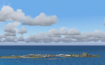
The Bermudas islands are located in the middle Atlantic. Their main island is in the 32 15 71 N and 64 52 50 W.Is a very broken into fragments island that it is part of s cluster of 150 islands distributed in an area of 53 square kms
This archipielago like superior vertex together with Puerto Rico island and the city of Lauderade-Hollywood in Florida U.S.A. tey form the celebrates TRIANGLE OF BERMUDAS that in the time 50 ships and 20 airplanes have disappeared. Most of these disappareances they can be explained, other nr.
Nevertheless to the one West of the island and a near a carrier to 2000-3000
feet high approximately I have discovery some ships floating in the space.
Not you if they are part of the disappareances....But they are there.
Discover it your same one....
| Filename: | The_Bermudas_Islands.zip |
| License: | Freeware |
| Added: | 8th November 2010, 04:31:29 |
| Downloads: | 1,810 |
| Author: | Toni Agramont |
| Size: | 14 MB |
| Category: Flight Simulator 2004 - Scenery | |
| Upgrade For Reggio Calabria Airport (LICR) V1.01 |
|
File Description:
Reposition and correct limit range for LOC 33 (18nm).
Correct limit range for RCA TVORDME and RCA NDB.
New Parking Position.
Correct Taxyway sign and rename taxyway.
Delete Start point Rwy 11.
Correct Helipad.
| Filename: | Upgrade_For_Reggio_Calabria_Airport_LICR_V101.zip |
| License: | Freeware |
| Added: | 9th November 2010, 20:09:04 |
| Downloads: | 569 |
| Author: | Fabio Iaria |
| Size: | 444.09 KB |
| Category: Flight Simulator 2004 - Scenery | |
| EBCI - Charleroi Brussels South |
|
Images related to this file:
File Description:
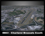
EBCI2010 with new terminal, photoreal ground textures, updated parking positions, new hangars, updated lighting system and new taxiways N
| Filename: | EBCI__Charleroi_Brussels_South.zip |
| License: | Freeware |
| Added: | 11th November 2010, 21:00:49 |
| Downloads: | 6,170 |
| Author: | Mattias Spiessens |
| Size: | 2.98 MB |
| Category: Flight Simulator 2004 - Scenery | |
| El Formosa - Taiwan Scenery Project, Part 10 Patch |
|
File Description:
This patch repairs El Formosa - Taiwan Scenery Project Part 10 Kaohsiung International Airport (RCKH) tree texture and light missing issue. Also, optional auto-refuel truck scenery from Robin is included.
| Filename: | El_Formosa__Taiwan_Scenery_Project_Part_10_Patch.zip |
| License: | Freeware, limited distribution |
| Added: | 14th November 2010, 00:35:12 |
| Downloads: | 6,148 |
| Author: | Formosa Group |
| Size: | 279.3 KB |
| Category: Flight Simulator 2004 - Scenery | |
| South African Cities |
|
File Description:
Includes Johannesburg, Cape Town, Durban and Sandton Buildings. The scenery is aligned to the South African Roads and Water feature packages done by Aeroworx authors which you can find here on Avsim. Dont install the scenery without the water feature package of Aeroworx otherwise the Durban buildings will float in the sea. This is also a re-upload because of the Avsim library problems. Nothing new has been added.
| Filename: | South_African_Cities.zip |
| License: | Freeware, limited distribution |
| Added: | 14th November 2010, 18:29:50 |
| Downloads: | 2,053 |
| Author: | Andre Potgieter |
| Size: | 3.15 MB |
| Category: Flight Simulator 2004 - Scenery | |
| Frozen & Landable Lakes & Rivers for All Canada Winter Ski Operations |
|
Images related to this file:
File Description:
This "freezes" ALL Canadian lakes and rivers for winter flying and means they can be landed on with skis or wheels. This edition covers all of Canada plus parts of the USA along the border, including Michigan, Wisconsin, Minnesota, North Dakota, and Montana. It is reversible with an "untick" in the FS scenery library. I have spent some time making sure that the sea and the inlets along the coast do not get frozen too, and also some of the lakes that are close to the coast and rarely get cold enough to freeze over. Along the north shore I went for the peak of the winter with sea ice all the way to the permanent polar cap; this is not totally realistic as there is usually a partially open lead along the coast, but this would be difficult to replicate convincingly. This is really for use with Ultimate Terrain, though it will work without it. The pics show Rockcliffe in the winter with the frozen Ottawa River for real and in FS for comparison; without UT the river would not be in the right place.
| Filename: | Frozen__Landable_Lakes__Rivers_for_All_Canada_Wint.zip |
| License: | Freeware, limited distribution |
| Added: | 15th November 2010, 01:01:36 |
| Downloads: | 603 |
| Author: | Roger Wensley |
| Size: | 871.82 KB |


© 2001-2026 AVSIM Online
All Rights Reserved
Privacy Policy |