
Where Flight Simulation Enthusiasts Gather from Around the World!
AVSIM Library - Search Results

| Category: Flight Simulator 2004 - Scenery | |
| Terrace CYXT in BC Canada Updated |

|
Images related to this file:
File Description:
This version of Terrace has night textures that work, good news for the 319 downloaders who did not tell the author that the ones already posted did not work. Why? Terrace is fifteen miles east and inland from Prince Rupert, which is 500 miles north of Vancouver up the BC coast. It is at the point in the mountains where two fjords meet, one coming from Prince Rupert and the other from Kitimat. There are two runways, the main one is a recently-extended 7,500 feet long and lighted 33/15 and the second is 5,373 feet of unlit 03/21. The apron has been enlarged to be able to accomodate a Boeing 737; though I don't think there is an airline using a 737 for flights to Terrace I have parked an Air Canada jet and the pics show the planes that do fly to Terrace, Air Canada and Hawk Air Dash 8-300's. The aircraft and the textures are down-loadable and and can be used for AI.
| Filename: | Terrace_CYXT_in_BC_Canada_Updated.zip |
| License: | Freeware, limited distribution |
| Added: | 3rd July 2010, 03:28:31 |
| Downloads: | 1,068 |
| Author: | Roger Wensley |
| Size: | 3.72 MB |
| Category: Flight Simulator 2004 - Scenery | |
| Quintin NZQT, New Zealand |
|
Images related to this file:
File Description:
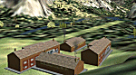
A small landing-strip on the Milford Track, New Zealand. For chartered-only aircraft. A pleasant ride from NZMF, up the valley to Quintin Lodge.
You must have Christian Stock's NZ mesh in the form of "Mountains of New Zealand"
and topo in the form of "Lakes and Rivers of New Zealand".
| Filename: | Quintin_NZQT_New_Zealand.zip |
| License: | Freeware |
| Added: | 4th July 2010, 10:17:09 |
| Downloads: | 306 |
| Author: | Godfrey Tier |
| Size: | 91.79 KB |
| Category: Flight Simulator 2004 - Scenery | |
| Heathrow - Myrtle Avenue (Beta Test) |
|
File Description:
This is a small scenery add-on designed to work with the UK2000 Heathrow Xtreme Scenery. It adds the famous spotting area known as Myrtle Avenue, which is situated near the threshold to Heathrow's runway 27L. It also includes some detailing of the A30 perimeter road, in order to enhance the views of approaching aircraft in this area.
The scenery is released in Beta Test form, and I therefore welcome comments and suggestions as to how it can be improved or enhanced. Please refer to the included read me for more details.
| Filename: | Heathrow__Myrtle_Avenue_Beta_Test.zip |
| License: | Freeware, limited distribution |
| Added: | 5th July 2010, 13:41:48 |
| Downloads: | 2,930 |
| Author: | Tim Faithfull |
| Size: | 13.51 MB |
| Category: Flight Simulator 2004 - Scenery | |
| Project LIEO2004 v2 - SP1 |
|
File Description:
ISD This service pack is to correct the flikkering or disappearing ground textures problem some users experience when taxiing at Olba airport.
Fix the ILS/DME 06 misalignment with the runway.
Also this SP fix the terrain problems with Spanish Airports installed from Aerosoft around Madrid.
| Filename: | Project_LIEO2004_v2__SP1.zip |
| License: | Freeware |
| Added: | 6th July 2010, 10:34:57 |
| Downloads: | 1,199 |
| Author: | John Meinen |
| Size: | 144.54 KB |
| Category: Flight Simulator 2004 - Scenery | |
| Kunovice Airport (LKKU), Czech Republic |
|
Images related to this file:
File Description:
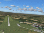
This scenery consists of a small factory/international airport Kunovice at the city Uherske Hradiste in the Czech Republic.
| Filename: | Kunovice_Airport_LKKU_Czech_Republic.zip |
| License: | Freeware |
| Added: | 6th July 2010, 22:08:44 |
| Downloads: | 712 |
| Author: | Martin Hrabeta |
| Size: | 4.03 MB |
| Category: Flight Simulator 2004 - Scenery | |
| Rabah Bitat Airport (DAAB) Algeria - Scenery |
|
File Description:
Formerly known as Les Salines Airport, and popularly as El Mellah Airport is an international airport located 9 km south of Annaba, a city in Algeria. It is named after Rabah Bitat a president of Algeria (1978-1979). During World
War II the airport was known as Bone Airfield, and was used by the German Luftwaffe. Later captured by the United States Army, the USAAF Twelfth Air Force in the Western Desert Campaign in 1942-1943.
| Filename: | Rabah_Bitat_Airport_DAAB_Algeria__Scenery.zip |
| License: | Freeware |
| Added: | 7th July 2010, 14:55:28 |
| Downloads: | 1,969 |
| Author: | Emad Qtiefan |
| Size: | 5.58 MB |
| Category: Flight Simulator 2004 - Scenery | |
| Mega Airport Memmingen (EDJA/FMM), Germany |
|
Images related to this file:
File Description:
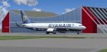
Memmingen Airport (EDJA) is located 100km West of Munich in Southern Germany. Several airlines operate out of the airport including Ryanair, Hapag-Lloyd Express, and Air Berlin. It's a small public airport. One of 4 airports in Bavaria with commercial air service and it has the highest elevation of all of Germany's commercial airports. Prior to 2008-09-25, it was known as Allgäu Airport/Memmingen. The airport not only serves Memmingen and the Allgäu area but also provides a low-cost alternative to Munich Airport.
This scenery is developed for FS2004 and updates the airport with new buildings and textures, along with the correct runway and taxiway dimensions and lighting.
| Filename: | Mega_Airport_Memmingen_EDJAFMM_Germany.zip |
| License: | Freeware, limited distribution |
| Added: | 7th July 2010, 23:19:27 |
| Downloads: | 6,256 |
| Author: | Ben Elsen |
| Size: | 9.49 MB |
| Category: Flight Simulator 2004 - Scenery | |
| Chennai International Airport , India ( VOMM ) |
|
Images related to this file:
File Description:
Chennai scenery has been in demand for long time and here it is ,the file also includes " the ACTIVE RNAV�1 (GNSS or DME/DME/IRU) SIDs and STARs. It also has the extended runway and the extended taxiway M3. Definitely the screen shots will help you decide if its worth downloading.T his will also work in FSX. Inside you will find a zip file that reads-"Asia.zip" if you are FSX user you will have to add this addition folder to database (FSX) 2-3 buildings used are default FS2004 object which are not in FSX . This additional will enable that thing previously if you have downloaded Chatrapatti shivaji International Scenery that I uploaded for everyone made the FSX users unhappy , because they must have found few objects hanging in air or something's missing. This asia folder included in the scenery will solve the trouble. Airport Features include- NEW models of taxiway edge fixtures, Parkable Hanger for General aviation light aircrafts. Just roll in and out sticking to the ctr guide line. You can even begin simulation parked inside the hanger .Don't worry , you won't be disappointed .. check out the pics. Oh! you'll also find surfaces painted " paraphernalia " kind of stuff at all taxiway- runway intersection and surface painting for stands numbers at one of the apron. stands 1-7 .
| Filename: | Chennai_International_Airport__India__VOMM_.zip |
| License: | Freeware |
| Added: | 10th July 2010, 02:54:43 |
| Downloads: | 6,698 |
| Author: | Ashish Singh |
| Size: | 70.84 MB |
| Category: Flight Simulator 2004 - Scenery | |
| Vietnam Bases USAF |
|
Images related to this file:
File Description:
Here's an update for George Knowles excellent Vietnam scenery much of which was lost during the hacking of the avsim site. I've added AFCAD files for you ai types, and charts for flying some of my latest Vietnam era planes...Just do a search under my full name....Peter Mercy.
| Filename: | Vietnam_Bases_USAF.zip |
| License: | Freeware |
| Added: | 10th July 2010, 19:29:57 |
| Downloads: | 3,004 |
| Author: | Peter Mercy, George Knowles |
| Size: | 15.9 MB |
| Category: Flight Simulator 2004 - Scenery | |
| Hope Field near Ottawa Ontario, Canada |
|
Images related to this file:
File Description:
The field is newly included in the Canada Flight Supplement. Unusually for a grass field the runway has the numbers marked out in white; given that this is a private airfield that does not invite unexpected guests and has only one plane based there, and presuming that the owner can remember his own runway headings, it is unlikely that these will still be there in a year's time. There is no hangar as yet. To the west is highway 416 and to the east is the Rideau River, both of which run north-south. Lke Rockcliffe (which is to the north) the airfield is right on the edge of the Ottawa control zone, so you should already be below 1,500 feet ASL when approaching from the south and talking to Ottawa tower when arriving from the north. The runway is 07/25 and 2,800 feet long, which should be enough for almost anybody, and the field is at 315 feet ASL. Manotick is a mile to the north east on the Rideau River and the Rideau Valley Airpark CPL3 is six miles south in the bend of the Rideau where it turns west.
| Filename: | Hope_Field_near_Ottawa_Ontario_Canada.zip |
| License: | Freeware, limited distribution |
| Added: | 10th July 2010, 19:34:51 |
| Downloads: | 201 |
| Author: | Roger Wensley |
| Size: | 3.15 MB |


© 2001-2026 AVSIM Online
All Rights Reserved
Privacy Policy |