
Where Flight Simulation Enthusiasts Gather from Around the World!
AVSIM Library - Search Results

| Category: Flight Simulator 2004 - Scenery | |
| Ubatuba (SDUB) Afcad |

|
Images related to this file:
File Description:
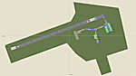
This is the afcad file for Ubatuba (SDUB) airport, located in Brazil's southwest area in a very beautiful place with pretty beaches. As a suggestion, take a short flight in a slow airplane from Ubatuba (SDUB) to Angra dos Reis (SBAG).
| Filename: | Ubatuba_SDUB_Afcad.zip |
| License: | Freeware |
| Added: | 21st May 2010, 03:27:18 |
| Downloads: | 1,225 |
| Author: | Felipe Bachian |
| Size: | 2.84 KB |
| Category: Flight Simulator 2004 - Scenery | |
| Netherlands 2000 v2.9 SP1 |
|
Images related to this file:
File Description:

Re-upload. This is Service Pack 1 for NL2000 version 2.9. The Netherlands 2000 V2.9 Scenery is the award winning free scenery package covering the Netherlands. It solves some issues and contains improvements in the installer and featurepanel, to better integrate with other add-ons. You need nl2kv29a.zip in addition to this file. By The Netherlands 2000 Design Team.
| Filename: | Netherlands_2000_v29_SP1.zip |
| License: | Freeware, limited distribution |
| Added: | 22nd May 2010, 04:41:31 |
| Downloads: | 20,991 |
| Author: | The Netherlands 2000 Design Team |
| Size: | 36.41 MB |
| Category: Flight Simulator 2004 - Scenery | |
| VAUD Udaipur/Dabok, India |
|
Images related to this file:
File Description:
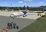
Googly scenery for VAUD Udaipur/Dabok, (also sometimes referred to as VAID) a small domestic airport in
India served by about six flights a day by jets and propeller aircraft from
airlines such as Alliance Air, Jagson Airlines and Jet Airways. These
scenery files improve/add aprons, taxiways, buildings and other airport
features to Flight Simulator's basic representation.
The scenery does not purport to be ultra-accurate. Based on high-detail satellite
imagery from Google Earth, the layout is proportionally correct but the added
[File re-uploaded at request of AVSIM]
airport features, such as buildings, are built from default Microsoft objects
and add-on libraries so will not look exactly like the real thing.
You are not obliged to download and install any additional scenery libraries,
but to enjoy this scenery in its entirety, you may wish to. It will work fine,
with or without.
[File re-uploaded at request of AVSIM]
| Filename: | VAUD__UdaipurDabok_India.zip |
| License: | Freeware |
| Added: | 23rd May 2010, 01:22:29 |
| Downloads: | 1,425 |
| Author: | John Hinson |
| Size: | 67.47 KB |
| Category: Flight Simulator 2004 - Scenery | |
| SPHZ Anta/Comandante German Arias Grazz, Peru |
|
Images related to this file:
File Description:
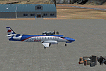
Googly scenery for SPHZ Anta/Comandante German Arias Grazz, Peru - a small
domestic airport for which nothing more than a runway is provided in Flight
Simulator 2004. These scenery files add the apron, taxiways, buildings and
other airport features so that you and your "AI" traffic can land, taxi, park
and take off in a realistic manner.
The airport is served daily by domestic operator L C Busre and perhaps also
others using small aircraft, but little information has been found on activity
in this area.
The scenery does not purport to be ultra-accurate. Based on high-detail satellite
imagery from Google Earth, the layout is proportionally correct but the added
airport features, such as buildings, are built from default Microsoft objects
and add-on libraries so will not look like the real thing.
You are not obliged to download and install any additional scenery libraries,
but to enjoy this scenery in its entirety, you may wish to. It will work fine,
with or without.
[File re-uploaded at request of AVSIM]
| Filename: | SPHZ_AntaComandante_German_Arias_Grazz_Peru.zip |
| License: | Freeware |
| Added: | 23rd May 2010, 01:24:24 |
| Downloads: | 1,224 |
| Author: | John Hinson |
| Size: | 65.15 KB |
| Category: Flight Simulator 2004 - Scenery | |
| DGSI Kumasi, Ghana |
|
Images related to this file:
File Description:
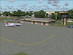
Googly scenery for Kumasi - a small domestic airport in Ghana for which no facilities
are provided in Flight Simulator 2004. These scenery files add taxiways, aprons,
buildings and other airport features, so that you and your "AI" traffic can land,
taxi, park and take off in a realistic manner.
The airport serves the city of Kumasi (capital of the Ashanti region) and sees
regular flights using turboprop airliners operated by Accra based operators
Antrak Air and Citylink.
The scenery does not purport to be ultra-accurate. Based on high-detail satellite
imagery from Google Earth, the layout is proportionally correct but the added
airport features, such as buildings, are built from default Microsoft objects
and add-on libraries so will not look like the real thing.
[File re-uploaded at request of AVSIM]
| Filename: | DGSI_Kumasi_Ghana.zip |
| License: | Freeware |
| Added: | 23rd May 2010, 01:25:23 |
| Downloads: | 1,420 |
| Author: | John Hinson |
| Size: | 80.3 KB |
| Category: Flight Simulator 2004 - Scenery | |
| OPGD Gwadar International, Pakistan |
|
Images related to this file:
File Description:
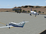
Googly scenery for OPGD Gwadar International, Pakistan. In Flight Simulator
2004 only general aviation parking is provided at this so-called international airport but in the real world it is served two or three times a day by Airbii of Airblue and ATRs of Pakistan International Airways. These scenery files improve or add
aprons, taxiways, buildings and other airport features to Flight Simulator's limited
representation and allow "AI" traffic to land, taxi, park and take off in a realistic
manner.
The scenery does not purport to be ultra-accurate. Based on high-detail satellite
imagery from Google Earth, the layout is proportionally correct but the added
airport features, such as buildings, are built from default Microsoft objects
and add-on libraries so will not look like the real thing.
You are not obliged to download and install any additional scenery libraries,
but to enjoy this scenery in its entirety, you may wish to. It will work fine,
with or without.
[File re-uploaded at request of AVSIM]
| Filename: | OPGD_Gwadar_International_Pakistan.zip |
| License: | Freeware |
| Added: | 23rd May 2010, 01:26:15 |
| Downloads: | 1,065 |
| Author: | John Hinson |
| Size: | 58.09 KB |
| Category: Flight Simulator 2004 - Scenery | |
| San Luis Valley Regl - KALS |
|
Images related to this file:
File Description:
FS2004 Scenery - San Luis Valley Regional/Bergman Field Airport serves Alamosa and Alamosa County and is owned by the City And County of Alamosa, Colorado, USA. The airport has more than one runway. The longest is a paved runway extending 8800 feet. The facility is at an elevation of 7535 feet at a distance of about 2 miles from Alamosa. The Airport (IATA: ALS, ICAO: KALS), also known as Bergman Field, is a public airport used for general aviation, but is also served by one commercial airline. Created with EZ Scenery. EZ Scenery libraries required. Scenery created over USA Roads. By John B. Loney, Jr.
| Filename: | San_Luis_Valley_Regl__KALS.zip |
| License: | Freeware, limited distribution |
| Added: | 23rd May 2010, 01:31:13 |
| Downloads: | 1,033 |
| Author: | John B. Loney, Jr. |
| Size: | 669.56 KB |
| Category: Flight Simulator 2004 - Scenery | |
| Laramie Regional KLAR |
|
Images related to this file:
File Description:
FS2004 Scenery-Laramie Regional Airport (KLAR) is located in Laramie Wyoming, home of the University of Wyoming, Wyoming Technical Institute and a number of businesses and organizations. Laramie Regional Airport was built in 1934 and was originally named Brees Field, after General Herbert Jay Brees of the US Army. The original hangar still stands today. In 1944, the runways were paved to allow hundreds of B-24 bombers to land at Laramie and bring crews for rest and recuperation to the UW recreation camp in the Snowy Range. In 1945 Summit Airways began to provide passenger service. The Brees Field Airport Board was formed in 1965 to oversee airport operations. In 1992, the airport's board changed the airport's name to Laramie Regional Airport. Created with EZ Scenery by John B. Loney, Jr.
| Filename: | Laramie_Regional_KLAR.zip |
| License: | Freeware, limited distribution |
| Added: | 23rd May 2010, 01:32:22 |
| Downloads: | 1,332 |
| Author: | John B. Loney, Jr. |
| Size: | 835.24 KB |
| Category: Flight Simulator 2004 - Scenery | |
| London City EGLC |
|
Images related to this file:
File Description:
Includes-
AFX/AFCAD detailed, one of its kind , 3d taxiway edge lights- 3 different models (new) pappi, 3d runway holding lights ,enhanced Landscape , interesting use of
default fs2004 buildings , all stands with signage , intermediate holdings provided with signage.screen shots will surely help you decide if it's worth.
| Filename: | London_City____EGLC.zip |
| License: | Freeware |
| Added: | 23rd May 2010, 01:52:20 |
| Downloads: | 4,880 |
| Author: | Ashish Singh |
| Size: | 54.86 MB |
| Category: Flight Simulator 2004 - Scenery | |
| Whitefish 58S in Montana US |
|
Images related to this file:
File Description:
I have made this because I downloaded and tried the Glacier Park scenery by Blue Sky Scenery and then discovered that the runway for Whitefish was wrongly aligned and headed off across the adjacent railroad tracks. This would be inconvenient if you had to wait for a train to pass before landing so I fixed that and added a couple of buildings. That's it, nothing more complicated than that. If I find some more airfields in this area with similar problems then I'll do more of the same. Whitefish is 3 or so miles north of Glacier Park International at 3,066 feet ASL and around 35 miles south of the Canadian border. There are no large towns close by; the nearest would be Missoula, which is 90 miles further south.
| Filename: | Whitefish_58S_in_Montana_US.zip |
| License: | Freeware, limited distribution |
| Added: | 23rd May 2010, 02:05:52 |
| Downloads: | 194 |
| Author: | Roger Wensley |
| Size: | 826.52 KB |


© 2001-2026 AVSIM Online
All Rights Reserved
Privacy Policy |