
Where Flight Simulation Enthusiasts Gather from Around the World!
AVSIM Library - Search Results

| Category: Flight Simulator 2004 - Scenery | |
| CYVC La Ronge Saskatchewan |

|
Images related to this file:
File Description:

La Ronge (Barber Field) is situated approximately six and a half kilometers north of the town of La Ronge, Saskatchewan, Canada. The present La Ronge airport was constructed beginning in 1976, notably as the central base of operations for the Province of Saskatchewan's water bomber fleet. The airport is home to maintenance facilities and a tanker base of operation for a fleet of CL-215, CL-215T, Convair 580 and deHavilland (Grumman) Tracker water bombers. The airport is also a major base of operation for Transwest airlines, West Wind Aviation, Osprey Airways and other bush operators.
CYVC was constructed using GMAX and represents the airport as it was in the Summer of 2009. It includes custom models of all the buildings at the airport, runway signs, taxiway and runway lighting, hangars, terminal building, custom vehicles and the seasonal tanker operations base. CYVC includes custom tarmac and textures to replicate the retardant and oil stained tanker ramp.
| Filename: | CYVC_La_Ronge_Saskatchewan.zip |
| License: | Freeware |
| Added: | 7th May 2010, 12:57:55 |
| Downloads: | 1,952 |
| Author: | Gregory Putz |
| Size: | 11.13 MB |
| Category: Flight Simulator 2004 - Scenery | |
| WASF Fak-Fak |
|
Images related to this file:
File Description:
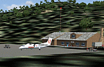
Googly scenery for WASF Fak-Fak, in Irian Jaya (Western New Gunea),
Indonesia - a small domestic airport that Microsoft managed to omit from Flight
Simulator 2004. These scenery files add the runway, apron, taxiways, buildings
and other airport features so that you and your "AI" traffic can land, taxi,
park and take off in a realistic manner.
Little information is available on the services operated - flight plans are
available for Lion Airlines showing two flights per week operated on their behalf
by Wings Abadi Dash 8 aircraft. But it is known that Merpati Nusentara also serve
the airport with Twin Otters. If you are using the Lion Airlines flight plans
for Winter 2006, you must change the airport's co-ordinates as detailed in the readme.txt file
because the co-ordinates given there will cause the aircraft to aim for a point
on the wrong side of the equator in the middle of the sea!
There is no lighting at this airport, and few navigational aids. However, I have
added a missing NDB nearby (FA, 380.0).
The scenery does not purport to be ultra-accurate. The quality of the satellite
imagery at Google Earth is poor, but a number of photographs and other information
has enabled this airport to be depicted reasonably accurately. However the added
airport features, such as buildings, are built from default Microsoft objects
and add-on libraries so will not look exactly like the real thing.
You are not obliged to download and install any additional scenery libraries,
but to enjoy this scenery in its entirety, you may wish to. It will work fine,
with or without.
An editvoicepack file has been included for the airport to help you embarrass
yourself in front of others when flying.
[File re-uploaded at request of AVSIM]
| Filename: | WASF_FakFak.zip |
| License: | Freeware |
| Added: | 7th May 2010, 22:30:22 |
| Downloads: | 1,904 |
| Author: | John Hinson |
| Size: | 72.51 KB |
| Category: Flight Simulator 2004 - Scenery | |
| VABP Bhopal/Bairagarh, India |
|
Images related to this file:
File Description:
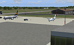
Googly scenery for VABP Bhopal/Bairagarh, India - an enhancement to the
airport provided in Flight Simulator 2004 which is incorrect in many respects.
These scenery files enlarge the apron to a realistic size to accept scheduled
traffic, remove spurious taxiways (they were actually perimeter tracks!), and
add buildings and other airport features so that you and your "AI" traffic
can land, taxi, park and take off in a realistic manner.
This small domestic airport is served by Boeing and Airbus jets of Indian
Airlines and Jet Airways together with local flights operated by ATRs of Air
Deccan.
The scenery does not purport to be ultra-accurate. Based on high-detail satellite
imagery from Google Earth, the layout is proportionally correct but the added
airport features, such as buildings, are built from default Microsoft objects
and add-on libraries so will not look like the real thing.
You are not obliged to download and install any additional scenery libraries,
but to enjoy this scenery in its entirety, you may wish to. It will work fine,
with or without.
[File re-uploaded at request of AVSIM]
| Filename: | VABP_BhopalBairagarh_India.zip |
| License: | Freeware |
| Added: | 7th May 2010, 22:34:06 |
| Downloads: | 1,625 |
| Author: | John Hinson |
| Size: | 64.37 KB |
| Category: Flight Simulator 2004 - Scenery | |
| Sleap Airfield - Shropshire |
|
Images related to this file:
File Description:
Sleap Airfield - Home of the Shropshire Aero Club not far from Wem - North Shropshire - England
A fairly accurate representation of this small airfield which used to be an RAF wartime airfield in both WWI and WWII. Now a private flying club
| Filename: | Sleap_Airfield__Shropshire.zip |
| License: | Freeware |
| Added: | 9th May 2010, 08:16:52 |
| Downloads: | 477 |
| Author: | Barrie Larks |
| Size: | 3.35 MB |
| Category: Flight Simulator 2004 - Scenery | |
| Neuchatel Airport (LSGN) |
|
Images related to this file:
File Description:
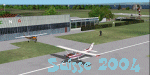
Neuchatel Airport (LSGN) for Suisse 2004
Re-upload of Neuchatel Airport (LSGN) Switzerland. A small place north west of Switzerland amongst the lake of Neuchatel, with a 800m runway. You can install it alone or in the same folder of all other Suisse 2004 sceneries.
| Filename: | Neuchatel_Airport_LSGN.zip |
| License: | Freeware |
| Added: | 9th May 2010, 09:36:14 |
| Downloads: | 9,466 |
| Author: | Daniel Gauthier |
| Size: | 3.63 MB |
| Category: Flight Simulator 2004 - Scenery | |
| Ribeirao Preto - Brazil - Photoreal Scenery v1.1 |
|
Images related to this file:
File Description:
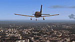
The Aeroclube Virtual de Ribeirao Preto in partnership with Paulo Ricardo, famous for his photoreal sceneries is launching the new version of the Ribeirao Preto Photoreal Scenery. Where we made bug corrections (even the heading problem found in the last version), afcad corrections, hangar and tower corrections and the inclusion of the detailed Aeroclube de Ribeirao hangar. If you have a low performance system, there is a light version of this scenery (sbrp_v11_light.zip).
This is a re-upload due Avsim hack (nothing has changed).
| Filename: | Ribeirao_Preto__Brazil__Photoreal_Scenery_v11.zip |
| License: | Freeware, limited distribution |
| Added: | 9th May 2010, 09:58:43 |
| Downloads: | 4,646 |
| Author: | Paulo Ricardo, Felipe Bachian, Andre Dilio |
| Size: | 49.9 MB |
| Category: Flight Simulator 2004 - Scenery | |
| Uvs Nuur Basin (Mongolia) - Mesh |
|
File Description:
LOD 9 (76 m) SRTM mesh file of the Uvs Nuur Basin in NW Mongolia. Coverage: N 49.0 - 51.8, E 90.0 - 96.8. Should also work with FSX. (Re-upload)
| Filename: | Uvs_Nuur_Basin_Mongolia__Mesh.zip |
| License: | Freeware |
| Added: | 9th May 2010, 10:01:22 |
| Downloads: | 1,545 |
| Author: | Markus Paul |
| Size: | 19.94 MB |
| Category: Flight Simulator 2004 - Scenery | |
| Hana Heli-Playground v1.0 |
|
Images related to this file:
File Description:
Hana Airport is a regional airport of the State of Hawaii on the east shore of the island of Maui, 3 NM northwest of the unincorporated town of Hana. The airport covers 119 acres and has one runway. It is primarily a commuter facility used by unscheduled air taxis and general aviation. This scenery is intended as a single/multiplayer helicopter obstacle course where heli pilots can meet to compete, show off, and share their helo skills. Since birdseye (Timm Turner) already did a neat scenery called Hana_Scenery_PHHN (search for "hana" in the HoverControl Downloads), we decided to convert PHHN to a full helicopter training area. Makes a great place for helo pilots to gather to practice and perfect their skills, and challenge other pilots! And keep an eye-out for that Hot Air Balloon, cruising around an altitude of 3000 feet (don't forget to wave at them!).
Another unique thing about this scenery is the neighboring islands (Honolulu Intl/Hickam AFB, Bellows AFB, Lanai City, Kahului, Molokai, etc). If you get frustrated during your heli obstacle course training, just take a heading of 275°, and relax at one of the neighboring islands.
| Filename: | Hana_HeliPlayground_v10.zip |
| License: | Freeware |
| Added: | 9th May 2010, 11:29:39 |
| Downloads: | 524 |
| Author: | Bob Ferguson |
| Size: | 27.79 MB |
| Category: Flight Simulator 2004 - Scenery | |
| Static Aircraft for California Central Coast Scenery CCCoastF |
|
Images related to this file:
File Description:
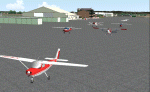
Static Aircraft for California Central Coast Scenery CCCoastF released
12/18/04. The static A/C are now separate from the CCC scenery per several requests. Requires CCCOASTF.ZIP.
This is a replacement file for the 12/18/04 file corrupted by the library hack.
| Filename: | Static_Aircraft_for_California_Central_Coast_Scene.zip |
| License: | Freeware |
| Added: | 9th May 2010, 11:38:40 |
| Downloads: | 1,602 |
| Author: | Al Wheeler |
| Size: | 1.43 MB |
| Category: Flight Simulator 2004 - Scenery | |
| Montreal Bridges, Mercier Bridge. |
|
File Description:
Montreal Bridges, Mercier Bridge. CORRECTION FOR Correction for FS9.1 or PATCHed FS2004.
There is no end, for these updates ?? B-) The correction is SCENERY DENSITY
dependent. Reason for scenery designers problems !!
| Filename: | Montreal_Bridges_Mercier_Bridge.zip |
| License: | Freeware |
| Added: | 10th May 2010, 01:15:11 |
| Downloads: | 1,913 |
| Author: | JEAN MORISSETTE |
| Size: | 1.61 KB |


© 2001-2026 AVSIM Online
All Rights Reserved
Privacy Policy |